Burnt Corn Spring Topo Map Arizona
To zoom in, hover over the map of Burnt Corn Spring
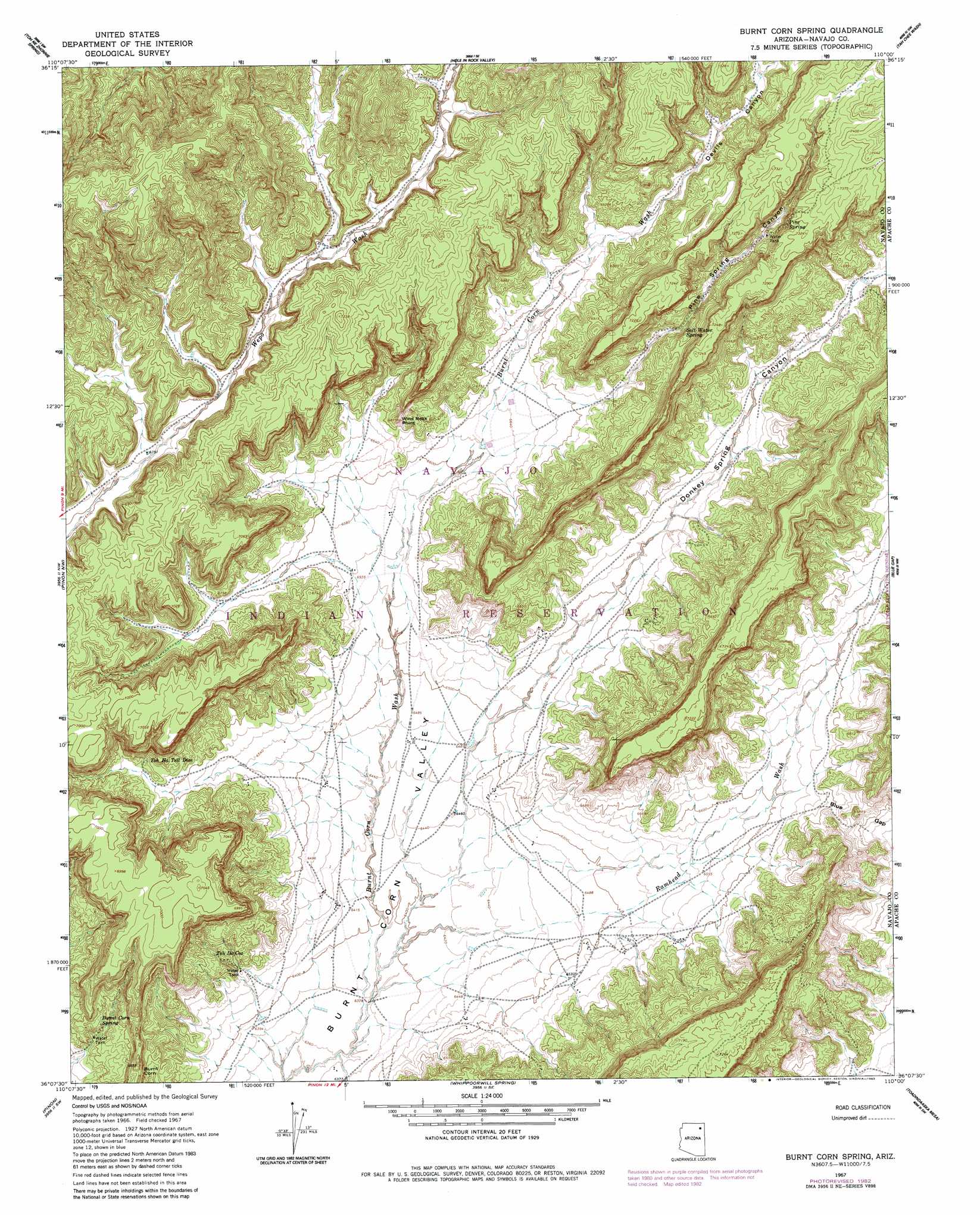
USGS Topo Quad 36110b1 - 1:24,000 scale
| Topo Map Name: | Burnt Corn Spring |
| USGS Topo Quad ID: | 36110b1 |
| Print Size: | ca. 21 1/4" wide x 27" high |
| Southeast Coordinates: | 36.125° N latitude / 110° W longitude |
| Map Center Coordinates: | 36.1875° N latitude / 110.0625° W longitude |
| U.S. State: | AZ |
| Filename: | o36110b1.jpg |
| Download Map JPG Image: | Burnt Corn Spring topo map 1:24,000 scale |
| Map Type: | Topographic |
| Topo Series: | 7.5´ |
| Map Scale: | 1:24,000 |
| Source of Map Images: | United States Geological Survey (USGS) |
| Alternate Map Versions: |
Burnt Corn Spring AZ 1967, updated 1969 Download PDF Buy paper map Burnt Corn Spring AZ 1967, updated 1983 Download PDF Buy paper map Burnt Corn Spring AZ 2011 Download PDF Buy paper map Burnt Corn Spring AZ 2014 Download PDF Buy paper map |
1:24,000 Topo Quads surrounding Burnt Corn Spring
Yucca Hill |
Cliff Rose Hill |
Chilchinbito Canyon |
Rough Rock Nw |
Rough Rock |
Red Slide Peak |
Toh Ne Zhonnie Spring |
Hole In Rock Valley |
Tah Chee Wash |
Sweathouse Peak |
Coat Spring |
Pinon Nw |
Burnt Corn Spring |
Blue Gap |
Lohali Point |
Little Black Spot Mountain |
Pinon |
Whippoorwill Spring |
Toadimdaaska Mesa |
Salina |
Wepo Village |
Echo Canyon |
Low Mountain |
Beeshsikad Spring |
Steamboat Rock Ne |
> Back to 36110a1 at 1:100,000 scale
> Back to 36110a1 at 1:250,000 scale
> Back to U.S. Topo Maps home
Burnt Corn Spring topo map: Gazetteer
Burnt Corn Spring: Cliffs
Burnt Corn elevation 2073m 6801′Wind Rock Point elevation 2093m 6866′
Burnt Corn Spring: Gaps
Blue Gap elevation 2021m 6630′Burnt Corn Spring: Springs
Burnt Corn Spring elevation 2003m 6571′Pine Spring elevation 2187m 7175′
Salt Water Spring elevation 0m 0′
Toh De Coz elevation 1993m 6538′
Toh Ha Tsil Dize elevation 2040m 6692′
Burnt Corn Spring: Valleys
Devils Canyon elevation 2027m 6650′Donkey Spring Canyon elevation 1988m 6522′
Pine Spring Canyon elevation 2044m 6706′
Ramhead Wash elevation 1942m 6371′
Burnt Corn Spring digital topo map on disk
Buy this Burnt Corn Spring topo map showing relief, roads, GPS coordinates and other geographical features, as a high-resolution digital map file on DVD: