Charleston School Topo Map California
To zoom in, hover over the map of Charleston School
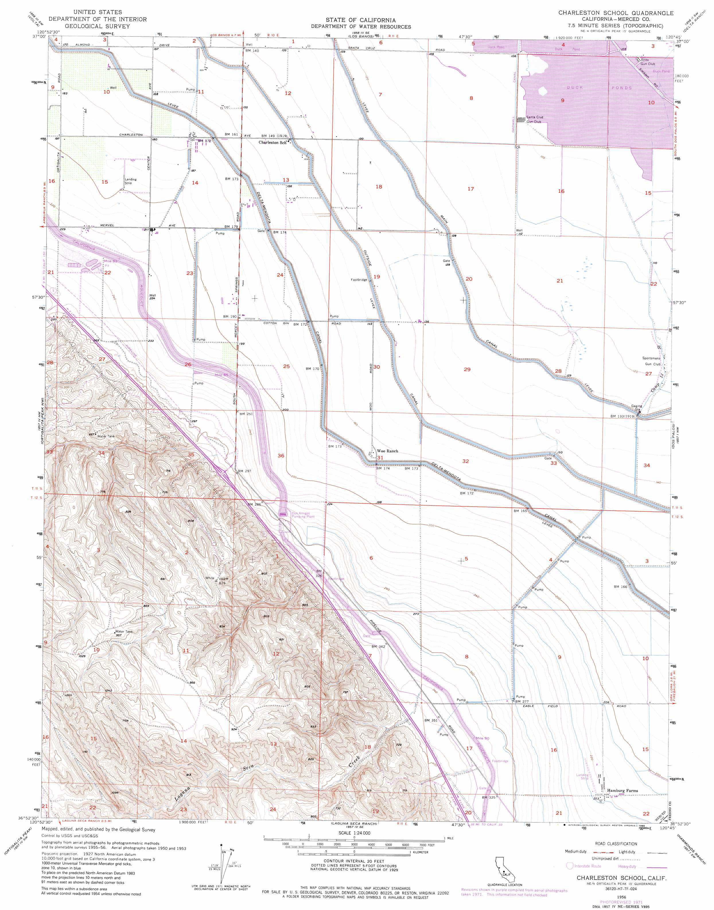
USGS Topo Quad 36120h7 - 1:24,000 scale
| Topo Map Name: | Charleston School |
| USGS Topo Quad ID: | 36120h7 |
| Print Size: | ca. 21 1/4" wide x 27" high |
| Southeast Coordinates: | 36.875° N latitude / 120.75° W longitude |
| Map Center Coordinates: | 36.9375° N latitude / 120.8125° W longitude |
| U.S. State: | CA |
| Filename: | o36120h7.jpg |
| Download Map JPG Image: | Charleston School topo map 1:24,000 scale |
| Map Type: | Topographic |
| Topo Series: | 7.5´ |
| Map Scale: | 1:24,000 |
| Source of Map Images: | United States Geological Survey (USGS) |
| Alternate Map Versions: |
Charleston School CA 1956, updated 1957 Download PDF Buy paper map Charleston School CA 1956, updated 1964 Download PDF Buy paper map Charleston School CA 1956, updated 1972 Download PDF Buy paper map Charleston School CA 1956, updated 1983 Download PDF Buy paper map Charleston School CA 1956, updated 1988 Download PDF Buy paper map Charleston School CA 2012 Download PDF Buy paper map Charleston School CA 2015 Download PDF Buy paper map |
1:24,000 Topo Quads surrounding Charleston School
Howard Ranch |
Ingomar |
San Luis Ranch |
Turner Ranch |
Sandy Mush |
San Luis Dam |
Volta |
Los Banos |
Delta Ranch |
Santa Rita Bridge |
Los Banos Valley |
Ortigalita Peak Nw |
Charleston School |
Dos Palos |
Oxalis |
Ruby Canyon |
Ortigalita Peak |
Laguna Seca Ranch |
Hammonds Ranch |
Broadview Farms |
Panoche Pass |
Cerro Colorado |
Mercey Hot Springs |
Chounet Ranch |
Chaney Ranch |
> Back to 36120e1 at 1:100,000 scale
> Back to 36120a1 at 1:250,000 scale
> Back to U.S. Topo Maps home
Charleston School topo map: Gazetteer
Charleston School: Canals
Gadwall Canal elevation 33m 108′Outside Canal elevation 46m 150′
Charleston School: Guts
Camp Thirteen Slough elevation 38m 124′Charleston School: Populated Places
Hamburg Farms elevation 69m 226′Charleston School: Streams
Laguna Seca Creek elevation 105m 344′Charleston School digital topo map on disk
Buy this Charleston School topo map showing relief, roads, GPS coordinates and other geographical features, as a high-resolution digital map file on DVD: