Saint Leo Topo Map Kansas
To zoom in, hover over the map of Saint Leo
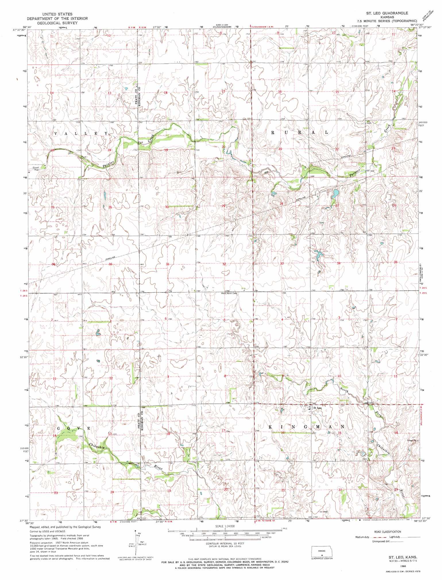
USGS Topo Quad 37098e4 - 1:24,000 scale
| Topo Map Name: | Saint Leo |
| USGS Topo Quad ID: | 37098e4 |
| Print Size: | ca. 21 1/4" wide x 27" high |
| Southeast Coordinates: | 37.5° N latitude / 98.375° W longitude |
| Map Center Coordinates: | 37.5625° N latitude / 98.4375° W longitude |
| U.S. State: | KS |
| Filename: | o37098e4.jpg |
| Download Map JPG Image: | Saint Leo topo map 1:24,000 scale |
| Map Type: | Topographic |
| Topo Series: | 7.5´ |
| Map Scale: | 1:24,000 |
| Source of Map Images: | United States Geological Survey (USGS) |
| Alternate Map Versions: |
St Leo KS 1966, updated 1968 Download PDF Buy paper map Saint Leo KS 2009 Download PDF Buy paper map Saint Leo KS 2012 Download PDF Buy paper map Saint Leo KS 2015 Download PDF Buy paper map |
1:24,000 Topo Quads surrounding Saint Leo
Stafford Sw |
Preston |
Turon |
Langdon |
Pretty Prairie Sw |
Pratt |
Cairo |
Cunningham |
Penalosa |
Kingman Nw |
Pratt Sw |
Pratt Se |
Saint Leo |
Willowdale |
Cleveland |
Sawyer |
Isabel |
Nashville |
Zenda |
Spivey |
Medicine Lodge Sw |
Medicine Lodge |
Sharon North |
Zenda Se |
Crystal Springs |
> Back to 37098e1 at 1:100,000 scale
> Back to 37098a1 at 1:250,000 scale
> Back to U.S. Topo Maps home
Saint Leo digital topo map on disk
Buy this Saint Leo topo map showing relief, roads, GPS coordinates and other geographical features, as a high-resolution digital map file on DVD: