Medicine Lodge Topo Map Kansas
To zoom in, hover over the map of Medicine Lodge
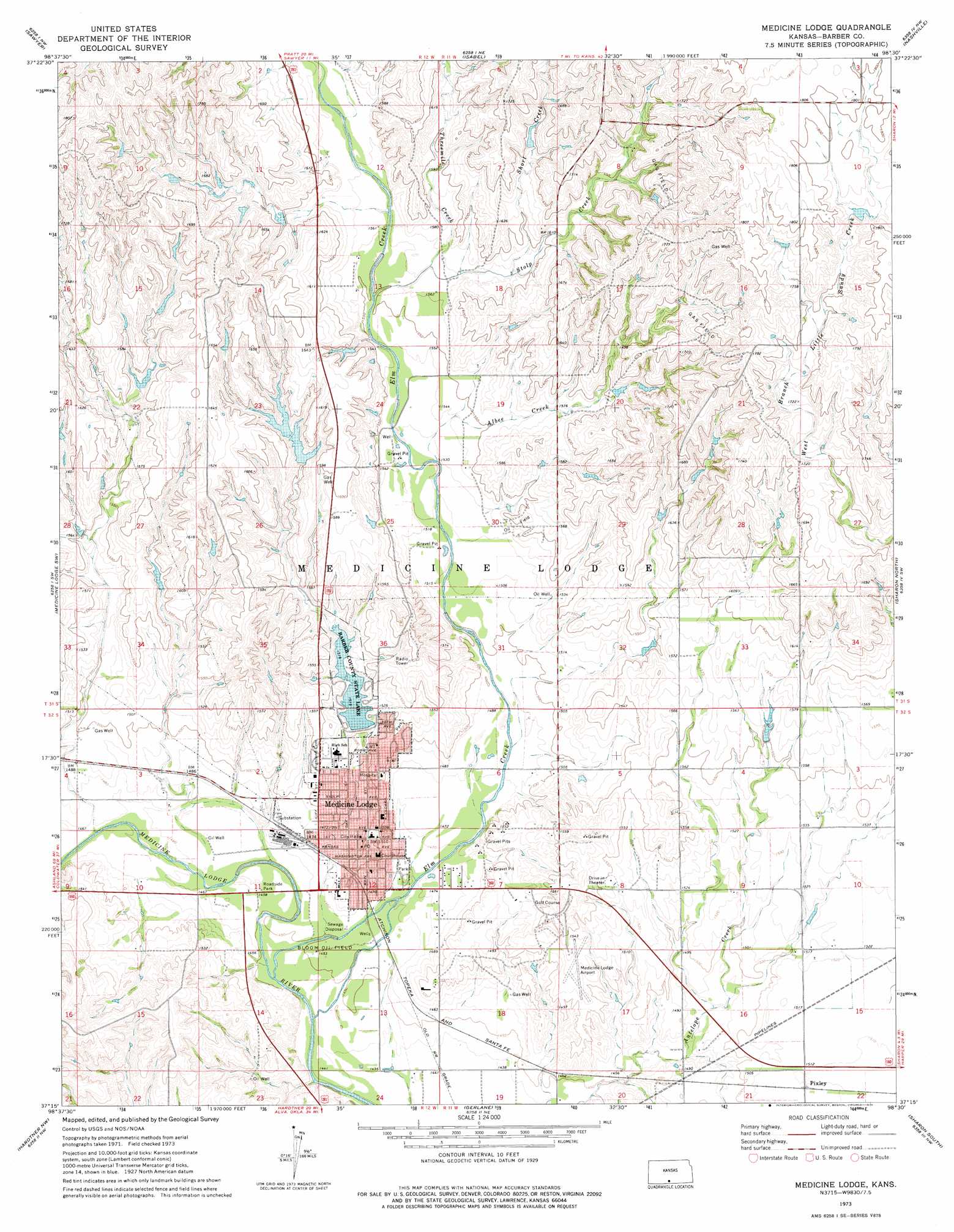
USGS Topo Quad 37098c5 - 1:24,000 scale
| Topo Map Name: | Medicine Lodge |
| USGS Topo Quad ID: | 37098c5 |
| Print Size: | ca. 21 1/4" wide x 27" high |
| Southeast Coordinates: | 37.25° N latitude / 98.5° W longitude |
| Map Center Coordinates: | 37.3125° N latitude / 98.5625° W longitude |
| U.S. State: | KS |
| Filename: | o37098c5.jpg |
| Download Map JPG Image: | Medicine Lodge topo map 1:24,000 scale |
| Map Type: | Topographic |
| Topo Series: | 7.5´ |
| Map Scale: | 1:24,000 |
| Source of Map Images: | United States Geological Survey (USGS) |
| Alternate Map Versions: |
Medicine Lodge KS 1973, updated 1975 Download PDF Buy paper map Medicine Lodge KS 2009 Download PDF Buy paper map Medicine Lodge KS 2012 Download PDF Buy paper map Medicine Lodge KS 2015 Download PDF Buy paper map |
1:24,000 Topo Quads surrounding Medicine Lodge
Coats |
Pratt Sw |
Pratt Se |
Saint Leo |
Willowdale |
Sun City Ne |
Sawyer |
Isabel |
Nashville |
Zenda |
Lake City |
Medicine Lodge Sw |
Medicine Lodge |
Sharon North |
Zenda Se |
Pump Creek |
Hardtner Nw |
Gerlane |
Sharon South |
Crisfield |
Hackberry Creek |
Hardtner |
Stubbs |
Kiowa |
Corwin |
> Back to 37098a1 at 1:100,000 scale
> Back to 37098a1 at 1:250,000 scale
> Back to U.S. Topo Maps home
Medicine Lodge topo map: Gazetteer
Medicine Lodge: Airports
Medicine Lodge Airport elevation 470m 1541′Medicine Lodge: Dams
Barber County State Lake Dam elevation 461m 1512′Medicine Lodge: Oilfields
Bloom Oil Field elevation 442m 1450′Medicine Lodge: Parks
Barber State Fishing Lake elevation 461m 1512′Barber State Fishing Lake and Wildlife Area elevation 461m 1512′
Memorial Peace Park elevation 447m 1466′
Medicine Lodge: Populated Places
Medicine Lodge elevation 456m 1496′Pixley elevation 460m 1509′
Medicine Lodge: Reservoirs
Barber County State Lake elevation 461m 1512′Medicine Lodge: Streams
Albee Creek elevation 463m 1519′Elm Creek elevation 449m 1473′
Short Creek elevation 480m 1574′
Threemile Creek elevation 475m 1558′
Medicine Lodge digital topo map on disk
Buy this Medicine Lodge topo map showing relief, roads, GPS coordinates and other geographical features, as a high-resolution digital map file on DVD: