River Spring Topo Map California
To zoom in, hover over the map of River Spring
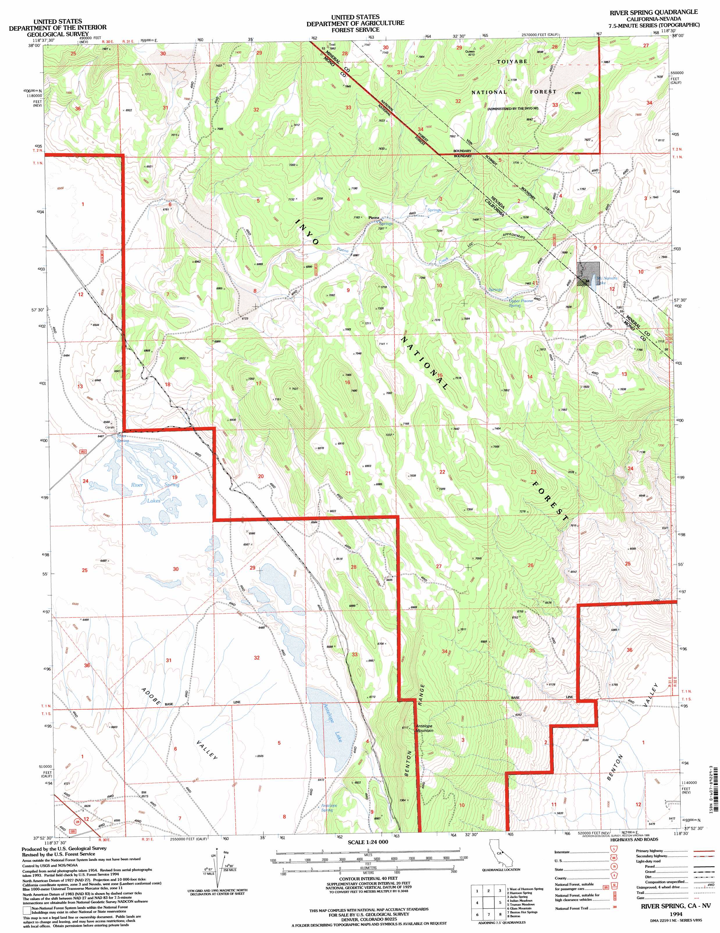
USGS Topo Quad 37118h5 - 1:24,000 scale
| Topo Map Name: | River Spring |
| USGS Topo Quad ID: | 37118h5 |
| Print Size: | ca. 21 1/4" wide x 27" high |
| Southeast Coordinates: | 37.875° N latitude / 118.5° W longitude |
| Map Center Coordinates: | 37.9375° N latitude / 118.5625° W longitude |
| U.S. States: | CA, NV |
| Filename: | o37118h5.jpg |
| Download Map JPG Image: | River Spring topo map 1:24,000 scale |
| Map Type: | Topographic |
| Topo Series: | 7.5´ |
| Map Scale: | 1:24,000 |
| Source of Map Images: | United States Geological Survey (USGS) |
| Alternate Map Versions: |
River Spring CA 1986, updated 1986 Download PDF Buy paper map River Spring CA 1986, updated 1986 Download PDF Buy paper map River Spring CA 1994, updated 1998 Download PDF Buy paper map River Spring CA 2012 Download PDF Buy paper map River Spring CA 2015 Download PDF Buy paper map |
| FStopo: | US Forest Service topo River Spring is available: Download FStopo PDF Download FStopo TIF |
1:24,000 Topo Quads surrounding River Spring
Cedar Hill |
Anchorite Hills |
Huntoon Valley |
Little Huntoon Valley |
Teels Marsh |
Alameda Well |
West Of Huntoon Spring |
Huntoon Spring |
Jacks Spring |
Basalt |
Cowtrack Mountain |
Indian Meadows |
River Spring |
Truman Meadows |
Mount Montgomery |
Dexter Canyon |
Glass Mountain |
Benton Hot Spirngs |
Benton |
Boundary Peak |
Whitmore Hot Springs |
Watterson Canyon |
Banner Ridge |
Hammil Valley |
White Mountain Peak |
> Back to 37118e1 at 1:100,000 scale
> Back to 37118a1 at 1:250,000 scale
> Back to U.S. Topo Maps home
River Spring topo map: Gazetteer
River Spring: Lakes
Antelope Lake elevation 1975m 6479′McNamara Lake elevation 2324m 7624′
River Spring Lakes elevation 1975m 6479′
River Spring: Populated Places
Pizona elevation 2145m 7037′River Spring: Springs
Antelope Spring elevation 1977m 6486′River Spring elevation 1980m 6496′
Upper Pizona Spring elevation 2232m 7322′
River Spring: Streams
Pizona Creek elevation 2005m 6578′Pizona Creek elevation 2047m 6715′
River Spring: Summits
Antelope Mountain elevation 2322m 7618′River Spring digital topo map on disk
Buy this River Spring topo map showing relief, roads, GPS coordinates and other geographical features, as a high-resolution digital map file on DVD: