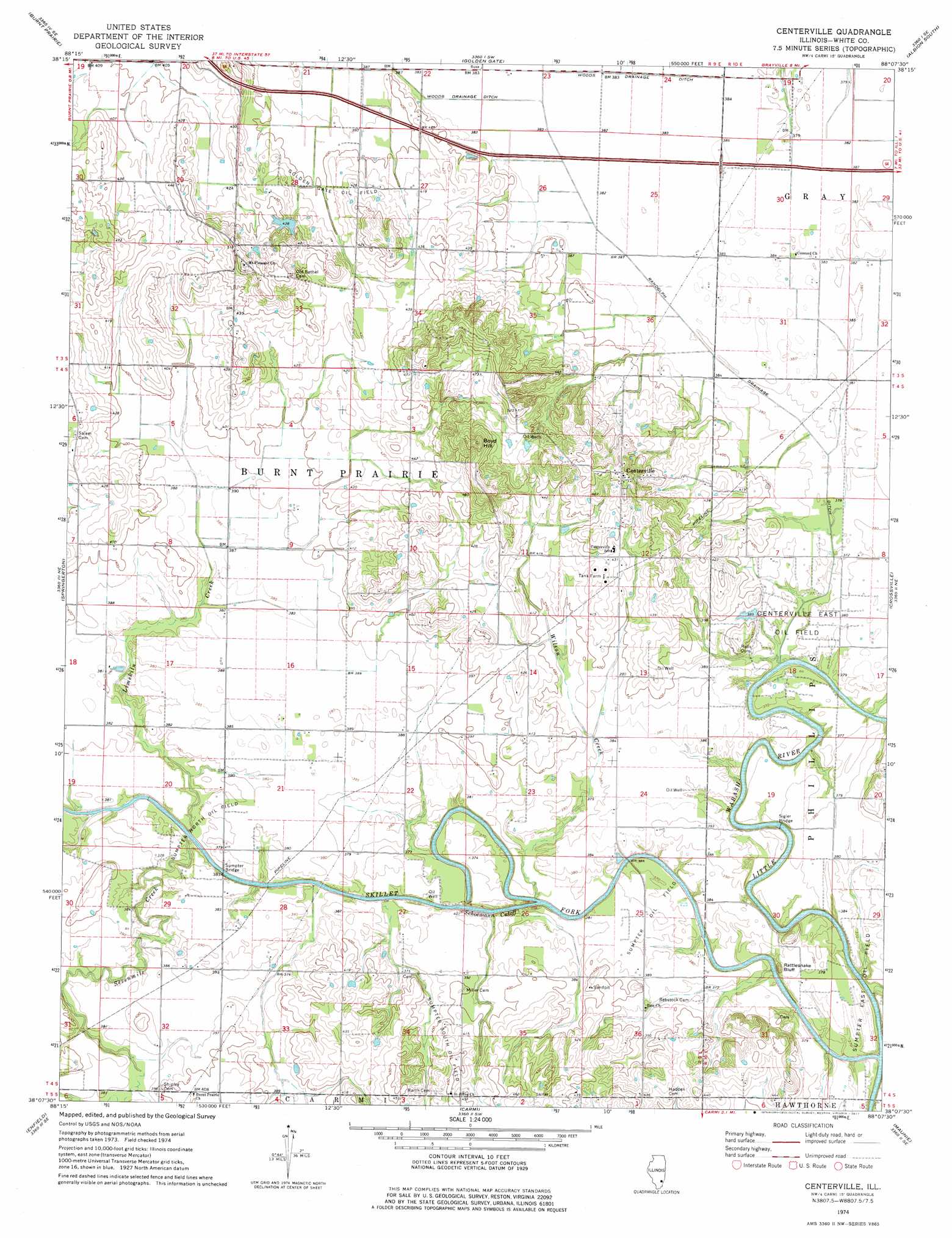
Centerville Topo Map Illinois
To zoom in, hover over the map of Centerville
USGS Topo Quad 38088b2 - 1:24,000 scale
| Topo Map Name: | Centerville |
| USGS Topo Quad ID: | 38088b2 |
| Print Size: | ca. 21 1/4" wide x 27" high |
| Southeast Coordinates: | 38.125° N latitude / 88.125° W longitude |
| Map Center Coordinates: | 38.1875° N latitude / 88.1875° W longitude |
| U.S. State: | IL |
| Filename: | o38088b2.jpg |
| Download Map JPG Image: | Centerville topo map 1:24,000 scale |
| Map Type: | Topographic |
| Topo Series: | 7.5´ |
| Map Scale: | 1:24,000 |
| Source of Map Images: | United States Geological Survey (USGS) |
| Alternate Map Versions: |
Centerville IL 1974, updated 1977 Download PDF Buy paper map Centerville IL 2012 Download PDF Buy paper map Centerville IL 2015 Download PDF Buy paper map |
1:24,000 Topo Quads surrounding Centerville
Geff |
Fairfield |
Albion Nw |
Albion North |
Bone Gap |
Boylestown |
Burnt Prairie |
Golden Gate |
Albion South |
Grayville |
Bungay |
Springerton |
Centerville |
Crossville |
New Harmony |
Thackeray |
Enfield |
Carmi |
Maunie |
Solitude |
Broughton |
Norris City |
New Haven |
Emma |
Mount Vernon |
> Back to 38088a1 at 1:100,000 scale
> Back to 38088a1 at 1:250,000 scale
> Back to U.S. Topo Maps home
Centerville topo map: Gazetteer
Centerville: Bridges
Sigler Bridge elevation 106m 347′Sumpter Bridge elevation 106m 347′
Winters Bridge elevation 104m 341′
Centerville: Canals
Randolph Drainage Ditch elevation 113m 370′Woods Drainage Ditch elevation 116m 380′
Centerville: Channels
Schoemann Cutoff elevation 106m 347′Centerville: Crossings
Interchange 117 elevation 131m 429′Centerville: Dams
Illinois No Name Number 2000 Dam elevation 128m 419′Centerville: Oilfields
Centerville East Oil Field elevation 111m 364′Sumpter North Oil Field elevation 113m 370′
Sumpter Oil Field elevation 116m 380′
Sumpter South Oil Field elevation 119m 390′
Centerville: Populated Places
Centerville elevation 155m 508′Centerville: Streams
Limekiln Creek elevation 106m 347′Sevenmile Creek elevation 106m 347′
Skillet Fork elevation 106m 347′
Wilson Creek elevation 106m 347′
Centerville: Summits
Boyd Hill elevation 175m 574′Rattlesnake Bluff elevation 131m 429′
Centerville digital topo map on disk
Buy this Centerville topo map showing relief, roads, GPS coordinates and other geographical features, as a high-resolution digital map file on DVD: