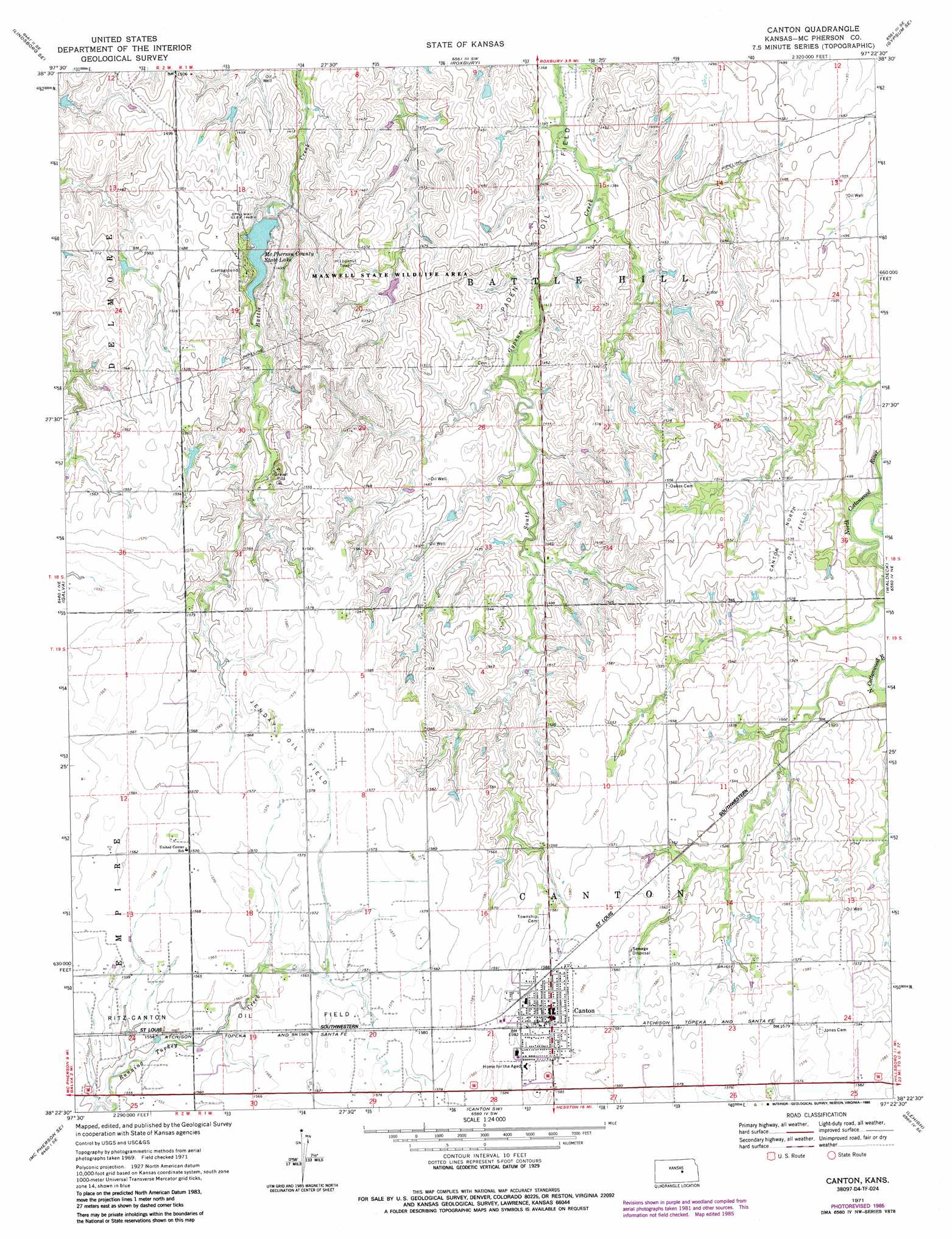
Canton Topo Map Kansas
To zoom in, hover over the map of Canton
USGS Topo Quad 38097d4 - 1:24,000 scale
| Topo Map Name: | Canton |
| USGS Topo Quad ID: | 38097d4 |
| Print Size: | ca. 21 1/4" wide x 27" high |
| Southeast Coordinates: | 38.375° N latitude / 97.375° W longitude |
| Map Center Coordinates: | 38.4375° N latitude / 97.4375° W longitude |
| U.S. State: | KS |
| Filename: | o38097d4.jpg |
| Download Map JPG Image: | Canton topo map 1:24,000 scale |
| Map Type: | Topographic |
| Topo Series: | 7.5´ |
| Map Scale: | 1:24,000 |
| Source of Map Images: | United States Geological Survey (USGS) |
| Alternate Map Versions: |
Canton KS 1971, updated 1972 Download PDF Buy paper map Canton KS 1971, updated 1985 Download PDF Buy paper map Canton KS 2010 Download PDF Buy paper map Canton KS 2012 Download PDF Buy paper map Canton KS 2015 Download PDF Buy paper map |
1:24,000 Topo Quads surrounding Canton
Smolan |
Assaria |
Gypsum |
Carlton |
Elmo |
Lindsborg |
Lindsborg Se |
Roxbury |
Gypsum Se |
Tampa |
Mcpherson North |
Galva |
Canton |
Waldeck |
Durham |
Mcpherson South |
Mcpherson Se |
Canton Sw |
Lehigh |
Hillsboro |
Halstead Nw |
Moundridge |
Hesston |
Goessel |
Peabody Nw |
> Back to 38097a1 at 1:100,000 scale
> Back to 38096a1 at 1:250,000 scale
> Back to U.S. Topo Maps home
Canton topo map: Gazetteer
Canton: Dams
McPherson County State Lake Dam elevation 439m 1440′Canton: Oilfields
Canton North Oil Field elevation 469m 1538′Jenday Oil Field elevation 480m 1574′
Paden Oil Field elevation 433m 1420′
Canton: Parks
Maxwell State Game Refuge elevation 449m 1473′Canton: Populated Places
Canton elevation 485m 1591′Canton: Reservoirs
McPherson County State Lake elevation 439m 1440′Canton digital topo map on disk
Buy this Canton topo map showing relief, roads, GPS coordinates and other geographical features, as a high-resolution digital map file on DVD: