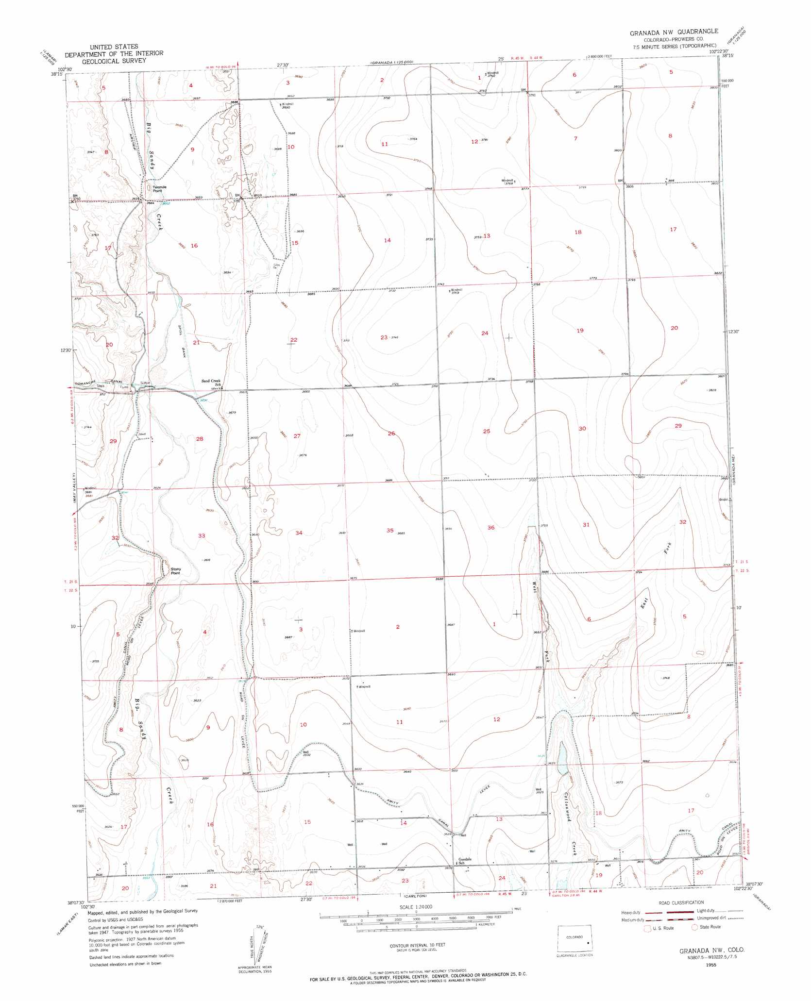
Granada Nw Topo Map Colorado
To zoom in, hover over the map of Granada Nw
USGS Topo Quad 38102b4 - 1:24,000 scale
| Topo Map Name: | Granada Nw |
| USGS Topo Quad ID: | 38102b4 |
| Print Size: | ca. 21 1/4" wide x 27" high |
| Southeast Coordinates: | 38.125° N latitude / 102.375° W longitude |
| Map Center Coordinates: | 38.1875° N latitude / 102.4375° W longitude |
| U.S. State: | CO |
| Filename: | o38102b4.jpg |
| Download Map JPG Image: | Granada Nw topo map 1:24,000 scale |
| Map Type: | Topographic |
| Topo Series: | 7.5´ |
| Map Scale: | 1:24,000 |
| Source of Map Images: | United States Geological Survey (USGS) |
| Alternate Map Versions: |
Granada NW CO 1955, updated 1956 Download PDF Buy paper map Granada NW CO 1955, updated 1956 Download PDF Buy paper map Granada NW CO 2010 Download PDF Buy paper map Granada NW CO 2013 Download PDF Buy paper map Granada NW CO 2016 Download PDF Buy paper map |
1:24,000 Topo Quads surrounding Granada Nw
Alkali Lake |
Chivington |
Brandon |
Sheridan Lake |
Stuart |
Neenoshe Reservoir |
Chivington Se |
Sheridan Lake Sw |
Sheridan Lake Se |
Lake Devore |
Wiley |
May Valley |
Granada Nw |
Granada Ne |
Holly Nw |
Lamar West |
Lamar East |
Carlton |
Granada |
Holly West |
Cat Creek Nw |
Cat Creek Ne |
North Plum Creek Nw |
North Plum Creek Ne |
Durkee Creek Nw |
> Back to 38102a1 at 1:100,000 scale
> Back to 38102a1 at 1:250,000 scale
> Back to U.S. Topo Maps home
Granada Nw topo map: Gazetteer
Granada Nw: Cliffs
Stony Point elevation 1114m 3654′Tenmile Point elevation 1128m 3700′
Granada Nw: Dams
Cottonwood Number 1 Dam elevation 1097m 3599′Granada Nw: Reservoirs
Wilson Reservoir elevation 1097m 3599′Granada Nw: Streams
East Fork Cottonwood Creek elevation 1105m 3625′West Fork Cottonwood Creek elevation 1105m 3625′
Granada Nw digital topo map on disk
Buy this Granada Nw topo map showing relief, roads, GPS coordinates and other geographical features, as a high-resolution digital map file on DVD: