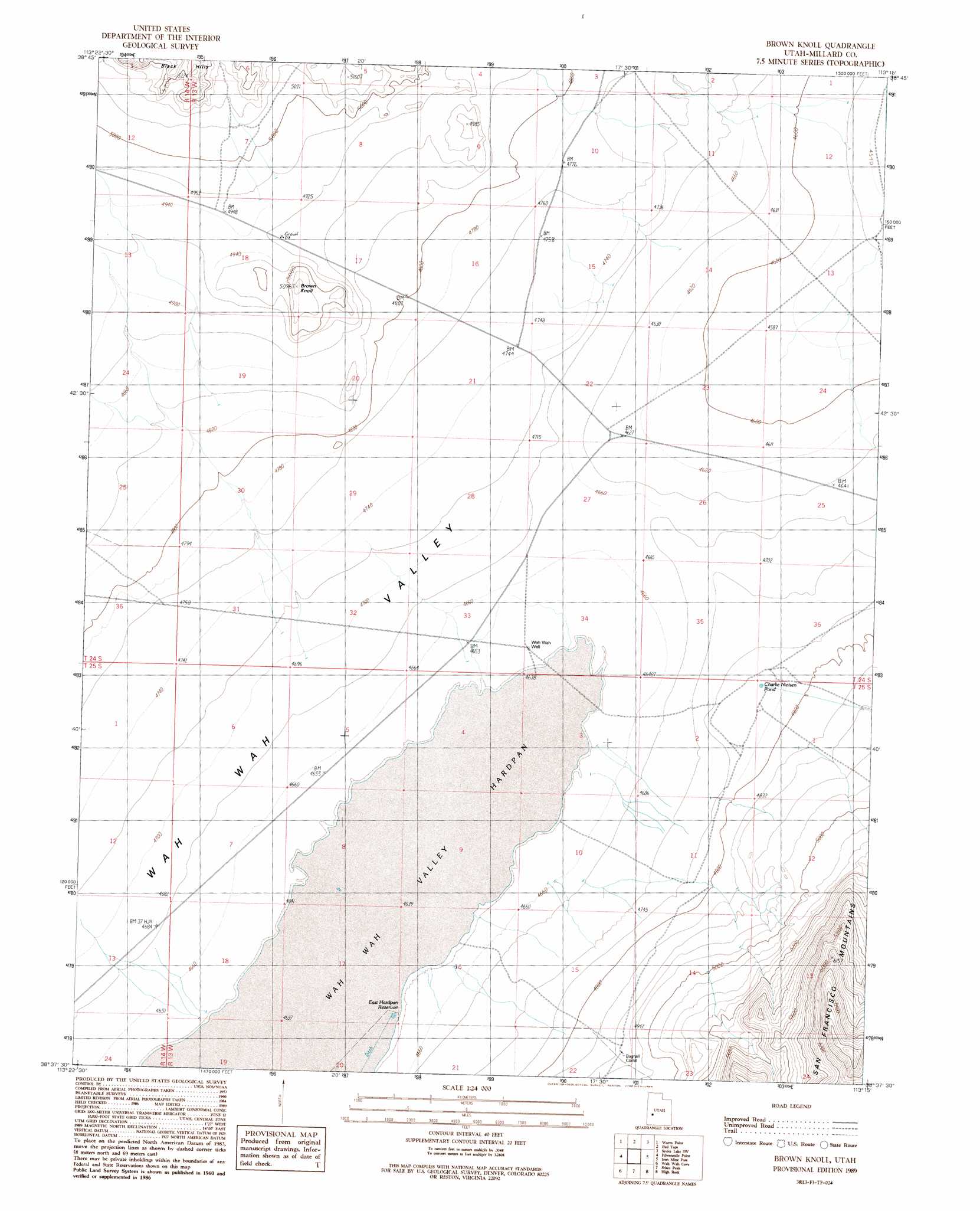
Brown Knoll Topo Map Utah
To zoom in, hover over the map of Brown Knoll
USGS Topo Quad 38113f3 - 1:24,000 scale
| Topo Map Name: | Brown Knoll |
| USGS Topo Quad ID: | 38113f3 |
| Print Size: | ca. 21 1/4" wide x 27" high |
| Southeast Coordinates: | 38.625° N latitude / 113.25° W longitude |
| Map Center Coordinates: | 38.6875° N latitude / 113.3125° W longitude |
| U.S. State: | UT |
| Filename: | o38113f3.jpg |
| Download Map JPG Image: | Brown Knoll topo map 1:24,000 scale |
| Map Type: | Topographic |
| Topo Series: | 7.5´ |
| Map Scale: | 1:24,000 |
| Source of Map Images: | United States Geological Survey (USGS) |
| Alternate Map Versions: |
Brown Knoll UT 1989, updated 1989 Download PDF Buy paper map Brown Knoll UT 2010 Download PDF Buy paper map Brown Knoll UT 2014 Download PDF Buy paper map |
1:24,000 Topo Quads surrounding Brown Knoll
King Top |
The Barn |
Burnout Canyon |
Needle Point |
Sevier Lake Ne |
Crystal Peak |
Warm Point |
Red Tops |
Sevier Lake Sw |
Headlight Mountain |
Grassy Cove |
Fifteenmile Point |
Brown Knoll |
Iron Mine Pass |
Red Rock Knoll |
Wah Wah Summit |
Wah Wah Cove |
Frisco Peak |
High Rock |
Lime Mountain |
Sewing Machine Pass |
Wallaces Peak |
Frisco |
Milford Nw |
Milford |
> Back to 38113e1 at 1:100,000 scale
> Back to 38112a1 at 1:250,000 scale
> Back to U.S. Topo Maps home
Brown Knoll topo map: Gazetteer
Brown Knoll: Flats
Wah Wah Valley Hardpan elevation 1411m 4629′Brown Knoll: Reservoirs
East Hardpan Reservoir elevation 1414m 4639′Nielson Pond elevation 1456m 4776′
Brown Knoll: Summits
Brown Knoll elevation 1519m 4983′Brown Knoll: Valleys
Wah Wah Valley elevation 1395m 4576′Brown Knoll: Wells
Wah Wah Well elevation 1417m 4648′Brown Knoll digital topo map on disk
Buy this Brown Knoll topo map showing relief, roads, GPS coordinates and other geographical features, as a high-resolution digital map file on DVD: