Sunnyside Nw Topo Map Nevada
To zoom in, hover over the map of Sunnyside Nw
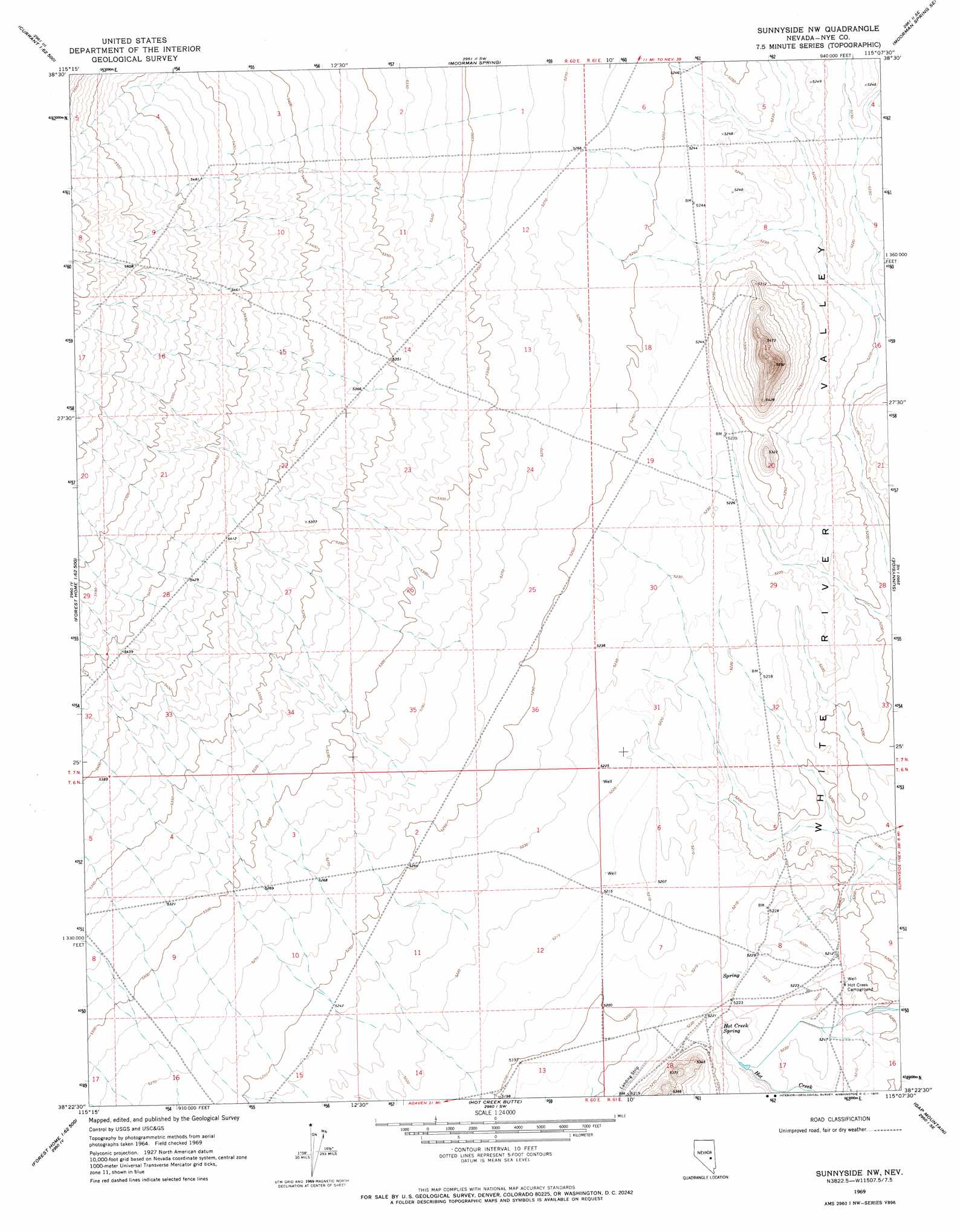
USGS Topo Quad 38115d2 - 1:24,000 scale
| Topo Map Name: | Sunnyside Nw |
| USGS Topo Quad ID: | 38115d2 |
| Print Size: | ca. 21 1/4" wide x 27" high |
| Southeast Coordinates: | 38.375° N latitude / 115.125° W longitude |
| Map Center Coordinates: | 38.4375° N latitude / 115.1875° W longitude |
| U.S. State: | NV |
| Filename: | o38115d2.jpg |
| Download Map JPG Image: | Sunnyside Nw topo map 1:24,000 scale |
| Map Type: | Topographic |
| Topo Series: | 7.5´ |
| Map Scale: | 1:24,000 |
| Source of Map Images: | United States Geological Survey (USGS) |
| Alternate Map Versions: |
Sunnyside NW NV 1969, updated 1971 Download PDF Buy paper map Sunnyside NW NV 2012 Download PDF Buy paper map Sunnyside NW NV 2014 Download PDF Buy paper map |
1:24,000 Topo Quads surrounding Sunnyside Nw
Currant |
Callaway Well |
Moorman Spring Nw |
Hardy Springs |
Haggerty Spring |
Blue Eagle Mountain |
Wells Station |
Moorman Spring |
Moorman Spring Se |
Shingle Pass |
Heath Canyon |
Forest Home Ne |
Sunnyside Nw |
Sunnyside |
Cave Valley Well |
Horse Spring Hills |
Forest Home |
Hot Creek Butte |
Gap Mountain |
Silver King Well |
Water Gap Nw |
Water Gap Ne |
Timber Mountain Pass Nw |
Timber Mountain Pass Ne |
Silver King Mountain |
> Back to 38115a1 at 1:100,000 scale
> Back to 38114a1 at 1:250,000 scale
> Back to U.S. Topo Maps home
Sunnyside Nw topo map: Gazetteer
Sunnyside Nw: Populated Places
Hot Creek elevation 1595m 5232′Sunnyside Nw: Springs
Egan Spring elevation 1592m 5223′Hot Creek Spring elevation 1594m 5229′
Sunnyside Nw: Valleys
Sandy Wash elevation 1614m 5295′Sunnyside Nw digital topo map on disk
Buy this Sunnyside Nw topo map showing relief, roads, GPS coordinates and other geographical features, as a high-resolution digital map file on DVD: