Hu-Pwi Wash Topo Map Nevada
To zoom in, hover over the map of Hu-Pwi Wash
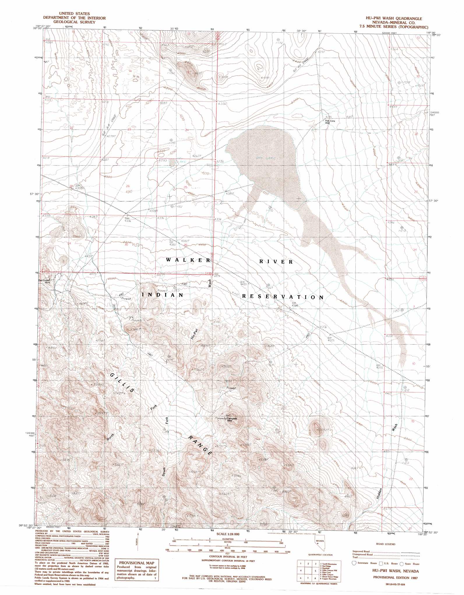
USGS Topo Quad 38118h5 - 1:24,000 scale
| Topo Map Name: | Hu-Pwi Wash |
| USGS Topo Quad ID: | 38118h5 |
| Print Size: | ca. 21 1/4" wide x 27" high |
| Southeast Coordinates: | 38.875° N latitude / 118.5° W longitude |
| Map Center Coordinates: | 38.9375° N latitude / 118.5625° W longitude |
| U.S. State: | NV |
| Filename: | o38118h5.jpg |
| Download Map JPG Image: | Hu-Pwi Wash topo map 1:24,000 scale |
| Map Type: | Topographic |
| Topo Series: | 7.5´ |
| Map Scale: | 1:24,000 |
| Source of Map Images: | United States Geological Survey (USGS) |
| Alternate Map Versions: |
Hu-Pwi Wash NV 1987, updated 1988 Download PDF Buy paper map Hu-Pwi Wash NV 2011 Download PDF Buy paper map Hu-Pwi Wash NV 2014 Download PDF Buy paper map |
1:24,000 Topo Quads surrounding Hu-Pwi Wash
Russell Spit |
Allen Springs |
Diamond Field Jack Wash |
Fourmile Canyon |
Chukar Canyon |
Weber Dam |
Terrill Mountains |
Red Ridge |
Rawhide |
Big Kasock Mountain |
Schurz |
Gillis Canyon Nw |
Hu-Pwi Wash |
Pilot Cone |
Murphys Well |
Reese River Canyon |
Gillis Canyon |
Ghost Dance Ridge |
Copper Mountain |
Poinsettia Spring |
Copper Canyon |
Walker Lake |
Ryan Canyon |
Kinkaid Nw |
Win Wan Flat |
> Back to 38118e1 at 1:100,000 scale
> Back to 38118a1 at 1:250,000 scale
> Back to U.S. Topo Maps home
Hu-Pwi Wash topo map: Gazetteer
Hu-Pwi Wash: Mines
Centipede Mine elevation 1603m 5259′Red Granite Mine elevation 1391m 4563′
Hu-Pwi Wash: Ranges
Gumdrop Hills elevation 1491m 4891′Hu-Pwi Wash: Springs
Greasewood Spring elevation 1410m 4625′Hu-Pwi Wash: Streams
Hidden Wash elevation 1296m 4251′Hu-Pwi Wash elevation 1296m 4251′
North Fork Hu-Pwi Wash elevation 1500m 4921′
South Fork Hu-Pwi Wash elevation 1468m 4816′
Hu-Pwi Wash: Wells
Pilot Cone Well elevation 1310m 4297′Hu-Pwi Wash digital topo map on disk
Buy this Hu-Pwi Wash topo map showing relief, roads, GPS coordinates and other geographical features, as a high-resolution digital map file on DVD: