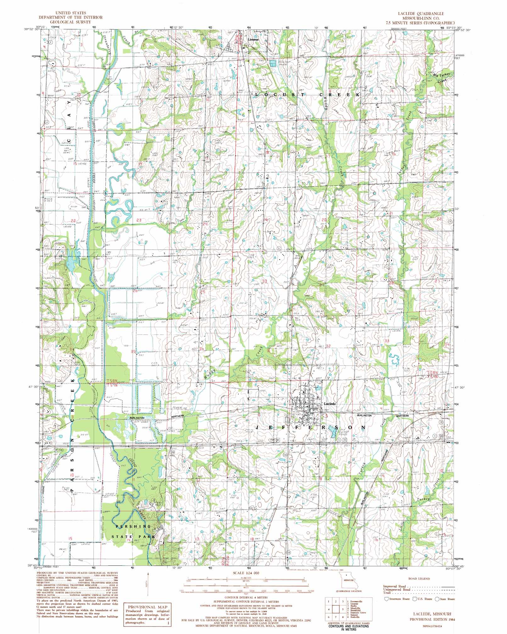
Laclede Topo Map Missouri
To zoom in, hover over the map of Laclede
USGS Topo Quad 39093g2 - 1:24,000 scale
| Topo Map Name: | Laclede |
| USGS Topo Quad ID: | 39093g2 |
| Print Size: | ca. 21 1/4" wide x 27" high |
| Southeast Coordinates: | 39.75° N latitude / 93.125° W longitude |
| Map Center Coordinates: | 39.8125° N latitude / 93.1875° W longitude |
| U.S. State: | MO |
| Filename: | o39093g2.jpg |
| Download Map JPG Image: | Laclede topo map 1:24,000 scale |
| Map Type: | Topographic |
| Topo Series: | 7.5´ |
| Map Scale: | 1:24,000 |
| Source of Map Images: | United States Geological Survey (USGS) |
| Alternate Map Versions: |
Laclede MO 1984, updated 1985 Download PDF Buy paper map Laclede MO 2012 Download PDF Buy paper map Laclede MO 2015 Download PDF Buy paper map |
1:24,000 Topo Quads surrounding Laclede
Laredo |
Lindley |
Browning |
Milan Se |
Winigan |
Chula |
Eversonville |
Linneus |
Shelby |
Bucklin Nw |
Wheeling |
Meadville |
Laclede |
Brookfield |
Bucklin |
Avalon |
Fountain Grove |
Sumner |
Rothville |
Marceline |
Tina |
Hale |
Mendon |
Indian Grove |
Mike |
> Back to 39093e1 at 1:100,000 scale
> Back to 39092a1 at 1:250,000 scale
> Back to U.S. Topo Maps home
Laclede topo map: Gazetteer
Laclede: Canals
Higgins Ditch elevation 209m 685′Laclede: Parks
Pershing State Park elevation 211m 692′Laclede: Populated Places
Laclede elevation 236m 774′Laclede: Streams
Big Turkey Creek elevation 236m 774′Kemper Branch elevation 212m 695′
Muddy Creek elevation 208m 682′
Strawberry Branch elevation 212m 695′
Laclede digital topo map on disk
Buy this Laclede topo map showing relief, roads, GPS coordinates and other geographical features, as a high-resolution digital map file on DVD: