De Nova Ne Topo Map Colorado
To zoom in, hover over the map of De Nova Ne
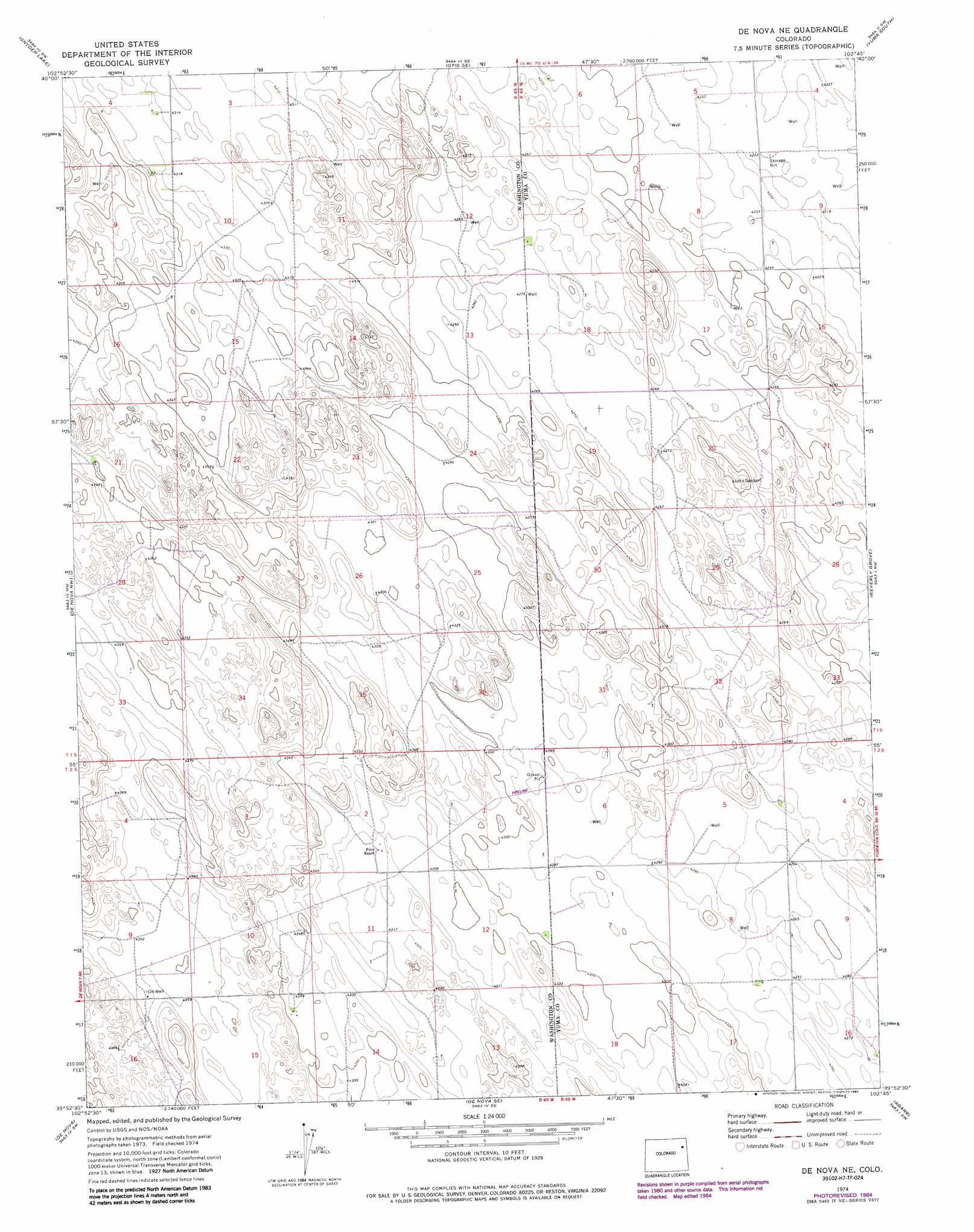
USGS Topo Quad 39102h7 - 1:24,000 scale
| Topo Map Name: | De Nova Ne |
| USGS Topo Quad ID: | 39102h7 |
| Print Size: | ca. 21 1/4" wide x 27" high |
| Southeast Coordinates: | 39.875° N latitude / 102.75° W longitude |
| Map Center Coordinates: | 39.9375° N latitude / 102.8125° W longitude |
| U.S. State: | CO |
| Filename: | o39102h7.jpg |
| Download Map JPG Image: | De Nova Ne topo map 1:24,000 scale |
| Map Type: | Topographic |
| Topo Series: | 7.5´ |
| Map Scale: | 1:24,000 |
| Source of Map Images: | United States Geological Survey (USGS) |
| Alternate Map Versions: |
De Nova NE CO 1974, updated 1977 Download PDF Buy paper map De Nova NE CO 1974, updated 1977 Download PDF Buy paper map De Nova NE CO 1974, updated 1985 Download PDF Buy paper map De Nova NE CO 2010 Download PDF Buy paper map De Nova NE CO 2013 Download PDF Buy paper map De Nova NE CO 2016 Download PDF Buy paper map |
1:24,000 Topo Quads surrounding De Nova Ne
Platner |
Otis |
Hyde |
Yuma North |
Yuma Ne |
Akron Se |
Snyder Lake |
Otis Se |
Yuma South |
Schramm |
Elba Ne |
De Nova Nw |
De Nova Ne |
Beverly Grove |
Heartstrong |
Elba Se |
De Nova |
De Nova Se |
Abarr |
Abarr Se |
Arickaree |
Cope Nw |
Cope |
Joes |
Adler Creek |
> Back to 39102e1 at 1:100,000 scale
> Back to 39102a1 at 1:250,000 scale
> Back to U.S. Topo Maps home
No gazetteer data is available for the De Nova Ne topo map sheet.
De Nova Ne digital topo map on disk
Buy this De Nova Ne topo map showing relief, roads, GPS coordinates and other geographical features, as a high-resolution digital map file on DVD: