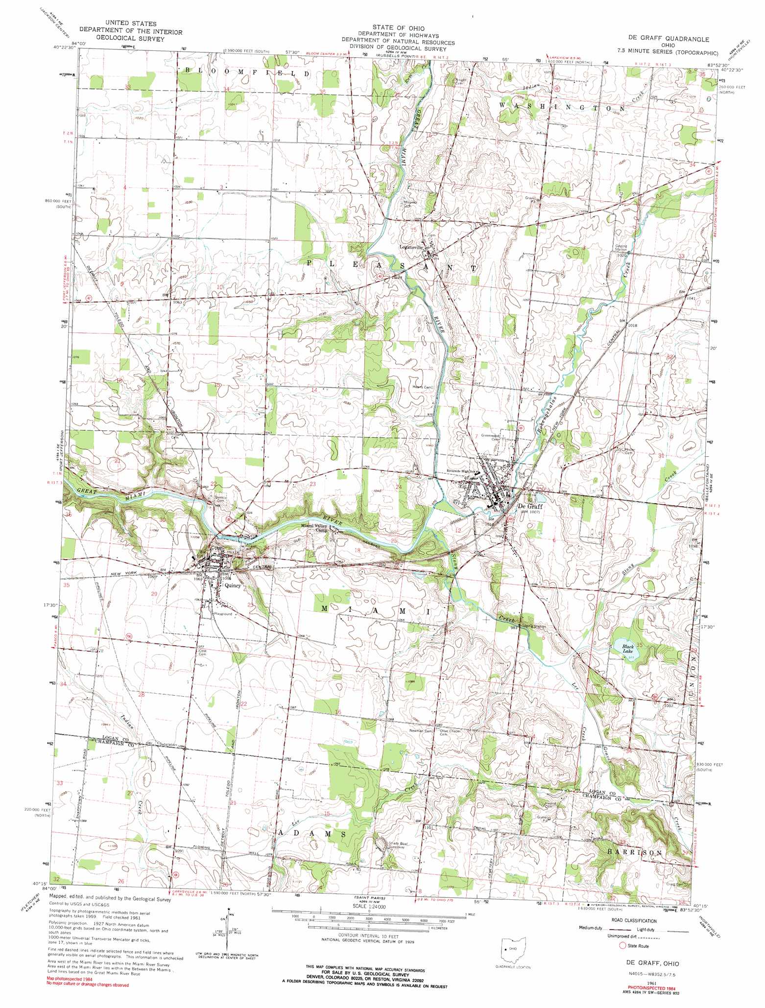
De Graff Topo Map Ohio
To zoom in, hover over the map of De Graff
USGS Topo Quad 40083c8 - 1:24,000 scale
| Topo Map Name: | De Graff |
| USGS Topo Quad ID: | 40083c8 |
| Print Size: | ca. 21 1/4" wide x 27" high |
| Southeast Coordinates: | 40.25° N latitude / 83.875° W longitude |
| Map Center Coordinates: | 40.3125° N latitude / 83.9375° W longitude |
| U.S. State: | OH |
| Filename: | o40083c8.jpg |
| Download Map JPG Image: | De Graff topo map 1:24,000 scale |
| Map Type: | Topographic |
| Topo Series: | 7.5´ |
| Map Scale: | 1:24,000 |
| Source of Map Images: | United States Geological Survey (USGS) |
| Alternate Map Versions: |
De Graff OH 1961, updated 1962 Download PDF Buy paper map De Graff OH 1961, updated 1976 Download PDF Buy paper map De Graff OH 1961, updated 1990 Download PDF Buy paper map De Graff OH 2010 Download PDF Buy paper map De Graff OH 2013 Download PDF Buy paper map De Graff OH 2016 Download PDF Buy paper map |
1:24,000 Topo Quads surrounding De Graff
Wapakoneta |
Uniopolis |
Waynesfield |
Roundhead |
Silver Creek |
Botkins |
Jackson Center |
Russells Point |
Huntsville |
Rushsylvania |
Sidney |
Port Jefferson |
De Graff |
Bellefontaine |
Zanesfield |
Piqua East |
Fletcher |
Saint Paris |
Northville |
Kingscreek |
Troy |
Christiansburg |
Thackery |
Urbana West |
Urbana East |
> Back to 40083a1 at 1:100,000 scale
> Back to 40082a1 at 1:250,000 scale
> Back to U.S. Topo Maps home
De Graff topo map: Gazetteer
De Graff: Airports
S and S Field elevation 320m 1049′De Graff: Lakes
Black Lake elevation 297m 974′De Graff: Populated Places
De Graff elevation 305m 1000′Logansville elevation 308m 1010′
Quincy elevation 321m 1053′
De Graff: Post Offices
De Graff Post Office elevation 305m 1000′Loganville Post Office (historical) elevation 308m 1010′
Quincy Post Office elevation 322m 1056′
De Graff: Streams
Bokengehalas Creek elevation 295m 967′Graves Creek elevation 298m 977′
Lee Creek elevation 296m 971′
Neals Run elevation 295m 967′
Rum Creek elevation 296m 971′
Stony Creek elevation 294m 964′
De Graff digital topo map on disk
Buy this De Graff topo map showing relief, roads, GPS coordinates and other geographical features, as a high-resolution digital map file on DVD:
 map DVD")