Wellfleet Ne Topo Map Nebraska
To zoom in, hover over the map of Wellfleet Ne
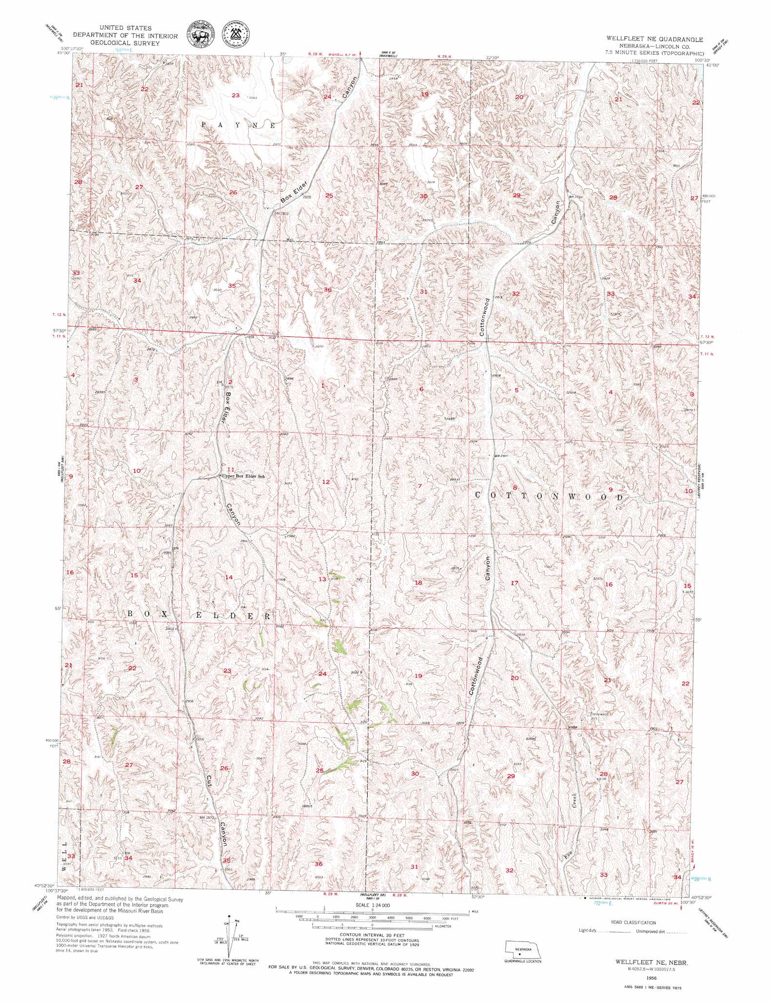
USGS Topo Quad 40100h5 - 1:24,000 scale
| Topo Map Name: | Wellfleet Ne |
| USGS Topo Quad ID: | 40100h5 |
| Print Size: | ca. 21 1/4" wide x 27" high |
| Southeast Coordinates: | 40.875° N latitude / 100.5° W longitude |
| Map Center Coordinates: | 40.9375° N latitude / 100.5625° W longitude |
| U.S. State: | NE |
| Filename: | O40100h5.jpg |
| Download Map JPG Image: | Wellfleet Ne topo map 1:24,000 scale |
| Map Type: | Topographic |
| Topo Series: | 7.5´ |
| Map Scale: | 1:24,000 |
| Source of Map Images: | United States Geological Survey (USGS) |
| Alternate Map Versions: |
Wellfleet NE NE 1956, updated 1974 Download PDF Buy paper map Wellfleet NE NE 1956, updated 1979 Download PDF Buy paper map Wellfleet NE NE 2011 Download PDF Buy paper map Wellfleet NE NE 2014 Download PDF Buy paper map |
1:24,000 Topo Quads surrounding Wellfleet Ne
North Platte West |
North Platte East |
Maxwell Ne |
Brady Nw |
Brady Ne |
Lake Maloney |
Maxwell Sw |
Maxwell |
Brady Sw |
Brady |
Dickens Ne |
Wellfleet Nw |
Wellfleet Ne |
Jeffrey Reservoir |
Jeffrey Reservoir Ne |
Somerset |
Wellfleet |
Wellfleet Se |
Jeffrey Reservoir Sw |
Jeffrey Reservoir Se |
Camp Hayes Lake Ne |
Curtis Nw |
Curtis |
Moorefield |
Stockville Ne |
> Back to 40100e1 at 1:100,000 scale
> Back to 40100a1 at 1:250,000 scale
> Back to U.S. Topo Maps home
Wellfleet Ne digital topo map on disk
Buy this Wellfleet Ne topo map showing relief, roads, GPS coordinates and other geographical features, as a high-resolution digital map file on DVD: