Geneseo Topo Map Illinois
To zoom in, hover over the map of Geneseo
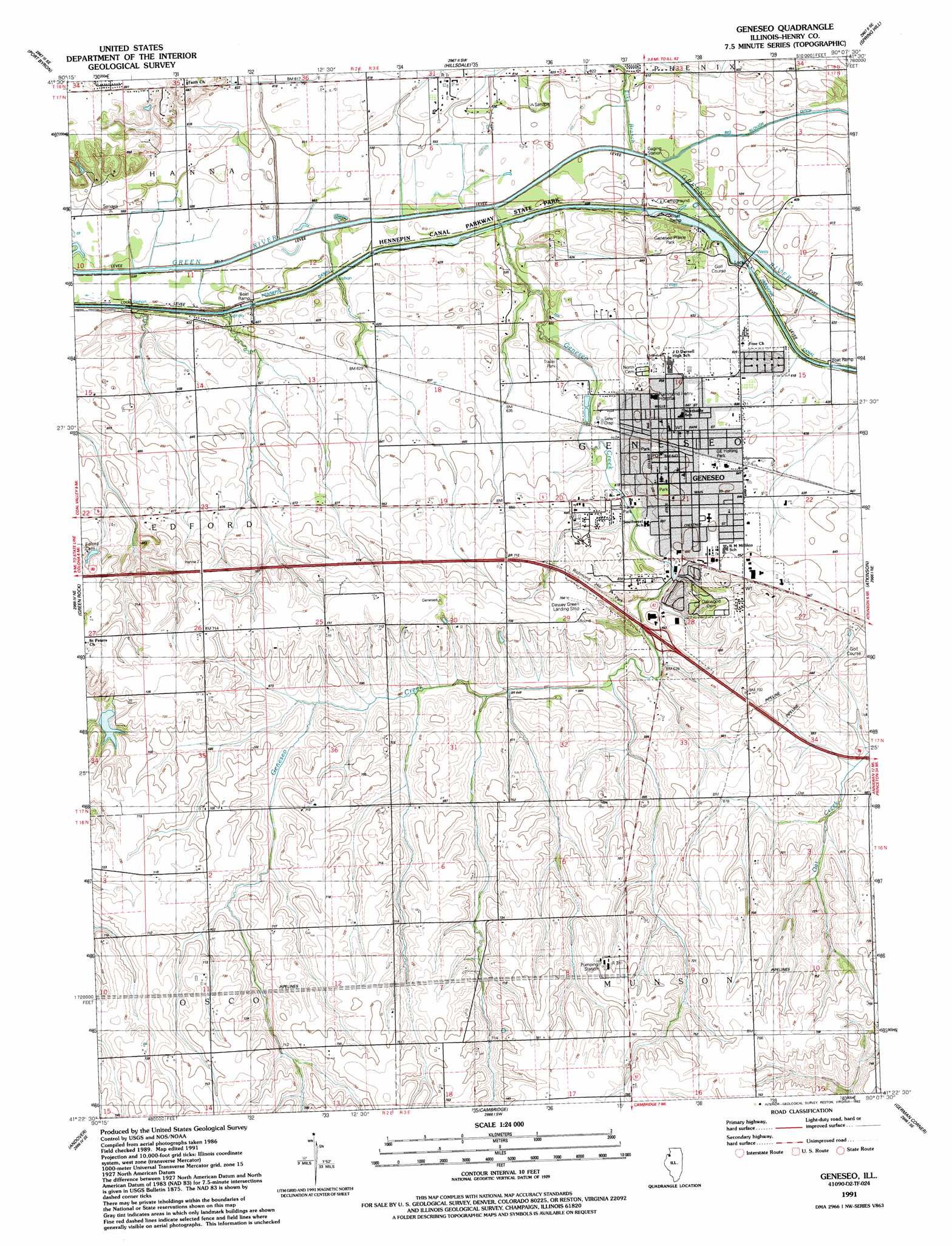
USGS Topo Quad 41090d2 - 1:24,000 scale
| Topo Map Name: | Geneseo |
| USGS Topo Quad ID: | 41090d2 |
| Print Size: | ca. 21 1/4" wide x 27" high |
| Southeast Coordinates: | 41.375° N latitude / 90.125° W longitude |
| Map Center Coordinates: | 41.4375° N latitude / 90.1875° W longitude |
| U.S. State: | IL |
| Filename: | o41090d2.jpg |
| Download Map JPG Image: | Geneseo topo map 1:24,000 scale |
| Map Type: | Topographic |
| Topo Series: | 7.5´ |
| Map Scale: | 1:24,000 |
| Source of Map Images: | United States Geological Survey (USGS) |
| Alternate Map Versions: |
Geneseo IL 1953, updated 1957 Download PDF Buy paper map Geneseo IL 1953, updated 1977 Download PDF Buy paper map Geneseo IL 1991, updated 1992 Download PDF Buy paper map Geneseo IL 2012 Download PDF Buy paper map Geneseo IL 2015 Download PDF Buy paper map |
1:24,000 Topo Quads surrounding Geneseo
Mccausland |
Cordova |
Erie Nw |
Erie |
Prophetstown |
Silvis |
Port Byron |
Hillsdale |
Spring Hill |
Hooppole |
Coal Valley |
Green Rock |
Geneseo |
Atkinson |
Annawan |
Orion |
Andover |
Cambridge |
German Corner |
Kewanee North |
New Windsor |
Woodhull |
Nekoma |
Galva |
Kewanee South |
> Back to 41090a1 at 1:100,000 scale
> Back to 41090a1 at 1:250,000 scale
> Back to U.S. Topo Maps home
Geneseo topo map: Gazetteer
Geneseo: Airports
Black Hawk Heliport elevation 189m 620′Dewey E Greene Airport elevation 215m 705′
Geneseo: Canals
Hennepin Canal elevation 182m 597′Geneseo: Crossings
Interchange 19 elevation 196m 643′Geneseo: Dams
Lock Number 24 elevation 181m 593′Lock Number 25 elevation 180m 590′
Swint Lake Dam elevation 199m 652′
Geneseo: Parks
G E Holting Park elevation 197m 646′Geneseo Prairie Park elevation 199m 652′
Geneseo: Populated Places
Geneseo elevation 198m 649′Geneseo: Post Offices
Geneseo Post Office elevation 195m 639′Geneseo: Reservoirs
Swint Lake elevation 199m 652′Geneseo: Streams
Elks Branch elevation 179m 587′Geneseo Creek elevation 179m 587′
Geneseo digital topo map on disk
Buy this Geneseo topo map showing relief, roads, GPS coordinates and other geographical features, as a high-resolution digital map file on DVD: