Nevinville Topo Map Iowa
To zoom in, hover over the map of Nevinville
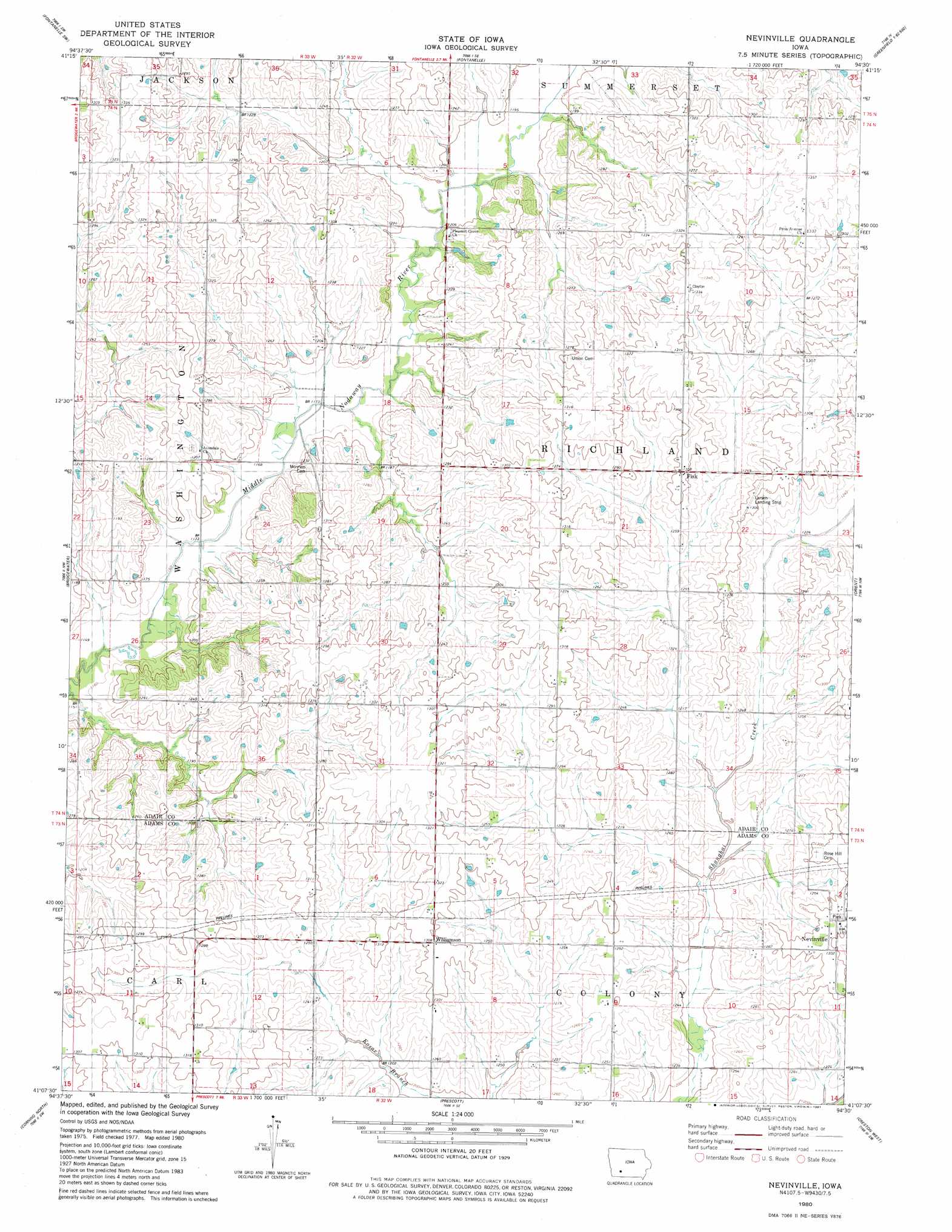
USGS Topo Quad 41094b5 - 1:24,000 scale
| Topo Map Name: | Nevinville |
| USGS Topo Quad ID: | 41094b5 |
| Print Size: | ca. 21 1/4" wide x 27" high |
| Southeast Coordinates: | 41.125° N latitude / 94.5° W longitude |
| Map Center Coordinates: | 41.1875° N latitude / 94.5625° W longitude |
| U.S. State: | IA |
| Filename: | o41094b5.jpg |
| Download Map JPG Image: | Nevinville topo map 1:24,000 scale |
| Map Type: | Topographic |
| Topo Series: | 7.5´ |
| Map Scale: | 1:24,000 |
| Source of Map Images: | United States Geological Survey (USGS) |
| Alternate Map Versions: |
Nevinville IA 1980, updated 1981 Download PDF Buy paper map Nevinville IA 2010 Download PDF Buy paper map Nevinville IA 2013 Download PDF Buy paper map Nevinville IA 2015 Download PDF Buy paper map |
1:24,000 Topo Quads surrounding Nevinville
Anita |
Adair South |
Canby |
Rosserdale |
Stuart South |
Massena |
Fontanelle Sw |
Fontanelle |
Greenfield |
Arbor Hill |
Dewey |
Bridgewater |
Nevinville |
Orient |
Zion |
Carbon |
Corning North |
Prescott |
Creston West |
Creston East |
Brooks |
Corning South |
Lenox |
Kent |
Shannon City |
> Back to 41094a1 at 1:100,000 scale
> Back to 41094a1 at 1:250,000 scale
> Back to U.S. Topo Maps home
Nevinville topo map: Gazetteer
Nevinville: Airports
Larsen Landing Strip elevation 399m 1309′Nevinville: Parks
Rex Sullivan Wildlife Area elevation 391m 1282′Nevinville: Populated Places
Fisk elevation 398m 1305′Gilead elevation 390m 1279′
Nevinville elevation 402m 1318′
Williamson elevation 398m 1305′
Nevinville: Post Offices
Avondale Post Office (historical) elevation 354m 1161′Fisk Post Office (historical) elevation 405m 1328′
Gilead Post Office (historical) elevation 390m 1279′
Nevinville Post Office (historical) elevation 402m 1318′
Williamson Post Office (historical) elevation 398m 1305′
Nevinville digital topo map on disk
Buy this Nevinville topo map showing relief, roads, GPS coordinates and other geographical features, as a high-resolution digital map file on DVD: