Gray Topo Map Iowa
To zoom in, hover over the map of Gray
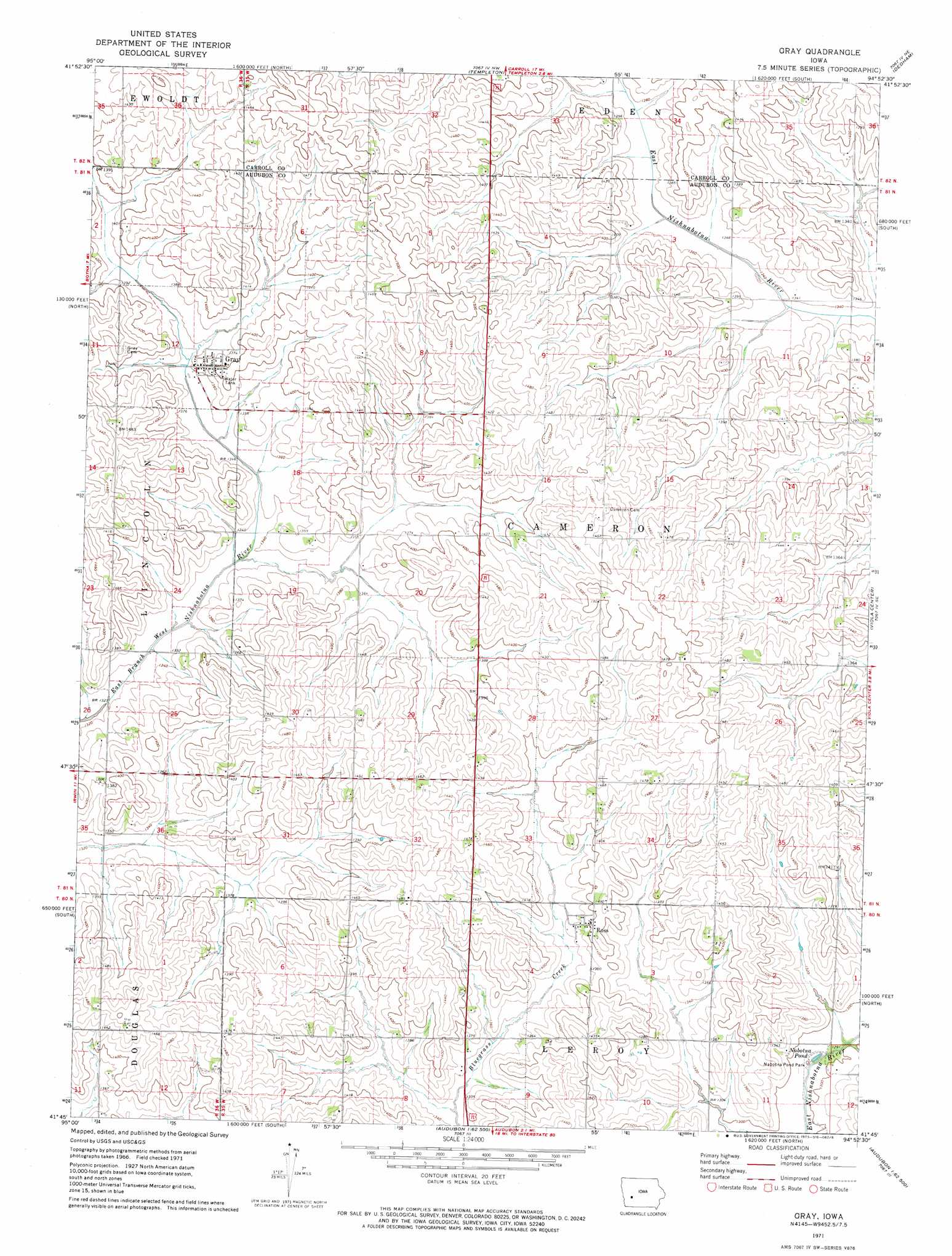
USGS Topo Quad 41094g8 - 1:24,000 scale
| Topo Map Name: | Gray |
| USGS Topo Quad ID: | 41094g8 |
| Print Size: | ca. 21 1/4" wide x 27" high |
| Southeast Coordinates: | 41.75° N latitude / 94.875° W longitude |
| Map Center Coordinates: | 41.8125° N latitude / 94.9375° W longitude |
| U.S. State: | IA |
| Filename: | o41094g8.jpg |
| Download Map JPG Image: | Gray topo map 1:24,000 scale |
| Map Type: | Topographic |
| Topo Series: | 7.5´ |
| Map Scale: | 1:24,000 |
| Source of Map Images: | United States Geological Survey (USGS) |
| Alternate Map Versions: |
Gray IA 1971, updated 1973 Download PDF Buy paper map Gray IA 2010 Download PDF Buy paper map Gray IA 2013 Download PDF Buy paper map Gray IA 2015 Download PDF Buy paper map |
1:24,000 Topo Quads surrounding Gray
Vail |
Arcadia |
Carroll West |
Carroll East |
Glidden |
Manilla |
Manning |
Templeton |
Dedham |
Coon Rapids North |
Irwin |
Manning Se |
Gray |
Viola Center |
Coon Rapids South |
Jacksonville |
Kimballton |
Audubon |
Gardner |
North Branch |
Prairie Rose Lake |
Elk Horn |
Exira West |
Exira East |
Adair North |
> Back to 41094e1 at 1:100,000 scale
> Back to 41094a1 at 1:250,000 scale
> Back to U.S. Topo Maps home
Gray topo map: Gazetteer
Gray: Areas
Heritage Rose Garden elevation 416m 1364′Gray: Parks
Nabotna Pond Park elevation 392m 1286′Gray: Populated Places
Gray elevation 416m 1364′Ross elevation 426m 1397′
Gray: Post Offices
Gray Post Office elevation 416m 1364′Ross Post Office (historical) elevation 426m 1397′
Thompson Post Office (historical) elevation 451m 1479′
Gray: Reservoirs
Nabotna Pond elevation 393m 1289′Gray digital topo map on disk
Buy this Gray topo map showing relief, roads, GPS coordinates and other geographical features, as a high-resolution digital map file on DVD: