Ansley Ne Topo Map Nebraska
To zoom in, hover over the map of Ansley Ne
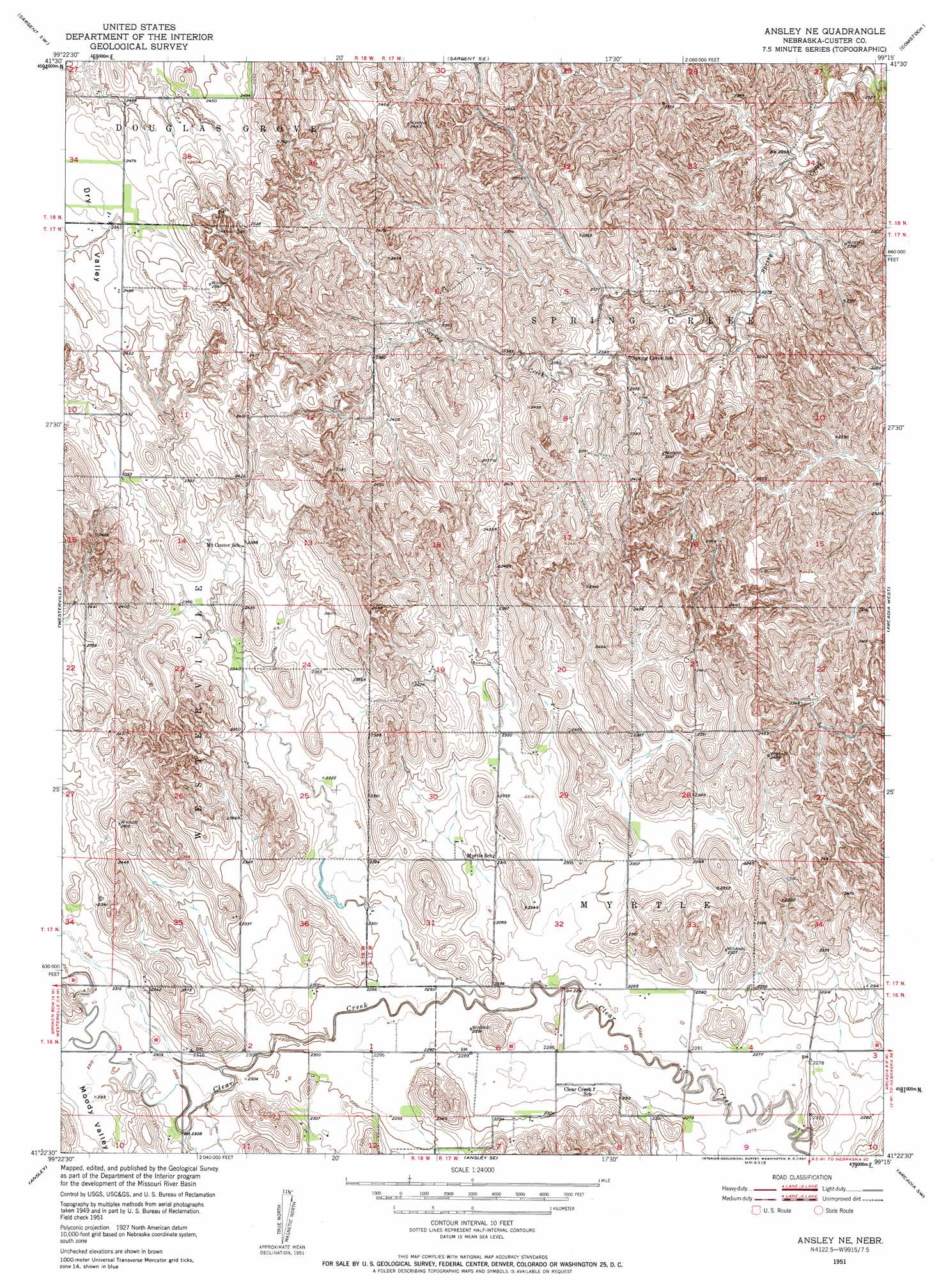
USGS Topo Quad 41099d3 - 1:24,000 scale
| Topo Map Name: | Ansley Ne |
| USGS Topo Quad ID: | 41099d3 |
| Print Size: | ca. 21 1/4" wide x 27" high |
| Southeast Coordinates: | 41.375° N latitude / 99.25° W longitude |
| Map Center Coordinates: | 41.4375° N latitude / 99.3125° W longitude |
| U.S. State: | NE |
| Filename: | O41099D3.jpg |
| Download Map JPG Image: | Ansley Ne topo map 1:24,000 scale |
| Map Type: | Topographic |
| Topo Series: | 7.5´ |
| Map Scale: | 1:24,000 |
| Source of Map Images: | United States Geological Survey (USGS) |
| Alternate Map Versions: |
Ansley NE NE 1951, updated 1952 Download PDF Buy paper map Ansley NE NE 1951, updated 1957 Download PDF Buy paper map Ansley NE NE 2011 Download PDF Buy paper map Ansley NE NE 2014 Download PDF Buy paper map |
1:24,000 Topo Quads surrounding Ansley Ne
Walworth |
Sargent West |
Sargent East |
Comstock Nw |
Elyria |
Round Valley |
Sargent Sw |
Sargent Se |
Comstock |
Comstock Se |
Broken Bow Ne |
Westerville |
Ansley Ne |
Arcadia West |
Arcadia East |
Broken Bow Se |
Ansley |
Ansley Se |
Arcadia Sw |
Arcadia Se |
Eddyville Ne |
Mason City Nw |
Mason City |
Litchfield |
Litchfield Ne |
> Back to 41099a1 at 1:100,000 scale
> Back to 41098a1 at 1:250,000 scale
> Back to U.S. Topo Maps home
Ansley Ne topo map: Gazetteer
Ansley Ne: Basins
Dry Valley elevation 747m 2450′Ansley Ne: Valleys
Moody Valley elevation 706m 2316′Ansley Ne digital topo map on disk
Buy this Ansley Ne topo map showing relief, roads, GPS coordinates and other geographical features, as a high-resolution digital map file on DVD: