Red Desert Nw Topo Map Wyoming
To zoom in, hover over the map of Red Desert Nw
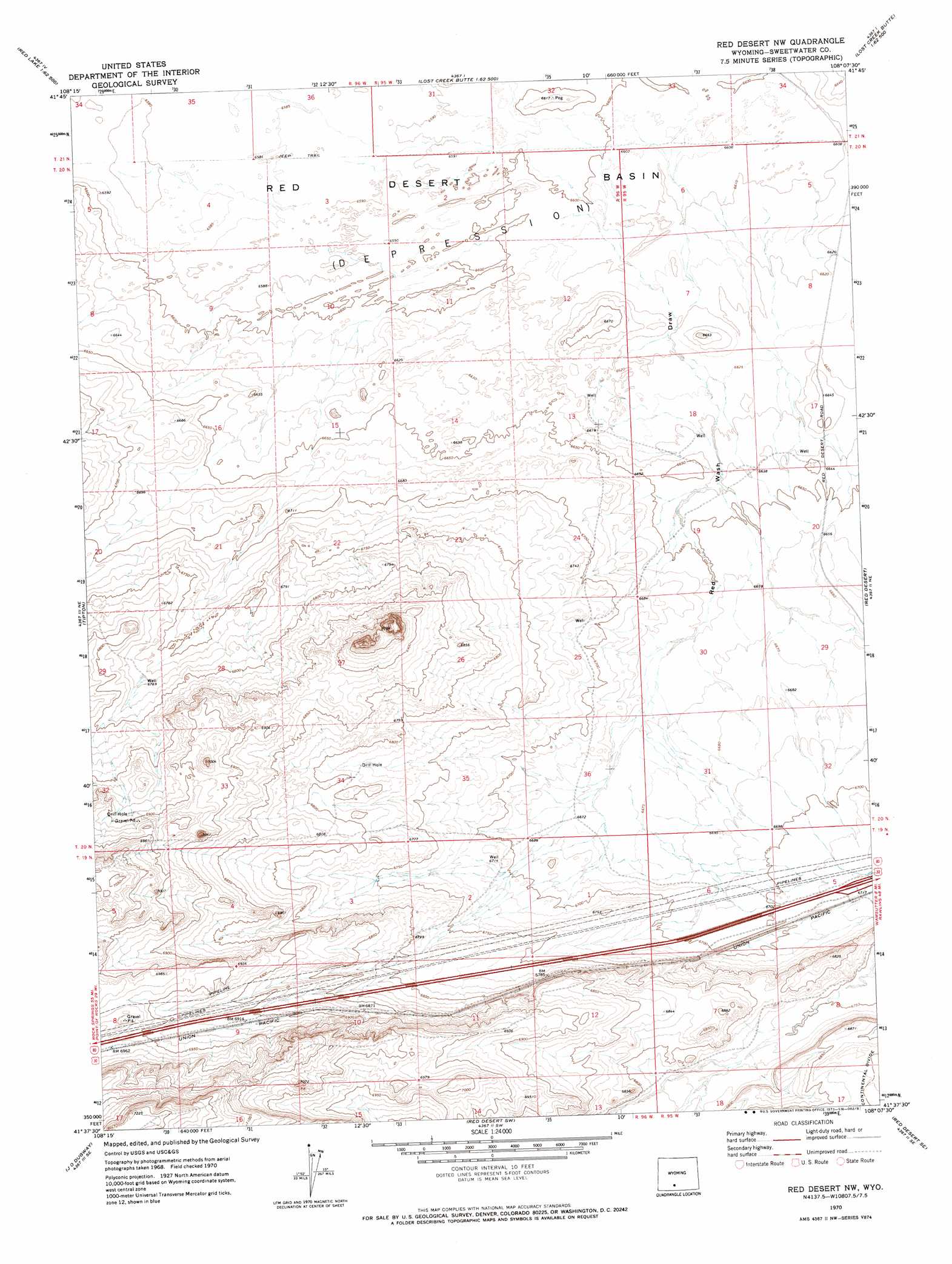
USGS Topo Quad 41108f2 - 1:24,000 scale
| Topo Map Name: | Red Desert Nw |
| USGS Topo Quad ID: | 41108f2 |
| Print Size: | ca. 21 1/4" wide x 27" high |
| Southeast Coordinates: | 41.625° N latitude / 108.125° W longitude |
| Map Center Coordinates: | 41.6875° N latitude / 108.1875° W longitude |
| U.S. State: | WY |
| Filename: | o41108f2.jpg |
| Download Map JPG Image: | Red Desert Nw topo map 1:24,000 scale |
| Map Type: | Topographic |
| Topo Series: | 7.5´ |
| Map Scale: | 1:24,000 |
| Source of Map Images: | United States Geological Survey (USGS) |
| Alternate Map Versions: |
Red Desert NW WY 1970, updated 1973 Download PDF Buy paper map Red Desert NW WY 2012 Download PDF Buy paper map Red Desert NW WY 2015 Download PDF Buy paper map |
1:24,000 Topo Quads surrounding Red Desert Nw
Red Lake |
Red Lake Ne |
Lost Creek Butte Nw |
Lost Creek Butte |
Hansen Lake |
Red Lake Sw |
Red Lake Se |
Lost Creek Butte Sw |
Dennison Cap |
Monument Lake |
Desert Springs |
Tipton |
Red Desert Nw |
Red Desert |
Wamsutter |
Table Rock |
J O Dugway |
Red Desert Sw |
Red Desert Se |
Eightmile Lake |
Fort La Clede |
Fort La Clede Ne |
Haystack Flats |
Barrel Springs |
Mexican Flats Nw |
> Back to 41108e1 at 1:100,000 scale
> Back to 41108a1 at 1:250,000 scale
> Back to U.S. Topo Maps home
No gazetteer data is available for the Red Desert Nw topo map sheet.
Red Desert Nw digital topo map on disk
Buy this Red Desert Nw topo map showing relief, roads, GPS coordinates and other geographical features, as a high-resolution digital map file on DVD: