Sunset Pass Topo Map Utah
To zoom in, hover over the map of Sunset Pass
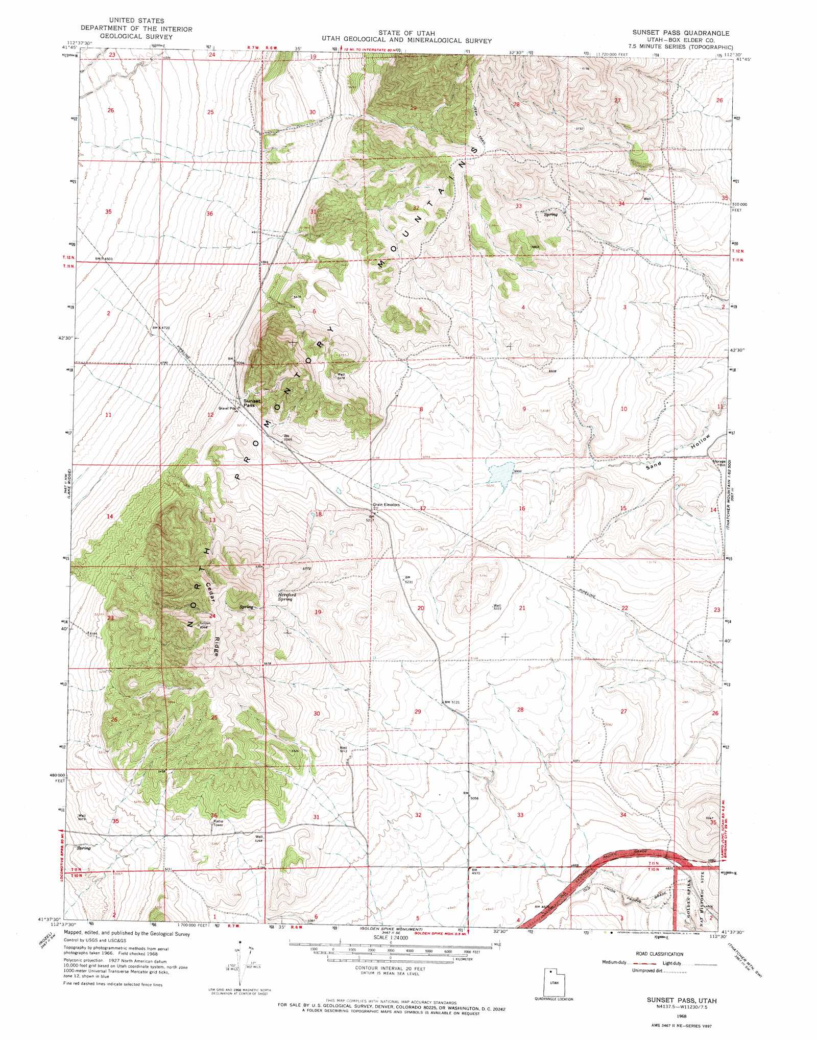
USGS Topo Quad 41112f5 - 1:24,000 scale
| Topo Map Name: | Sunset Pass |
| USGS Topo Quad ID: | 41112f5 |
| Print Size: | ca. 21 1/4" wide x 27" high |
| Southeast Coordinates: | 41.625° N latitude / 112.5° W longitude |
| Map Center Coordinates: | 41.6875° N latitude / 112.5625° W longitude |
| U.S. State: | UT |
| Filename: | o41112f5.jpg |
| Download Map JPG Image: | Sunset Pass topo map 1:24,000 scale |
| Map Type: | Topographic |
| Topo Series: | 7.5´ |
| Map Scale: | 1:24,000 |
| Source of Map Images: | United States Geological Survey (USGS) |
| Alternate Map Versions: |
Sunset Pass UT 1968, updated 1969 Download PDF Buy paper map Sunset Pass UT 2011 Download PDF Buy paper map Sunset Pass UT 2014 Download PDF Buy paper map |
1:24,000 Topo Quads surrounding Sunset Pass
Monument Peak Ne |
Snowville |
Rattlesnake Pass |
Ridgedale Pass |
Limekiln Knoll |
Monument Peak |
Salt Wells |
Bulls Pass |
Howell |
Blind Springs |
Monument Point |
Lake Ridge |
Sunset Pass |
Lampo Junction |
Thatcher Mountain |
Coyote Point |
Rozel |
Golden Spike Monument |
Thatcher Mountain Sw |
Public Shooting Grounds |
Gunnison Island Ne |
Rozel Point |
Messix Peak |
East Promontory |
Mouth Of Bear River |
> Back to 41112e1 at 1:100,000 scale
> Back to 41112a1 at 1:250,000 scale
> Back to U.S. Topo Maps home
Sunset Pass topo map: Gazetteer
Sunset Pass: Gaps
Sunset Pass elevation 1595m 5232′Sunset Pass: Ridges
Cedar Ridge elevation 1899m 6230′Sunset Pass: Springs
Hereford Spring elevation 1738m 5702′Sunset Pass digital topo map on disk
Buy this Sunset Pass topo map showing relief, roads, GPS coordinates and other geographical features, as a high-resolution digital map file on DVD: