Monument Peak Topo Map Utah
To zoom in, hover over the map of Monument Peak
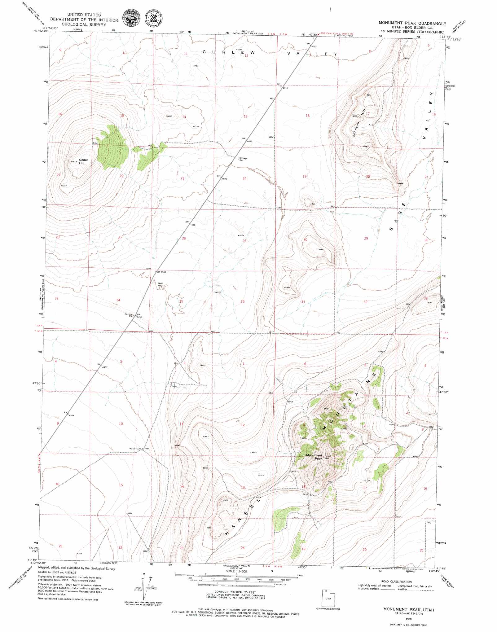
USGS Topo Quad 41112g7 - 1:24,000 scale
| Topo Map Name: | Monument Peak |
| USGS Topo Quad ID: | 41112g7 |
| Print Size: | ca. 21 1/4" wide x 27" high |
| Southeast Coordinates: | 41.75° N latitude / 112.75° W longitude |
| Map Center Coordinates: | 41.8125° N latitude / 112.8125° W longitude |
| U.S. State: | UT |
| Filename: | o41112g7.jpg |
| Download Map JPG Image: | Monument Peak topo map 1:24,000 scale |
| Map Type: | Topographic |
| Topo Series: | 7.5´ |
| Map Scale: | 1:24,000 |
| Source of Map Images: | United States Geological Survey (USGS) |
| Alternate Map Versions: |
Monument Peak UT 1968, updated 1972 Download PDF Buy paper map Monument Peak UT 1968, updated 1979 Download PDF Buy paper map Monument Peak UT 2011 Download PDF Buy paper map Monument Peak UT 2014 Download PDF Buy paper map |
1:24,000 Topo Quads surrounding Monument Peak
Black Pine Peak |
Black Pine |
The Cove |
Stone |
Co-Op Spring |
Curlew Junction |
Monument Peak Nw |
Monument Peak Ne |
Snowville |
Rattlesnake Pass |
Kelton Pass Se |
Monument Peak Sw |
Monument Peak |
Salt Wells |
Bulls Pass |
Crocodile Mountain Ne |
Locomotive Springs |
Monument Point |
Lake Ridge |
Sunset Pass |
Crocodile Mountain Se |
Spring Bay Sw |
Coyote Point |
Rozel |
Golden Spike Monument |
> Back to 41112e1 at 1:100,000 scale
> Back to 41112a1 at 1:250,000 scale
> Back to U.S. Topo Maps home
Monument Peak topo map: Gazetteer
Monument Peak: Summits
Cedar Hill elevation 1580m 5183′Johnson Hill elevation 1527m 5009′
Monument Peak elevation 1825m 5987′
Monument Peak: Valleys
Sage Valley elevation 1397m 4583′Monument Peak digital topo map on disk
Buy this Monument Peak topo map showing relief, roads, GPS coordinates and other geographical features, as a high-resolution digital map file on DVD: