Park Valley Topo Map Utah
To zoom in, hover over the map of Park Valley
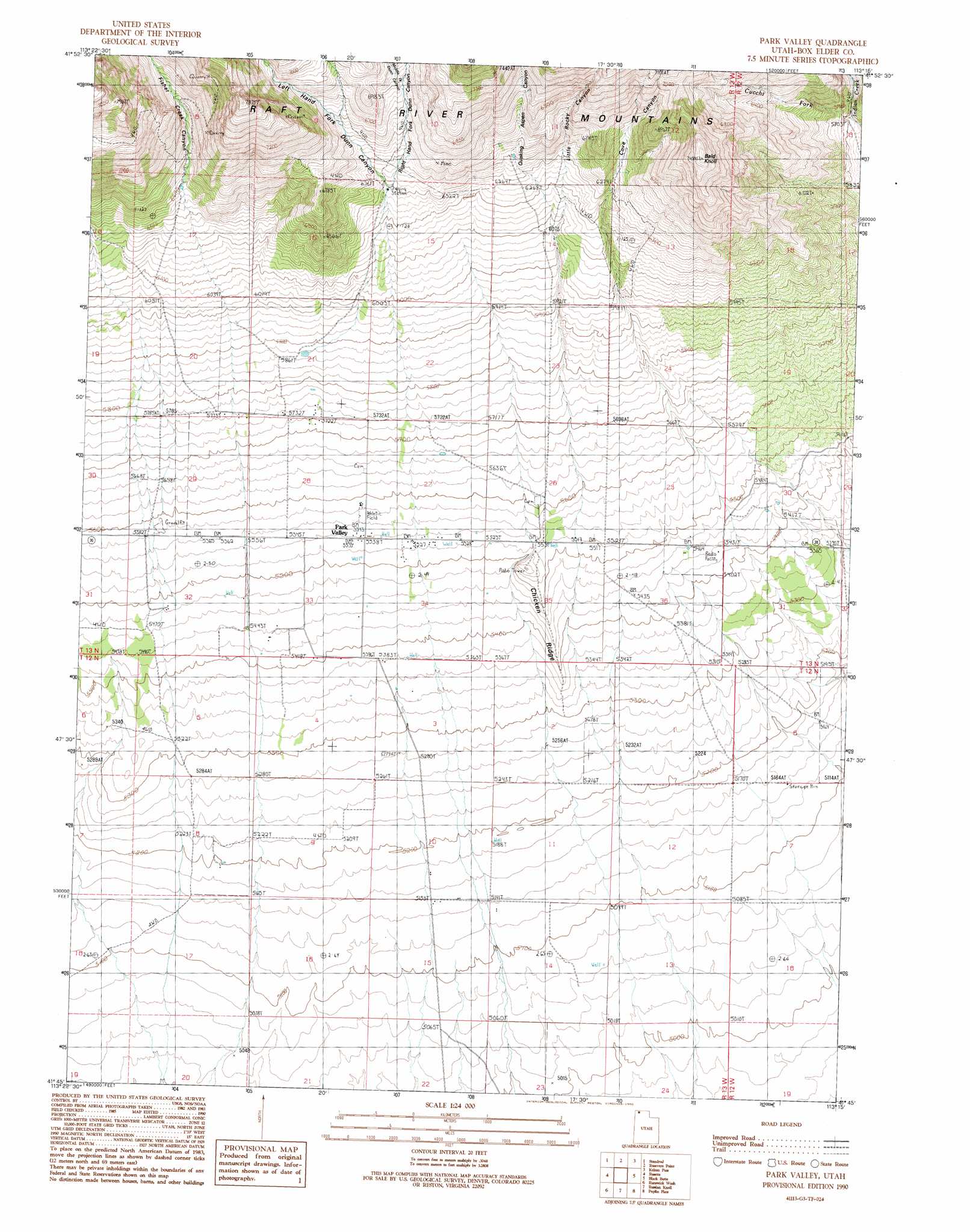
USGS Topo Quad 41113g3 - 1:24,000 scale
| Topo Map Name: | Park Valley |
| USGS Topo Quad ID: | 41113g3 |
| Print Size: | ca. 21 1/4" wide x 27" high |
| Southeast Coordinates: | 41.75° N latitude / 113.25° W longitude |
| Map Center Coordinates: | 41.8125° N latitude / 113.3125° W longitude |
| U.S. State: | UT |
| Filename: | o41113g3.jpg |
| Download Map JPG Image: | Park Valley topo map 1:24,000 scale |
| Map Type: | Topographic |
| Topo Series: | 7.5´ |
| Map Scale: | 1:24,000 |
| Source of Map Images: | United States Geological Survey (USGS) |
| Alternate Map Versions: |
Park Valley UT 1990, updated 1990 Download PDF Buy paper map Park Valley UT 2011 Download PDF Buy paper map Park Valley UT 2014 Download PDF Buy paper map |
1:24,000 Topo Quads surrounding Park Valley
Jim Sage Canyon |
Chokecherry Canyon |
Naf |
Strevell |
Black Pine Peak |
Yost |
Standrod |
Rosevere Point |
Kelton Pass |
Curlew Junction |
Dennis Hill |
Rosette |
Park Valley |
Black Butte |
Kelton Pass Se |
Warm Spring Hills |
Runswick Wash |
Russian Knoll |
Peplin Flats |
Crocodile Mountain Ne |
Prohibition Spring |
Red Dome |
Matlin |
Hogup Bar |
Crocodile Mountain Se |
> Back to 41113e1 at 1:100,000 scale
> Back to 41112a1 at 1:250,000 scale
> Back to U.S. Topo Maps home
Park Valley topo map: Gazetteer
Park Valley: Populated Places
Park Valley elevation 1691m 5547′Park Valley: Ridges
Chicken Ridge elevation 1653m 5423′Park Valley: Streams
Cucchi Fork elevation 1757m 5764′Park Valley: Summits
Bald Knoll elevation 2272m 7454′Park Valley: Valleys
Cove Canyon elevation 1893m 6210′Fisher Creek Canyon elevation 1922m 6305′
Left Hand Fork Dunn Canyon elevation 1921m 6302′
Little Rocky Canyon elevation 1919m 6295′
Middle Fork Dunn Canyon elevation 2044m 6706′
Quaking Aspen Canyon elevation 1711m 5613′
Right Hand Fork Dunn Canyon elevation 1921m 6302′
Park Valley digital topo map on disk
Buy this Park Valley topo map showing relief, roads, GPS coordinates and other geographical features, as a high-resolution digital map file on DVD: