Burner Hills Topo Map Nevada
To zoom in, hover over the map of Burner Hills
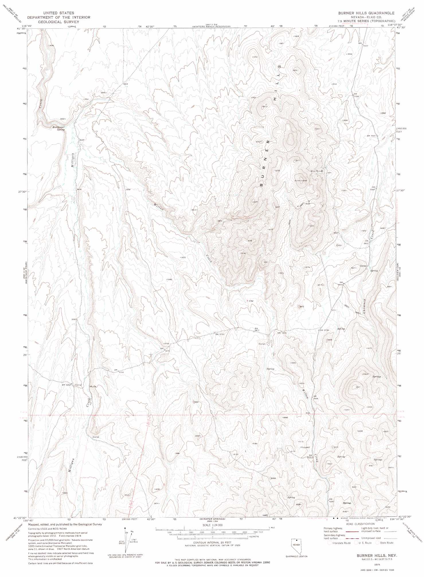
USGS Topo Quad 41116d6 - 1:24,000 scale
| Topo Map Name: | Burner Hills |
| USGS Topo Quad ID: | 41116d6 |
| Print Size: | ca. 21 1/4" wide x 27" high |
| Southeast Coordinates: | 41.375° N latitude / 116.625° W longitude |
| Map Center Coordinates: | 41.4375° N latitude / 116.6875° W longitude |
| U.S. State: | NV |
| Filename: | o41116d6.jpg |
| Download Map JPG Image: | Burner Hills topo map 1:24,000 scale |
| Map Type: | Topographic |
| Topo Series: | 7.5´ |
| Map Scale: | 1:24,000 |
| Source of Map Images: | United States Geological Survey (USGS) |
| Alternate Map Versions: |
Burner Hills NV 1974, updated 1977 Download PDF Buy paper map Burner Hills NV 2012 Download PDF Buy paper map Burner Hills NV 2014 Download PDF Buy paper map |
1:24,000 Topo Quads surrounding Burner Hills
Button Lake Well |
Corral Lake |
Silver Lake |
Desert Ranch |
Fourmile Butte |
Humboldt Hill |
Mccleary Wells |
Winters Ranch Reservoir |
Middle Draw Reservoir |
I-L Ranch |
Rodear Flat |
Haystack Peak |
Burner Hills |
Soldier Cap |
Red Cow Creek |
Snowstorm Mountain |
Oregon Canyon |
Scraper Springs |
Little Rock Creek |
Toe Jam Mountain |
Jake Creek Mountain |
Midas |
Squaw Valley Ranch |
Willow Creek Reservoir |
China Camp |
> Back to 41116a1 at 1:100,000 scale
> Back to 41116a1 at 1:250,000 scale
> Back to U.S. Topo Maps home
Burner Hills topo map: Gazetteer
Burner Hills: Mines
Mint Mine elevation 1788m 5866′Burner Hills: Springs
Bookeeper Spring elevation 1663m 5456′Burner Hills: Streams
Willow Creek elevation 1663m 5456′Burner Hills: Summits
Burner Hills elevation 1915m 6282′Burner Hills digital topo map on disk
Buy this Burner Hills topo map showing relief, roads, GPS coordinates and other geographical features, as a high-resolution digital map file on DVD: