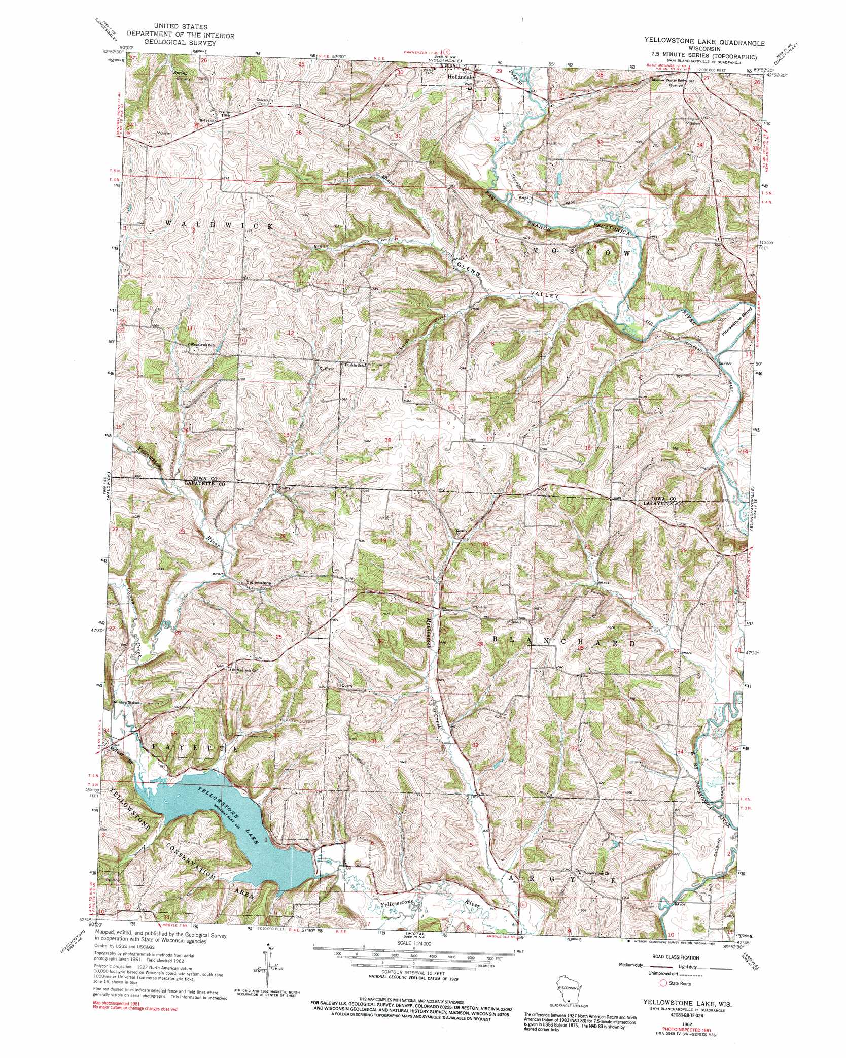
Yellowstone Lake Topo Map Wisconsin
To zoom in, hover over the map of Yellowstone Lake
USGS Topo Quad 42089g8 - 1:24,000 scale
| Topo Map Name: | Yellowstone Lake |
| USGS Topo Quad ID: | 42089g8 |
| Print Size: | ca. 21 1/4" wide x 27" high |
| Southeast Coordinates: | 42.75° N latitude / 89.875° W longitude |
| Map Center Coordinates: | 42.8125° N latitude / 89.9375° W longitude |
| U.S. State: | WI |
| Filename: | o42089g8.jpg |
| Download Map JPG Image: | Yellowstone Lake topo map 1:24,000 scale |
| Map Type: | Topographic |
| Topo Series: | 7.5´ |
| Map Scale: | 1:24,000 |
| Source of Map Images: | United States Geological Survey (USGS) |
| Alternate Map Versions: |
Yellowstone Lake WI 1962, updated 1964 Download PDF Buy paper map Yellowstone Lake WI 1962, updated 1992 Download PDF Buy paper map Yellowstone Lake WI 2010 Download PDF Buy paper map Yellowstone Lake WI 2013 Download PDF Buy paper map Yellowstone Lake WI 2016 Download PDF Buy paper map |
1:24,000 Topo Quads surrounding Yellowstone Lake
Clyde |
Pleasant Ridge |
Barneveld |
Blue Mounds |
Cross Plains |
Dodgeville |
Jonesdale |
Hollandale |
Daleyville |
Mount Vernon |
Mineral Point |
Waldwick |
Yellowstone Lake |
Blanchardville |
New Glarus |
Calamine |
Darlington |
Wiota |
Argyle |
Monroe Nw |
Shullsburg |
Apple River |
South Wayne |
Browntown |
Monroe |
> Back to 42089e1 at 1:100,000 scale
> Back to 42088a1 at 1:250,000 scale
> Back to U.S. Topo Maps home
Yellowstone Lake topo map: Gazetteer
Yellowstone Lake: Bends
Horseshoe Bend elevation 257m 843′Yellowstone Lake: Dams
Hidden Valley Lake G6316 Dam elevation 249m 816′Yellowstone 2WP88652 Dam elevation 256m 839′
Yellowstone Lake: Parks
Yellowstone Conservation Area elevation 299m 980′Yellowstone Savanna State Natural Area elevation 297m 974′
Yellowstone Lake: Populated Places
Yellowstone elevation 278m 912′Yellowstone Lake: Reservoirs
Hidden Valley Lake 1 elevation 249m 816′Yellowstone Lake elevation 256m 839′
Yellowstone Lake 18 elevation 261m 856′
Yellowstone Lake: Streams
Canon Creek elevation 259m 849′Dodge Branch elevation 256m 839′
McClintock Creek elevation 246m 807′
Olson Creek elevation 251m 823′
Regan Creek elevation 265m 869′
Schmidt Creek elevation 259m 849′
Steiner Branch elevation 255m 836′
Yellowstone Lake: Valleys
Glenn Valley elevation 251m 823′Yellowstone Lake digital topo map on disk
Buy this Yellowstone Lake topo map showing relief, roads, GPS coordinates and other geographical features, as a high-resolution digital map file on DVD:
Northern Illinois, Northern Indiana & Southwestern Michigan
Buy digital topo maps: Northern Illinois, Northern Indiana & Southwestern Michigan