Dodgeville Topo Map Wisconsin
To zoom in, hover over the map of Dodgeville
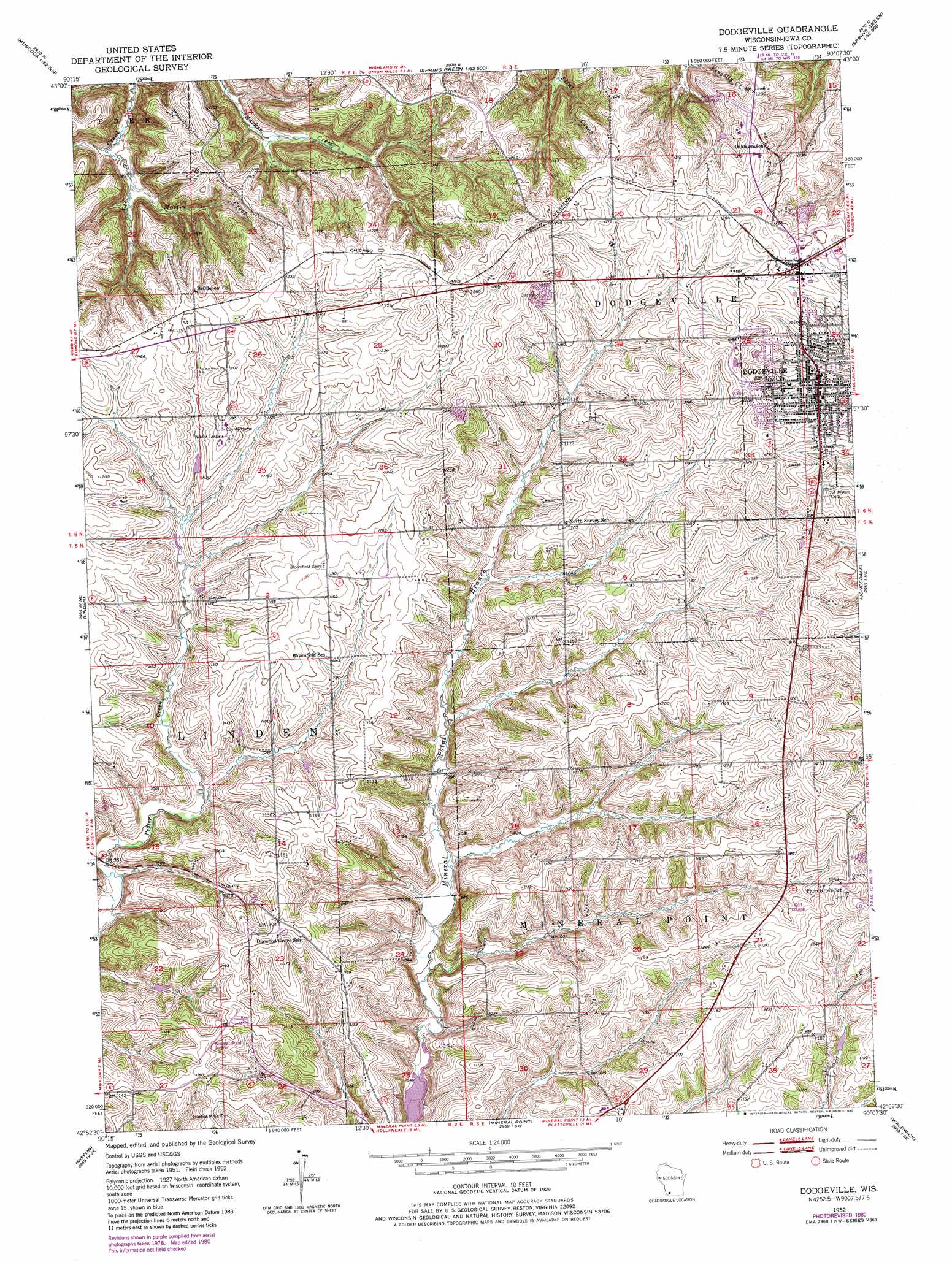
USGS Topo Quad 42090h2 - 1:24,000 scale
| Topo Map Name: | Dodgeville |
| USGS Topo Quad ID: | 42090h2 |
| Print Size: | ca. 21 1/4" wide x 27" high |
| Southeast Coordinates: | 42.875° N latitude / 90.125° W longitude |
| Map Center Coordinates: | 42.9375° N latitude / 90.1875° W longitude |
| U.S. State: | WI |
| Filename: | o42090h2.jpg |
| Download Map JPG Image: | Dodgeville topo map 1:24,000 scale |
| Map Type: | Topographic |
| Topo Series: | 7.5´ |
| Map Scale: | 1:24,000 |
| Source of Map Images: | United States Geological Survey (USGS) |
| Alternate Map Versions: |
Dodgeville WI 1952, updated 1954 Download PDF Buy paper map Dodgeville WI 1952, updated 1973 Download PDF Buy paper map Dodgeville WI 1952, updated 1980 Download PDF Buy paper map Dodgeville WI 2010 Download PDF Buy paper map Dodgeville WI 2013 Download PDF Buy paper map Dodgeville WI 2016 Download PDF Buy paper map |
1:24,000 Topo Quads surrounding Dodgeville
Muscoda |
Avoca |
Lone Rock |
Spring Green |
Arena |
Highland West |
Highland East |
Clyde |
Pleasant Ridge |
Barneveld |
Montfort |
Linden |
Dodgeville |
Jonesdale |
Hollandale |
Rewey |
Mifflin |
Mineral Point |
Waldwick |
Yellowstone Lake |
Platteville |
Belmont |
Calamine |
Darlington |
Wiota |
> Back to 42090e1 at 1:100,000 scale
> Back to 42090a1 at 1:250,000 scale
> Back to U.S. Topo Maps home
Dodgeville topo map: Gazetteer
Dodgeville: Airports
Dodgeville Municipal Airport elevation 367m 1204′Iowa County Airport elevation 354m 1161′
Memorial Hospital Heliport elevation 366m 1200′
Dodgeville: Populated Places
Dodgeville elevation 369m 1210′Dodgeville: Streams
Martin Creek elevation 279m 915′Dodgeville digital topo map on disk
Buy this Dodgeville topo map showing relief, roads, GPS coordinates and other geographical features, as a high-resolution digital map file on DVD: