Deloit Ne Topo Map Nebraska
To zoom in, hover over the map of Deloit Ne
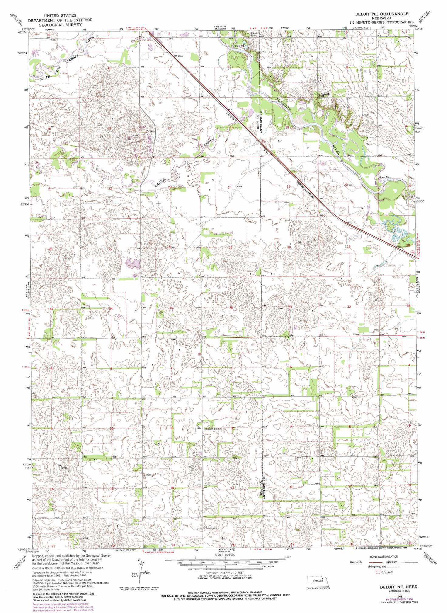
USGS Topo Quad 42098b3 - 1:24,000 scale
| Topo Map Name: | Deloit Ne |
| USGS Topo Quad ID: | 42098b3 |
| Print Size: | ca. 21 1/4" wide x 27" high |
| Southeast Coordinates: | 42.125° N latitude / 98.25° W longitude |
| Map Center Coordinates: | 42.1875° N latitude / 98.3125° W longitude |
| U.S. State: | NE |
| Filename: | O42098B3.jpg |
| Download Map JPG Image: | Deloit Ne topo map 1:24,000 scale |
| Map Type: | Topographic |
| Topo Series: | 7.5´ |
| Map Scale: | 1:24,000 |
| Source of Map Images: | United States Geological Survey (USGS) |
| Alternate Map Versions: |
Deloit NE NE 1963, updated 1964 Download PDF Buy paper map Deloit NE NE 1963, updated 1986 Download PDF Buy paper map Deloit NE NE 2011 Download PDF Buy paper map Deloit NE NE 2014 Download PDF Buy paper map |
1:24,000 Topo Quads surrounding Deloit Ne
Inman |
Page |
Venus |
Orchard Nw |
Orchard Ne |
O'Neill Se |
Ewing Sw |
Ewing |
Orchard |
Royal |
Goose Lake Ne |
Deloit Nw |
Deloit Ne |
Clearwater |
Neligh |
Goose Lake |
Deloit Sw |
Deloit |
Neligh Sw |
Neligh Se |
Bartlett |
Spalding 2 Nw |
Spalding 2 Ne |
Elgin Nw |
Elgin |
> Back to 42098a1 at 1:100,000 scale
> Back to 42098a1 at 1:250,000 scale
> Back to U.S. Topo Maps home
Deloit Ne digital topo map on disk
Buy this Deloit Ne topo map showing relief, roads, GPS coordinates and other geographical features, as a high-resolution digital map file on DVD: