Gruver Topo Map Iowa
To zoom in, hover over the map of Gruver
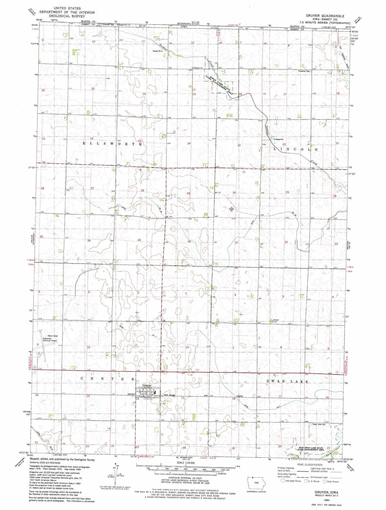
USGS Topo Quad 43094d6 - 1:24,000 scale
| Topo Map Name: | Gruver |
| USGS Topo Quad ID: | 43094d6 |
| Print Size: | ca. 21 1/4" wide x 27" high |
| Southeast Coordinates: | 43.375° N latitude / 94.625° W longitude |
| Map Center Coordinates: | 43.4375° N latitude / 94.6875° W longitude |
| U.S. State: | IA |
| Filename: | o43094d6.jpg |
| Download Map JPG Image: | Gruver topo map 1:24,000 scale |
| Map Type: | Topographic |
| Topo Series: | 7.5´ |
| Map Scale: | 1:24,000 |
| Source of Map Images: | United States Geological Survey (USGS) |
| Alternate Map Versions: |
Gruver IA 1980, updated 1980 Download PDF Buy paper map Gruver IA 2010 Download PDF Buy paper map Gruver IA 2013 Download PDF Buy paper map Gruver IA 2015 Download PDF Buy paper map |
1:24,000 Topo Quads surrounding Gruver
Jackson Nw |
Alpha |
Sherburn |
Welcome |
Fairmont |
Jackson |
Dunnell |
Ceylon |
Wilbert |
Wilmert Lake |
Superior |
Estherville |
Gruver |
Dolliver |
Armstrong |
Terril |
Wallingford |
Ingham Lake |
Ringsted |
Seneca |
Ruthven |
Graettinger West |
Graettinger East |
Depew |
Fenton |
> Back to 43094a1 at 1:100,000 scale
> Back to 43094a1 at 1:250,000 scale
> Back to U.S. Topo Maps home
Gruver topo map: Gazetteer
Gruver: Airports
Estherville Municipal Airport elevation 401m 1315′Gruver: Canals
County Ditch Number 53 elevation 388m 1272′Ditch Number 40 elevation 387m 1269′
Ditch Number 7 elevation 390m 1279′
Gruver: Lakes
Birge Lake (historical) elevation 385m 1263′Gruver: Parks
Birge Lake State Game Management Area elevation 383m 1256′East Swan Lake State Games Management Area elevation 386m 1266′
Okamanpeedam State Park elevation 376m 1233′
Gruver: Populated Places
Dolliver elevation 390m 1279′Gruver elevation 397m 1302′
Maple Hill elevation 388m 1272′
Gruver: Post Offices
Gruver Post Office elevation 397m 1302′Roslea Post Office (historical) elevation 380m 1246′
Gruver: Streams
Soldier Creek elevation 387m 1269′Gruver digital topo map on disk
Buy this Gruver topo map showing relief, roads, GPS coordinates and other geographical features, as a high-resolution digital map file on DVD: