Witten Sw Topo Map South Dakota
To zoom in, hover over the map of Witten Sw
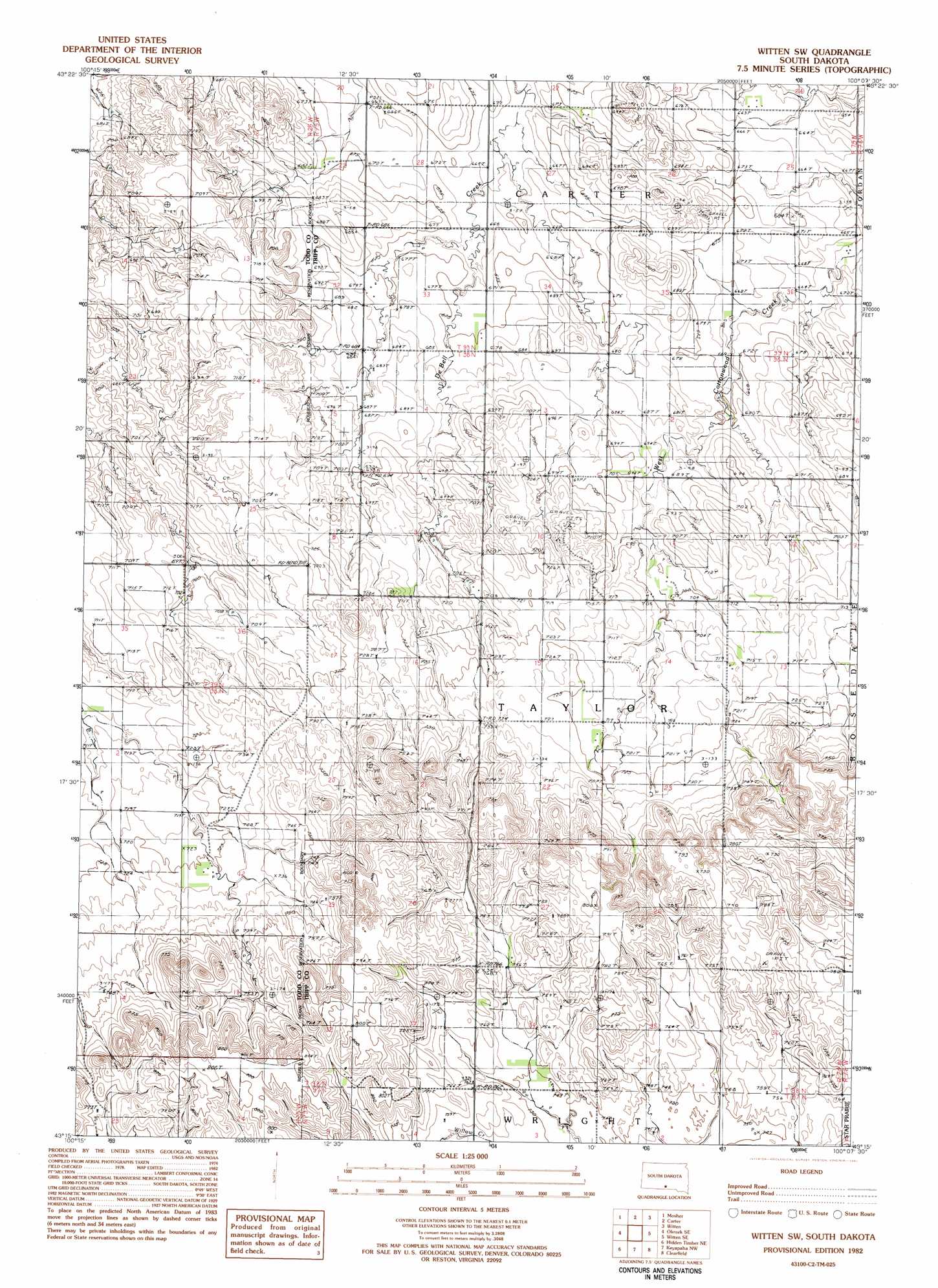
USGS Topo Quad 43100c2 - 1:25,000 scale
| Topo Map Name: | Witten Sw |
| USGS Topo Quad ID: | 43100c2 |
| Print Size: | ca. 21 1/4" wide x 27" high |
| Southeast Coordinates: | 43.25° N latitude / 100.125° W longitude |
| Map Center Coordinates: | 43.3125° N latitude / 100.1875° W longitude |
| U.S. State: | SD |
| Filename: | l43100c2.jpg |
| Download Map JPG Image: | Witten Sw topo map 1:25,000 scale |
| Map Type: | Topographic |
| Topo Series: | 7.5´ |
| Map Scale: | 1:25,000 |
| Source of Map Images: | United States Geological Survey (USGS) |
| Alternate Map Versions: |
1:24,000 Topo Quads surrounding Witten Sw
Wood North |
Badnation Se |
Two Nation Creek |
Presho 4 Se |
Ideal |
Wood South |
Mosher |
Carter |
Witten |
Miller Hill |
Okreek |
Okreek Se |
Witten Sw |
Witten Se |
Dog Ear Buttes |
Hidden Timber |
Hidden Timber Ne |
Keyapaha Nw |
Clearfield |
Dog Ear Lake |
Littleburg |
Hidden Timber Se |
Keyapaha |
Keyapaha Se |
Millboro |
> Back to 43100a1 at 1:100,000 scale
> Back to 43100a1 at 1:250,000 scale
> Back to U.S. Topo Maps home
No gazetteer data is available for the Witten Sw topo map sheet.
Witten Sw digital topo map on disk
Buy this Witten Sw topo map showing relief, roads, GPS coordinates and other geographical features, as a high-resolution digital map file on DVD:
Eastern North Dakota & Eastern South Dakota
Buy digital topo maps: Eastern North Dakota & Eastern South Dakota