Arapahoe Ranch Topo Map Wyoming
To zoom in, hover over the map of Arapahoe Ranch
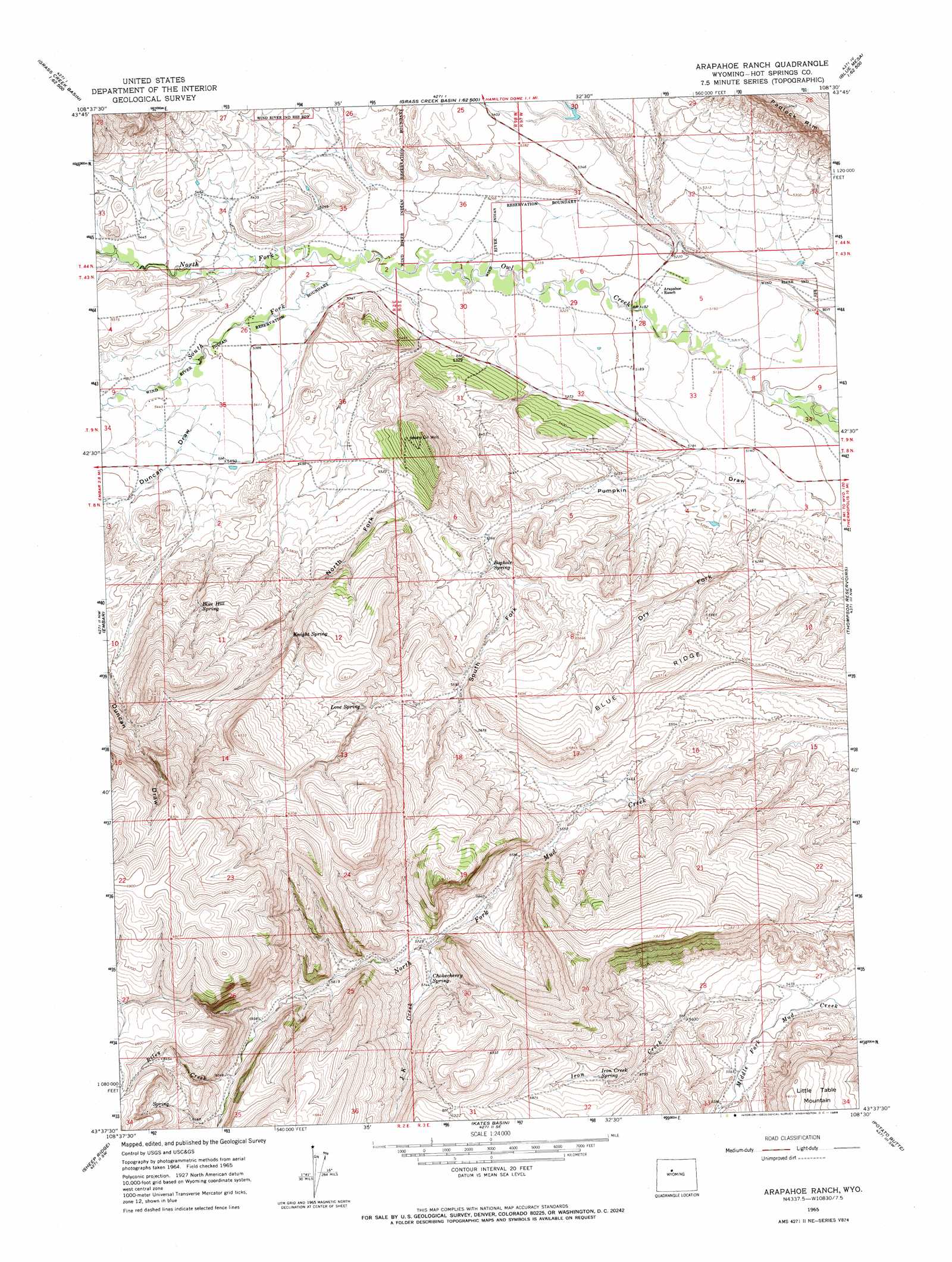
USGS Topo Quad 43108f5 - 1:24,000 scale
| Topo Map Name: | Arapahoe Ranch |
| USGS Topo Quad ID: | 43108f5 |
| Print Size: | ca. 21 1/4" wide x 27" high |
| Southeast Coordinates: | 43.625° N latitude / 108.5° W longitude |
| Map Center Coordinates: | 43.6875° N latitude / 108.5625° W longitude |
| U.S. State: | WY |
| Filename: | o43108f5.jpg |
| Download Map JPG Image: | Arapahoe Ranch topo map 1:24,000 scale |
| Map Type: | Topographic |
| Topo Series: | 7.5´ |
| Map Scale: | 1:24,000 |
| Source of Map Images: | United States Geological Survey (USGS) |
| Alternate Map Versions: |
Arapahoe Ranch WY 1965, updated 1968 Download PDF Buy paper map Arapahoe Ranch WY 2012 Download PDF Buy paper map Arapahoe Ranch WY 2015 Download PDF Buy paper map |
1:24,000 Topo Quads surrounding Arapahoe Ranch
Adam Weiss Peak |
Grass Creek |
Red Ridge |
Blue Mesa West |
Blue Mesa East |
Twentyone Creek |
Crater Sink |
Hamilton Dome |
Gloin Reservoir |
Little Sand Draw |
Anchor Reservoir |
Embar |
Arapahoe Ranch |
Thompson Reservoirs |
Rattlesnake Gulch |
Bargee |
Sheep Ridge |
Kates Basin |
Potato Butte |
Nostrum Mountain |
Eagle Point |
Shotgun Butte |
Jenkins Mountain |
Mexican Pass |
Morrison Canyon |
> Back to 43108e1 at 1:100,000 scale
> Back to 43108a1 at 1:250,000 scale
> Back to U.S. Topo Maps home
Arapahoe Ranch topo map: Gazetteer
Arapahoe Ranch: Springs
Blue Hill Spring elevation 1764m 5787′Boghole Spring elevation 1644m 5393′
Chokecherry Spring elevation 1747m 5731′
Iron Creek Spring elevation 1779m 5836′
Knight Spring elevation 1762m 5780′
Love Spring elevation 1800m 5905′
Arapahoe Ranch: Streams
Dry Fork elevation 1562m 5124′Iron Creek elevation 1663m 5456′
J K Creek elevation 1735m 5692′
North Fork Owl Creek elevation 1621m 5318′
Riley Creek elevation 1833m 6013′
South Fork Owl Creek elevation 1621m 5318′
Arapahoe Ranch: Summits
Little Table Mountain elevation 1862m 6108′Arapahoe Ranch: Valleys
North Fork Pumpkin Draw elevation 1635m 5364′South Fork Pumpkin Draw elevation 1635m 5364′
Arapahoe Ranch digital topo map on disk
Buy this Arapahoe Ranch topo map showing relief, roads, GPS coordinates and other geographical features, as a high-resolution digital map file on DVD: