Big Sheep Mountain Topo Map Wyoming
To zoom in, hover over the map of Big Sheep Mountain
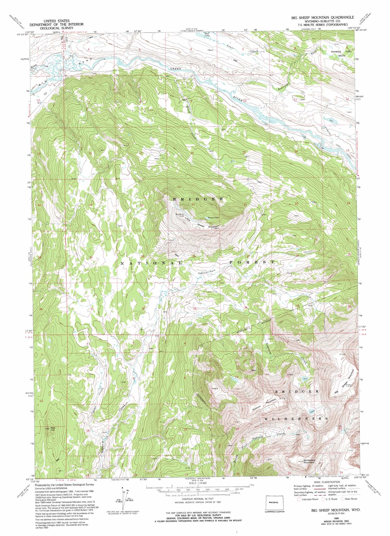
USGS Topo Quad 43109c8 - 1:24,000 scale
| Topo Map Name: | Big Sheep Mountain |
| USGS Topo Quad ID: | 43109c8 |
| Print Size: | ca. 21 1/4" wide x 27" high |
| Southeast Coordinates: | 43.25° N latitude / 109.875° W longitude |
| Map Center Coordinates: | 43.3125° N latitude / 109.9375° W longitude |
| U.S. State: | WY |
| Filename: | o43109c8.jpg |
| Download Map JPG Image: | Big Sheep Mountain topo map 1:24,000 scale |
| Map Type: | Topographic |
| Topo Series: | 7.5´ |
| Map Scale: | 1:24,000 |
| Source of Map Images: | United States Geological Survey (USGS) |
| Alternate Map Versions: |
Big Sheep Mountain WY 1968, updated 1973 Download PDF Buy paper map Big Sheep Mountain WY 1968, updated 1993 Download PDF Buy paper map Big Sheep Mountain WY 2012 Download PDF Buy paper map Big Sheep Mountain WY 2015 Download PDF Buy paper map |
| FStopo: | US Forest Service topo Big Sheep Mountain is available: Download FStopo PDF Download FStopo TIF |
1:24,000 Topo Quads surrounding Big Sheep Mountain
Burnt Mountain |
Sheridan Pass |
Fish Lake |
Warm Spring Mountain |
Dubois |
Ouzel Falls |
Mosquito Lake |
Fish Creek Park |
Union Peak |
Simpson Lake |
Tosi Peak |
Klondike Hill |
Big Sheep Mountain |
Green River Lakes |
Downs Mountain |
Pass Peak |
Dodge Butte |
Kendall Mountain |
Squaretop Mountain |
Gannett Peak |
Signal Hill |
Warren Bridge |
New Fork Lakes |
Fremont Lake North |
Bridger Lakes |
> Back to 43109a1 at 1:100,000 scale
> Back to 43108a1 at 1:250,000 scale
> Back to U.S. Topo Maps home
Big Sheep Mountain topo map: Gazetteer
Big Sheep Mountain: Bends
Big Bend elevation 2379m 7805′Big Sheep Mountain: Flats
Gypsum Park elevation 2719m 8920′Big Sheep Mountain: Lakes
Brook Lake elevation 3033m 9950′Mud Lake elevation 2532m 8307′
Big Sheep Mountain: Streams
Crow Creek elevation 2404m 7887′Dago Creek elevation 2501m 8205′
Moose Creek elevation 2409m 7903′
Roaring Fork elevation 2427m 7962′
Wagon Creek elevation 2378m 7801′
Big Sheep Mountain: Summits
Battleship Mountain elevation 3521m 11551′Big Sheep Mountain elevation 3533m 11591′
Gypsum Mountain elevation 3501m 11486′
Little Sheep Mountain elevation 3113m 10213′
Red Hill elevation 2720m 8923′
Big Sheep Mountain digital topo map on disk
Buy this Big Sheep Mountain topo map showing relief, roads, GPS coordinates and other geographical features, as a high-resolution digital map file on DVD: