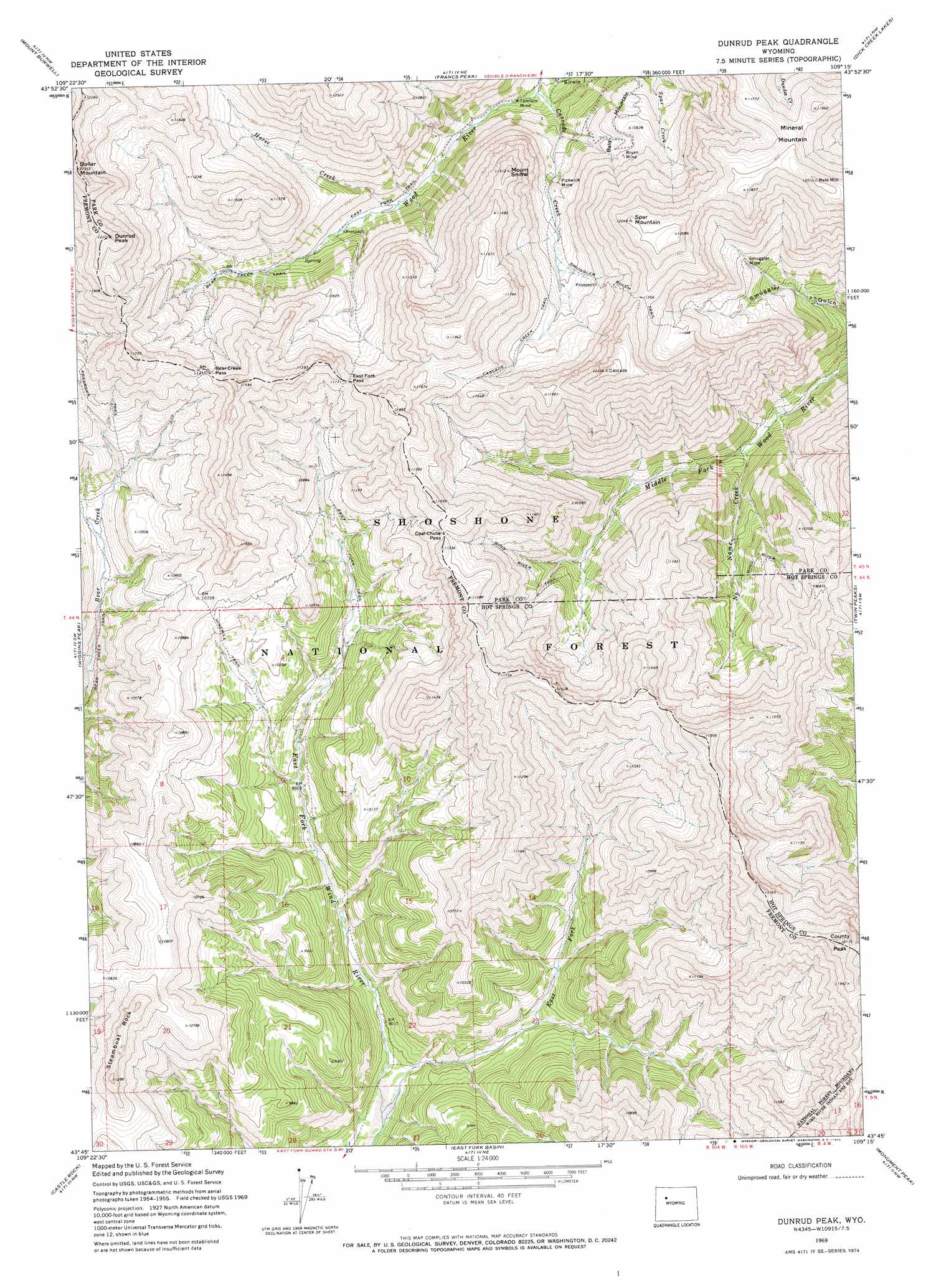
Dunrud Peak Topo Map Wyoming
To zoom in, hover over the map of Dunrud Peak
USGS Topo Quad 43109g3 - 1:24,000 scale
| Topo Map Name: | Dunrud Peak |
| USGS Topo Quad ID: | 43109g3 |
| Print Size: | ca. 21 1/4" wide x 27" high |
| Southeast Coordinates: | 43.75° N latitude / 109.25° W longitude |
| Map Center Coordinates: | 43.8125° N latitude / 109.3125° W longitude |
| U.S. State: | WY |
| Filename: | o43109g3.jpg |
| Download Map JPG Image: | Dunrud Peak topo map 1:24,000 scale |
| Map Type: | Topographic |
| Topo Series: | 7.5´ |
| Map Scale: | 1:24,000 |
| Source of Map Images: | United States Geological Survey (USGS) |
| Alternate Map Versions: |
Dunrud Peak WY 1969, updated 1972 Download PDF Buy paper map Dunrud Peak WY 1991, updated 1997 Download PDF Buy paper map Dunrud Peak WY 1991, updated 1997 Download PDF Buy paper map Dunrud Peak WY 2012 Download PDF Buy paper map Dunrud Peak WY 2015 Download PDF Buy paper map |
| FStopo: | US Forest Service topo Dunrud Peak is available: Download FStopo PDF Download FStopo TIF |
1:24,000 Topo Quads surrounding Dunrud Peak
Needle Mountain |
Irish Rock |
Phelps Mountain |
Pitchfork |
Sunshine Reservoir |
Emerald Lake |
Mount Burwell |
Francs Peak |
Dick Creek Lakes |
Noon Point |
Snow Lake |
Wiggins Peak |
Dunrud Peak |
Twin Peaks |
Cottonwood Peak |
Indian Point |
Castle Rock |
East Fork Basin |
Monument Peak |
Willow Creek |
Mason Draw |
Bain Draw |
Crow Mountain |
Johnson Draw |
Circle Ridge |
> Back to 43109e1 at 1:100,000 scale
> Back to 43108a1 at 1:250,000 scale
> Back to U.S. Topo Maps home
Dunrud Peak topo map: Gazetteer
Dunrud Peak: Gaps
Bear Creek Pass elevation 3442m 11292′Coal Chute Pass elevation 3407m 11177′
East Fork Pass elevation 3390m 11122′
Dunrud Peak: Mines
Bryan Mine elevation 3248m 10656′Kirwin District Mine elevation 3016m 9895′
Kirwin Mine elevation 3036m 9960′
Pickwick Mine elevation 3163m 10377′
Smuggler Mine elevation 3128m 10262′
Tumlum Mine elevation 2817m 9242′
Wolf Shaft elevation 2806m 9206′
Dunrud Peak: Streams
Cascade Creek elevation 2833m 9294′East Fork East Fork Wind River elevation 2707m 8881′
Horse Creek elevation 2955m 9694′
Name Creek elevation 2813m 9229′
Dunrud Peak: Summits
Bald Mountain elevation 3179m 10429′County Peak elevation 3668m 12034′
Dollar Mountain elevation 3617m 11866′
Dunrud Peak elevation 3647m 11965′
Mineral Mountain elevation 3480m 11417′
Mount Sniffel elevation 3237m 10620′
Spar Mountain elevation 3638m 11935′
Steamboat Rock elevation 3377m 11079′
Dunrud Peak: Trails
Absaroka Trail elevation 3288m 10787′Cascade Creek Trail elevation 3300m 10826′
East Fork Trail elevation 3118m 10229′
Ninemile Trail elevation 3129m 10265′
Smuggler Gulch Trail elevation 3398m 11148′
Dunrud Peak digital topo map on disk
Buy this Dunrud Peak topo map showing relief, roads, GPS coordinates and other geographical features, as a high-resolution digital map file on DVD: