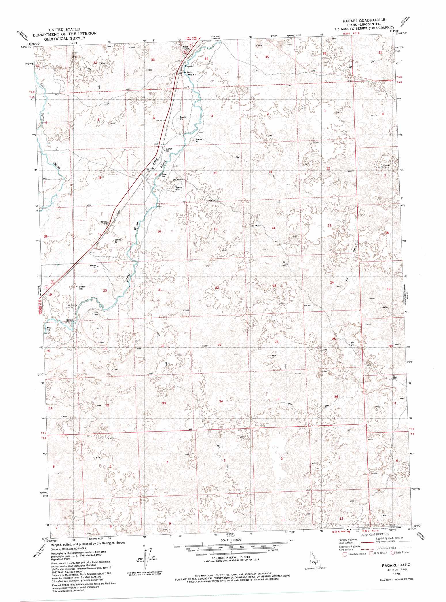
Pagari Topo Map Idaho
To zoom in, hover over the map of Pagari
USGS Topo Quad 43114a1 - 1:24,000 scale
| Topo Map Name: | Pagari |
| USGS Topo Quad ID: | 43114a1 |
| Print Size: | ca. 21 1/4" wide x 27" high |
| Southeast Coordinates: | 43° N latitude / 114° W longitude |
| Map Center Coordinates: | 43.0625° N latitude / 114.0625° W longitude |
| U.S. State: | ID |
| Filename: | o43114a1.jpg |
| Download Map JPG Image: | Pagari topo map 1:24,000 scale |
| Map Type: | Topographic |
| Topo Series: | 7.5´ |
| Map Scale: | 1:24,000 |
| Source of Map Images: | United States Geological Survey (USGS) |
| Alternate Map Versions: |
Pagari ID 1979, updated 1979 Download PDF Buy paper map Pagari ID 1979, updated 1985 Download PDF Buy paper map Pagari ID 2010 Download PDF Buy paper map Pagari ID 2013 Download PDF Buy paper map |
1:24,000 Topo Quads surrounding Pagari
Magic Reservoir East |
Gannett |
Picabo |
Carey |
Paddelford Flat |
Shoshone Ice Cave |
Tapper Lake |
Tikura |
Pagari Well |
Wagon Butte |
Kinzie Butte |
Richfield |
Pagari |
Black Ridge Crater |
Halfway Lake |
Dietrich |
Dietrich Butte |
Owinza |
Senter |
Shale Butte |
Shoshone Se |
Star Lake |
Owinza Butte |
Kimama Butte |
Kimama |
> Back to 43114a1 at 1:100,000 scale
> Back to 43114a1 at 1:250,000 scale
> Back to U.S. Topo Maps home
Pagari topo map: Gazetteer
Pagari: Canals
Jim Byrns Slough elevation 1350m 4429′Pagari: Lakes
Crater Lake elevation 1372m 4501′Pagari: Populated Places
Pagari elevation 1355m 4445′Pagari digital topo map on disk
Buy this Pagari topo map showing relief, roads, GPS coordinates and other geographical features, as a high-resolution digital map file on DVD: