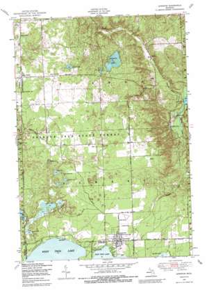
Lewiston Topo Map Michigan
To zoom in, hover over the map of Lewiston
USGS Topo Quad 44084h3 - 1:24,000 scale
| Topo Map Name: | Lewiston |
| USGS Topo Quad ID: | 44084h3 |
| Print Size: | ca. 21 1/4" wide x 27" high |
| Southeast Coordinates: | 44.875° N latitude / 84.25° W longitude |
| Map Center Coordinates: | 44.9375° N latitude / 84.3125° W longitude |
| U.S. State: | MI |
| Filename: | o44084h3.jpg |
| Download Map JPG Image: | Lewiston topo map 1:24,000 scale |
| Map Type: | Topographic |
| Topo Series: | 7.5´ |
| Map Scale: | 1:24,000 |
| Source of Map Images: | United States Geological Survey (USGS) |
| Alternate Map Versions: |
Lewiston MI 1950, updated 1973 Download PDF Buy paper map Lewiston MI 1950, updated 1979 Download PDF Buy paper map Lewiston MI 1950, updated 1989 Download PDF Buy paper map Lewiston MI 1951, updated 1951 Download PDF Buy paper map Lewiston MI 2011 Download PDF Buy paper map Lewiston MI 2014 Download PDF Buy paper map Lewiston MI 2017 Download PDF Buy paper map |
1:24,000 Topo Quads surrounding Lewiston
> Back to 44084e1 at 1:100,000 scale
> Back to 44084a1 at 1:250,000 scale
> Back to U.S. Topo Maps home
Lewiston topo map: Gazetteer
Lewiston: Airports
Twin Lakes Airport elevation 390m 1279′Lewiston: Forests
Presque Isle State Forest elevation 393m 1289′Lewiston: Lakes
Bourne Lake elevation 375m 1230′Crystal Lake elevation 376m 1233′
Double Lake elevation 411m 1348′
Ellsworth Lake elevation 284m 931′
Gaylanta Lake elevation 413m 1354′
Gee Lake elevation 376m 1233′
Hidden Lake elevation 375m 1230′
Kirkland Lake elevation 374m 1227′
Kirtland Lake elevation 374m 1227′
Little Crystal Lake elevation 377m 1236′
Lunden Lake elevation 410m 1345′
McMullen Lake elevation 377m 1236′
Shoepack Lake elevation 375m 1230′
Spectacle Lake elevation 374m 1227′
Spectacle Lakes elevation 374m 1227′
Thompson Pond elevation 294m 964′
West Twin Lake elevation 371m 1217′
Woodmere Lake elevation 373m 1223′
Lewiston: Parks
Angusdale Stock Farm Historical Marker elevation 411m 1348′Bingham Park elevation 378m 1240′
Congregational United Church of Christ Historical Marker elevation 384m 1259′
Lewiston: Populated Places
Bigelow elevation 342m 1122′Donnelly elevation 385m 1263′
Lewiston elevation 379m 1243′
Vienna Corners elevation 407m 1335′
Vienna Junction elevation 374m 1227′
Lewiston: Post Offices
Idlewild Post Office (historical) elevation 364m 1194′Lewiston Post Office elevation 378m 1240′
Vienna Post Office (historical) elevation 374m 1227′
Lewiston: Streams
Sheridan Creek elevation 283m 928′Stanniger Creek elevation 286m 938′
Lewiston digital topo map on disk
Buy this Lewiston topo map showing relief, roads, GPS coordinates and other geographical features, as a high-resolution digital map file on DVD:


