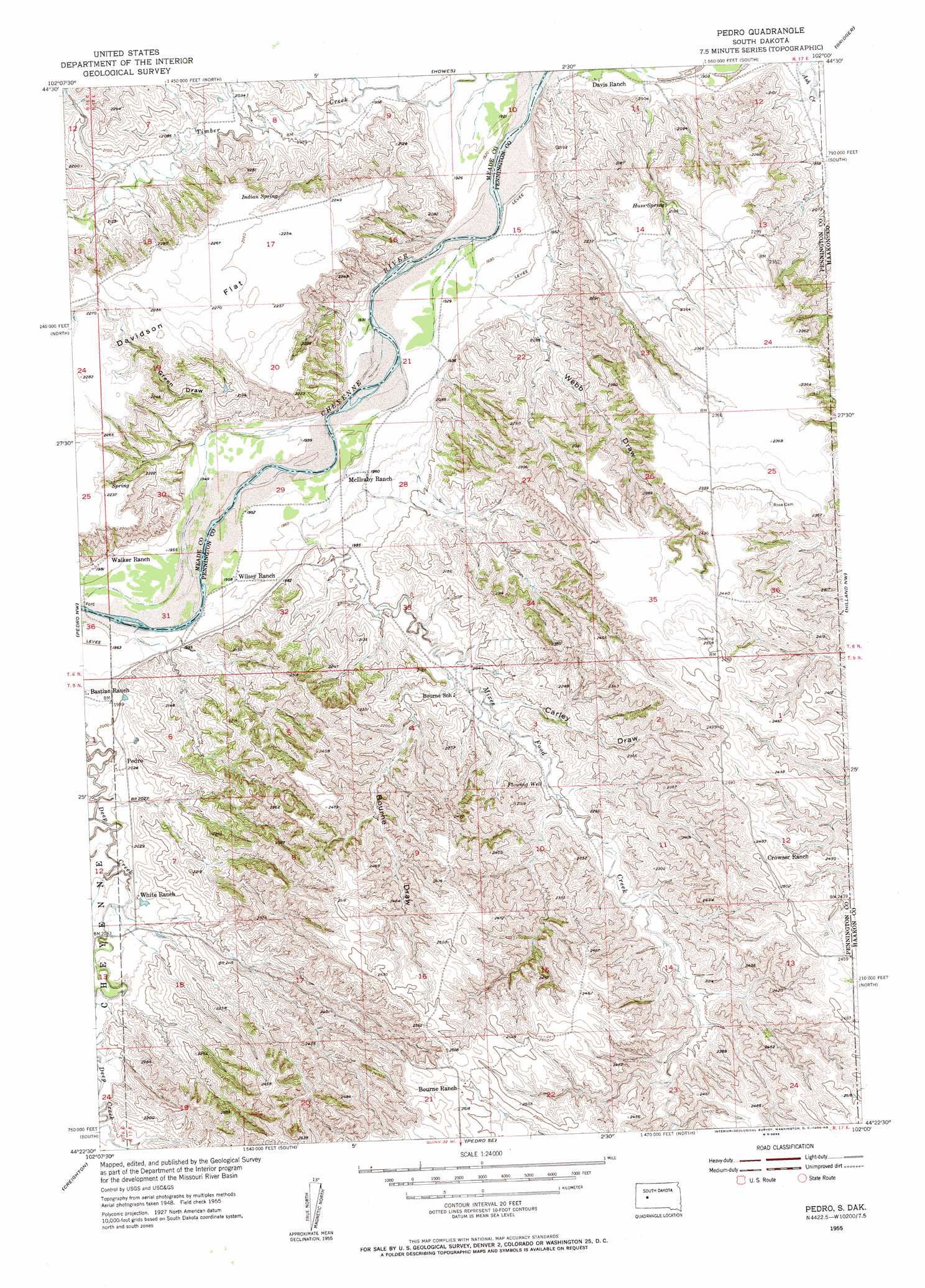
Pedro Topo Map South Dakota
To zoom in, hover over the map of Pedro
USGS Topo Quad 44102d1 - 1:24,000 scale
| Topo Map Name: | Pedro |
| USGS Topo Quad ID: | 44102d1 |
| Print Size: | ca. 21 1/4" wide x 27" high |
| Southeast Coordinates: | 44.375° N latitude / 102° W longitude |
| Map Center Coordinates: | 44.4375° N latitude / 102.0625° W longitude |
| U.S. State: | SD |
| Filename: | o44102d1.jpg |
| Download Map JPG Image: | Pedro topo map 1:24,000 scale |
| Map Type: | Topographic |
| Topo Series: | 7.5´ |
| Map Scale: | 1:24,000 |
| Source of Map Images: | United States Geological Survey (USGS) |
| Alternate Map Versions: |
Pedro SD 1955, updated 1956 Download PDF Buy paper map Pedro SD 2012 Download PDF Buy paper map Pedro SD 2015 Download PDF Buy paper map |
1:24,000 Topo Quads surrounding Pedro
Marcus |
Thompson Lake |
Lemmon Creek |
Dead Horse Draw |
Bridger Ne |
White Owl Se |
Plainview |
Howes |
Bridger |
Bridger Se |
Dalzell Ne |
Pedro Nw |
Pedro |
Hilland Nw |
Hartley |
Dalzell Se |
Creighton |
Pedro Se |
Post Ranch |
Hilland |
Wasta Ne |
Pedrow 4 Nw |
Horse Tooth |
Grindstone |
Grindstone Butte |
> Back to 44102a1 at 1:100,000 scale
> Back to 44102a1 at 1:250,000 scale
> Back to U.S. Topo Maps home
Pedro topo map: Gazetteer
Pedro: Populated Places
Pedro elevation 619m 2030′Pedro: Springs
Huss Spring elevation 665m 2181′Indian Spring elevation 674m 2211′
Pedro: Streams
Mixes Food Creek elevation 588m 1929′Pedro: Valleys
Bourne Draw elevation 630m 2066′Carley Draw elevation 635m 2083′
Green Draw elevation 603m 1978′
Webb Draw elevation 598m 1961′
Pedro digital topo map on disk
Buy this Pedro topo map showing relief, roads, GPS coordinates and other geographical features, as a high-resolution digital map file on DVD:
Eastern Wyoming & Western South Dakota
Buy digital topo maps: Eastern Wyoming & Western South Dakota