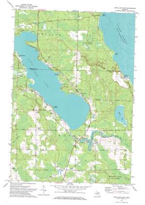
Long Lake East Topo Map Michigan
To zoom in, hover over the map of Long Lake East
USGS Topo Quad 45083b4 - 1:24,000 scale
| Topo Map Name: | Long Lake East |
| USGS Topo Quad ID: | 45083b4 |
| Print Size: | ca. 21 1/4" wide x 27" high |
| Southeast Coordinates: | 45.125° N latitude / 83.375° W longitude |
| Map Center Coordinates: | 45.1875° N latitude / 83.4375° W longitude |
| U.S. State: | MI |
| Filename: | o45083b4.jpg |
| Download Map JPG Image: | Long Lake East topo map 1:24,000 scale |
| Map Type: | Topographic |
| Topo Series: | 7.5´ |
| Map Scale: | 1:24,000 |
| Source of Map Images: | United States Geological Survey (USGS) |
| Alternate Map Versions: |
Long Lake East MI 1971, updated 1974 Download PDF Buy paper map Long Lake East MI 2011 Download PDF Buy paper map Long Lake East MI 2014 Download PDF Buy paper map Long Lake East MI 2016 Download PDF Buy paper map |
1:24,000 Topo Quads surrounding Long Lake East
> Back to 45083a1 at 1:100,000 scale
> Back to 45082a1 at 1:250,000 scale
> Back to U.S. Topo Maps home
Long Lake East topo map: Gazetteer
Long Lake East: Capes
Bolton Point elevation 177m 580′Breezy Point elevation 198m 649′
Ferron Point elevation 177m 580′
Long Lake East: Dams
McConnell Dam elevation 199m 652′Long Lake East: Lakes
Devils Lake elevation 196m 643′Long Lake elevation 199m 652′
Middle Lake elevation 188m 616′
Long Lake East: Parks
Alpena County Park elevation 201m 659′Besser Natural Area elevation 180m 590′
Long Lake County Park elevation 201m 659′
Long Lake East: Populated Places
Ashland elevation 201m 659′Bell elevation 187m 613′
Lakeshore Estates Mobile Home Park elevation 201m 659′
Lakewood elevation 200m 656′
Orchard Point elevation 201m 659′
Rockport elevation 187m 613′
Sunrise Estates Mobile Home Community elevation 204m 669′
Long Lake East: Post Offices
Bell Post Office (historical) elevation 187m 613′Long Lake East: Streams
Fitzgerald Creek elevation 199m 652′Long Lake East digital topo map on disk
Buy this Long Lake East topo map showing relief, roads, GPS coordinates and other geographical features, as a high-resolution digital map file on DVD:


