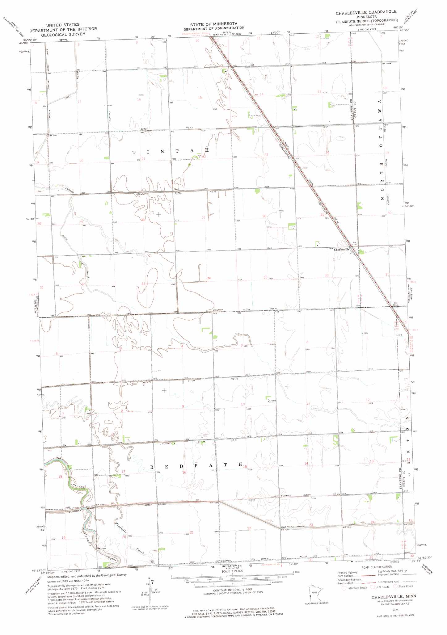
Charlesville Topo Map Minnesota
To zoom in, hover over the map of Charlesville
USGS Topo Quad 45096h3 - 1:24,000 scale
| Topo Map Name: | Charlesville |
| USGS Topo Quad ID: | 45096h3 |
| Print Size: | ca. 21 1/4" wide x 27" high |
| Southeast Coordinates: | 45.875° N latitude / 96.25° W longitude |
| Map Center Coordinates: | 45.9375° N latitude / 96.3125° W longitude |
| U.S. State: | MN |
| Filename: | o45096h3.jpg |
| Download Map JPG Image: | Charlesville topo map 1:24,000 scale |
| Map Type: | Topographic |
| Topo Series: | 7.5´ |
| Map Scale: | 1:24,000 |
| Source of Map Images: | United States Geological Survey (USGS) |
| Alternate Map Versions: |
Charlesville MN 1974, updated 1976 Download PDF Buy paper map Charlesville MN 2010 Download PDF Buy paper map Charlesville MN 2013 Download PDF Buy paper map Charlesville MN 2016 Download PDF Buy paper map |
1:24,000 Topo Quads surrounding Charlesville
South Of Wahpeton |
Doran |
Campbell Ne |
Orwell Lake |
Dayton Hollow Dam |
Fairmount |
Campbell |
Tintah |
Stony Lake |
Wendell |
Boisberg |
Wheaton Nw |
Charlesville |
Herman Nw |
Trisko Lake |
Wheaton West |
Wheaton East |
Wheaton Se |
Herman |
Niemackl Lakes |
Beardsley Ne |
Dumont |
Graceville Ne |
Chokio Nw |
Donnelly |
> Back to 45096e1 at 1:100,000 scale
> Back to 45096a1 at 1:250,000 scale
> Back to U.S. Topo Maps home
Charlesville topo map: Gazetteer
Charlesville: Canals
County Ditch Number Eleven elevation 303m 994′County Ditch Number Eleven elevation 307m 1007′
County Ditch Number Fiftythree elevation 302m 990′
County Ditch Number Fortythree elevation 303m 994′
County Ditch Number Nine elevation 305m 1000′
County Ditch Number Ten elevation 305m 1000′
County Ditch Number Thirtyfive elevation 307m 1007′
County Ditch Number Twentyfour elevation 308m 1010′
County Ditch Number Twentysix elevation 305m 1000′
Judicial Ditch Number Twelve elevation 307m 1007′
Judicial Ditch Number Two elevation 308m 1010′
Mustinka River Ditch elevation 305m 1000′
Charlesville: Populated Places
Charlesville elevation 307m 1007′Charlesville: Streams
Twelvemile Creek elevation 303m 994′Charlesville digital topo map on disk
Buy this Charlesville topo map showing relief, roads, GPS coordinates and other geographical features, as a high-resolution digital map file on DVD:
Eastern North Dakota & Eastern South Dakota
Buy digital topo maps: Eastern North Dakota & Eastern South Dakota