Akaska Sw Topo Map South Dakota
To zoom in, hover over the map of Akaska Sw
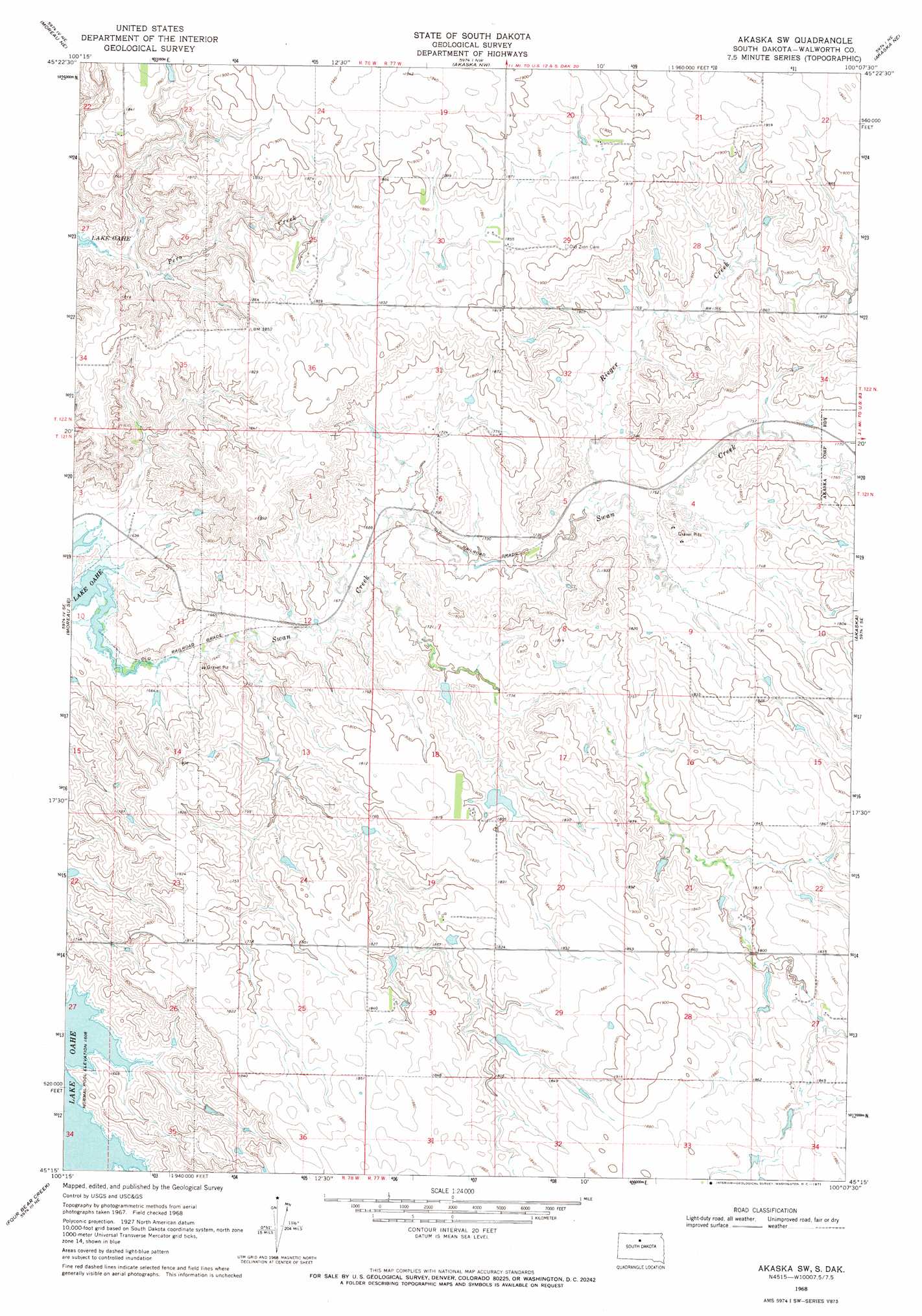
USGS Topo Quad 45100c2 - 1:24,000 scale
| Topo Map Name: | Akaska Sw |
| USGS Topo Quad ID: | 45100c2 |
| Print Size: | ca. 21 1/4" wide x 27" high |
| Southeast Coordinates: | 45.25° N latitude / 100.125° W longitude |
| Map Center Coordinates: | 45.3125° N latitude / 100.1875° W longitude |
| U.S. State: | SD |
| Filename: | o45100c2.jpg |
| Download Map JPG Image: | Akaska Sw topo map 1:24,000 scale |
| Map Type: | Topographic |
| Topo Series: | 7.5´ |
| Map Scale: | 1:24,000 |
| Source of Map Images: | United States Geological Survey (USGS) |
| Alternate Map Versions: |
Akaska SW SD 1968, updated 1971 Download PDF Buy paper map Akaska SW SD 2012 Download PDF Buy paper map Akaska SW SD 2015 Download PDF Buy paper map |
1:24,000 Topo Quads surrounding Akaska Sw
Mobridge |
Glenham |
Selby Sw |
Selby |
Java |
Moreau Nw |
Moreau Ne |
Akaska Nw |
Akaska Ne |
Lowry Nw |
Moreau |
Moreau Se |
Akaska Sw |
Akaska |
Lowry |
Patch Skin Buttes |
Four Bear Creek |
Steamboat Creek |
Lake Hurley Ne |
Flight Lake |
Patch Skin Buttes Sw |
Patch Skin Buttes Se |
Lake Hurley |
Lake Hurley Se |
Gettysburg |
> Back to 45100a1 at 1:100,000 scale
> Back to 45100a1 at 1:250,000 scale
> Back to U.S. Topo Maps home
Akaska Sw topo map: Gazetteer
Akaska Sw: Dams
Albert Kulm Dam elevation 566m 1856′Calvin Ballensky Dam elevation 542m 1778′
Tom Hauk Number 1 Dam elevation 507m 1663′
Akaska Sw: Streams
Rieger Creek elevation 520m 1706′Akaska Sw digital topo map on disk
Buy this Akaska Sw topo map showing relief, roads, GPS coordinates and other geographical features, as a high-resolution digital map file on DVD:
Eastern North Dakota & Eastern South Dakota
Buy digital topo maps: Eastern North Dakota & Eastern South Dakota