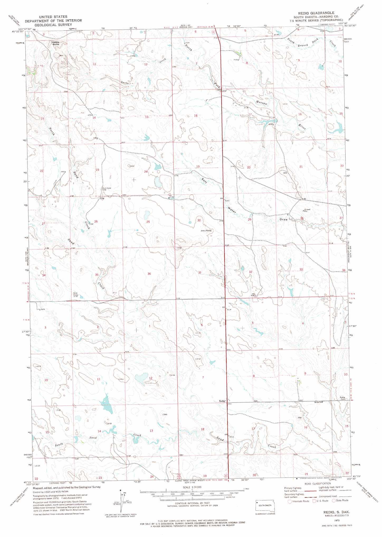
Redig Topo Map South Dakota
To zoom in, hover over the map of Redig
USGS Topo Quad 45103c5 - 1:24,000 scale
| Topo Map Name: | Redig |
| USGS Topo Quad ID: | 45103c5 |
| Print Size: | ca. 21 1/4" wide x 27" high |
| Southeast Coordinates: | 45.25° N latitude / 103.5° W longitude |
| Map Center Coordinates: | 45.3125° N latitude / 103.5625° W longitude |
| U.S. State: | SD |
| Filename: | o45103c5.jpg |
| Download Map JPG Image: | Redig topo map 1:24,000 scale |
| Map Type: | Topographic |
| Topo Series: | 7.5´ |
| Map Scale: | 1:24,000 |
| Source of Map Images: | United States Geological Survey (USGS) |
| Alternate Map Versions: |
Redig SD 1973, updated 1978 Download PDF Buy paper map Redig SD 2012 Download PDF Buy paper map Redig SD 2015 Download PDF Buy paper map |
1:24,000 Topo Quads surrounding Redig
Pine Spring |
Saddle Butte |
Buffalo |
Sheep Pen Draw Sw |
Sheep Pen Draw Se |
Harding |
Bog Creek |
Redig Ne |
Bams Butte Nw |
Bams Butte |
Hells Canyon |
Moreau Peak |
Redig |
Roundup Butte |
Bams Butte Se |
Alkali Creek West |
Alkali Creek East |
Lone Tree Draw West |
Lone Tree Draw East |
Granger Creek |
Battle Creek Butte |
Antelope Creek West |
Antelope Creek East |
Haystack Butte |
Hoover |
> Back to 45103a1 at 1:100,000 scale
> Back to 45102a1 at 1:250,000 scale
> Back to U.S. Topo Maps home
Redig topo map: Gazetteer
Redig: Dams
Lloyd Fox Dam Number 3 elevation 941m 3087′Ted Matson Dam elevation 950m 3116′
Ward Vanhorn Dam elevation 972m 3188′
Redig: Populated Places
Redig elevation 927m 3041′Redig: Streams
North Sand Creek elevation 944m 3097′Snake Creek elevation 950m 3116′
South Sand Creek elevation 929m 3047′
Redig: Summits
Saddle Butte elevation 1046m 3431′Redig digital topo map on disk
Buy this Redig topo map showing relief, roads, GPS coordinates and other geographical features, as a high-resolution digital map file on DVD:
Eastern Montana & Western North Dakota
Buy digital topo maps: Eastern Montana & Western North Dakota