Lawler Topo Map Minnesota
To zoom in, hover over the map of Lawler
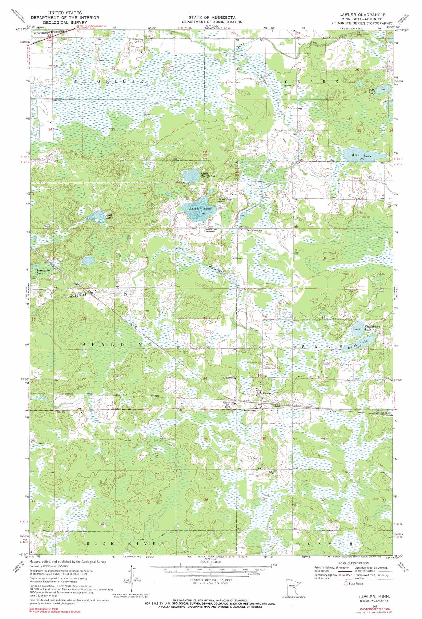
USGS Topo Quad 46093e2 - 1:24,000 scale
| Topo Map Name: | Lawler |
| USGS Topo Quad ID: | 46093e2 |
| Print Size: | ca. 21 1/4" wide x 27" high |
| Southeast Coordinates: | 46.5° N latitude / 93.125° W longitude |
| Map Center Coordinates: | 46.5625° N latitude / 93.1875° W longitude |
| U.S. State: | MN |
| Filename: | o46093e2.jpg |
| Download Map JPG Image: | Lawler topo map 1:24,000 scale |
| Map Type: | Topographic |
| Topo Series: | 7.5´ |
| Map Scale: | 1:24,000 |
| Source of Map Images: | United States Geological Survey (USGS) |
| Alternate Map Versions: |
Lawler MN 1969, updated 1972 Download PDF Buy paper map Lawler MN 1969, updated 1990 Download PDF Buy paper map Lawler MN 2010 Download PDF Buy paper map Lawler MN 2013 Download PDF Buy paper map Lawler MN 2016 Download PDF Buy paper map |
1:24,000 Topo Quads surrounding Lawler
Sanders Lake |
Libby |
Balsam |
Little Prairie Lake |
Prairie Lake |
Palisade |
Minnewawa |
Tamarack |
Wright |
Cromwell West |
Kimberly |
Mcgregor |
Lawler |
Automba |
Heikkila Creek |
Thor |
Thor Ne |
Split Rock Lake |
Ronald |
Kettle River |
Thor Sw |
Thor Se |
Solana |
Arthyde |
Denham |
> Back to 46093e1 at 1:100,000 scale
> Back to 46092a1 at 1:250,000 scale
> Back to U.S. Topo Maps home
Lawler topo map: Gazetteer
Lawler: Lakes
Dutch Lake elevation 394m 1292′Kelly Lake elevation 390m 1279′
Little Sheriff Lake elevation 388m 1272′
Lost Lake elevation 384m 1259′
Rice Lake elevation 387m 1269′
Sandabacka Lake elevation 394m 1292′
Sheriff Lake elevation 391m 1282′
Lawler: Parks
Lawler Wildlife Management Area elevation 399m 1309′Lawler: Populated Places
Lawler elevation 401m 1315′Lawler: Post Offices
Lawler Post Office (historical) elevation 401m 1315′Lawler digital topo map on disk
Buy this Lawler topo map showing relief, roads, GPS coordinates and other geographical features, as a high-resolution digital map file on DVD: