Kettle River Topo Map Minnesota
To zoom in, hover over the map of Kettle River
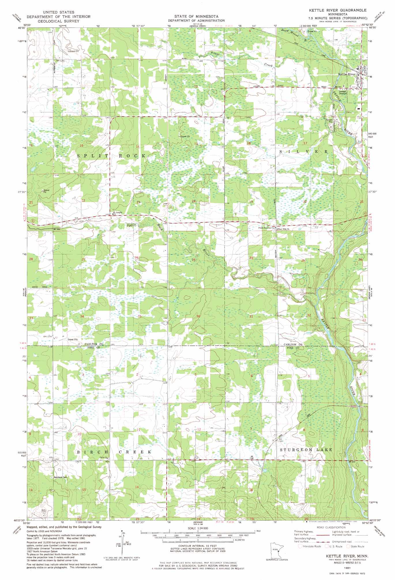
USGS Topo Quad 46092d8 - 1:24,000 scale
| Topo Map Name: | Kettle River |
| USGS Topo Quad ID: | 46092d8 |
| Print Size: | ca. 21 1/4" wide x 27" high |
| Southeast Coordinates: | 46.375° N latitude / 92.875° W longitude |
| Map Center Coordinates: | 46.4375° N latitude / 92.9375° W longitude |
| U.S. State: | MN |
| Filename: | o46092d8.jpg |
| Download Map JPG Image: | Kettle River topo map 1:24,000 scale |
| Map Type: | Topographic |
| Topo Series: | 7.5´ |
| Map Scale: | 1:24,000 |
| Source of Map Images: | United States Geological Survey (USGS) |
| Alternate Map Versions: |
Kettle River MN 1981, updated 1982 Download PDF Buy paper map Kettle River MN 2010 Download PDF Buy paper map Kettle River MN 2013 Download PDF Buy paper map Kettle River MN 2016 Download PDF Buy paper map |
1:24,000 Topo Quads surrounding Kettle River
Tamarack |
Wright |
Cromwell West |
Cromwell East |
Sawyer |
Lawler |
Automba |
Heikkila Creek |
Cromwell Se |
Barnum |
Split Rock Lake |
Ronald |
Kettle River |
Moose Lake |
Hanging Horn Lake |
Solana |
Arthyde |
Denham |
Willow River |
Bruno |
Kroschel Nw |
Giese |
Finlayson |
Sandstone North |
Askov Lookout Tower |
> Back to 46092a1 at 1:100,000 scale
> Back to 46092a1 at 1:250,000 scale
> Back to U.S. Topo Maps home
Kettle River topo map: Gazetteer
Kettle River: Populated Places
Kettle River elevation 360m 1181′Kettle River: Post Offices
Kettle River Post Office elevation 360m 1181′Kettle River: Streams
Dead Moose River elevation 357m 1171′Gillespie Brook elevation 334m 1095′
Silver Creek elevation 347m 1138′
Split Rock River elevation 329m 1079′
Kettle River digital topo map on disk
Buy this Kettle River topo map showing relief, roads, GPS coordinates and other geographical features, as a high-resolution digital map file on DVD: