Great Bend Topo Map North Dakota
To zoom in, hover over the map of Great Bend
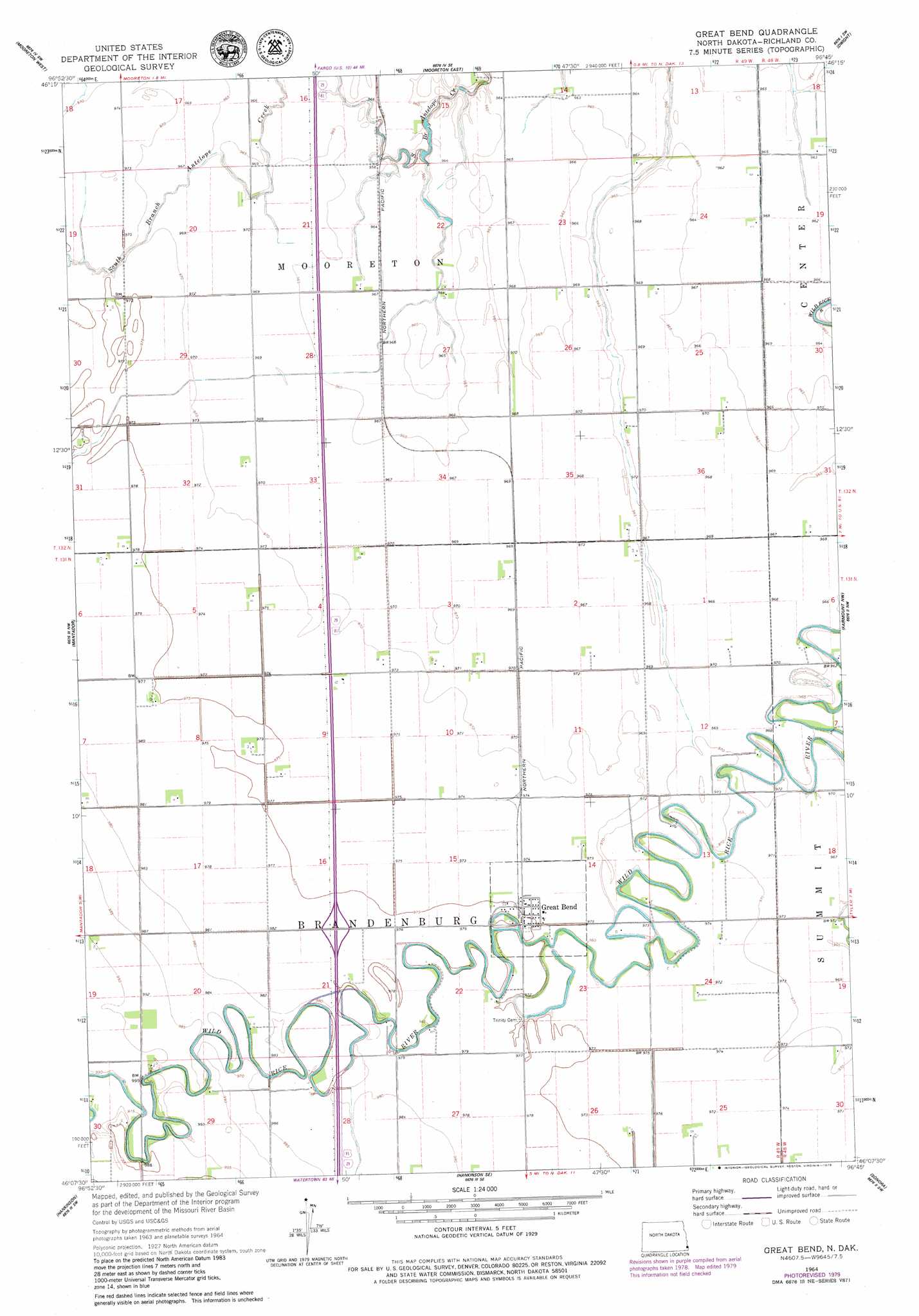
USGS Topo Quad 46096b7 - 1:24,000 scale
| Topo Map Name: | Great Bend |
| USGS Topo Quad ID: | 46096b7 |
| Print Size: | ca. 21 1/4" wide x 27" high |
| Southeast Coordinates: | 46.125° N latitude / 96.75° W longitude |
| Map Center Coordinates: | 46.1875° N latitude / 96.8125° W longitude |
| U.S. State: | ND |
| Filename: | O46096B7.jpg |
| Download Map JPG Image: | Great Bend topo map 1:24,000 scale |
| Map Type: | Topographic |
| Topo Series: | 7.5´ |
| Map Scale: | 1:24,000 |
| Source of Map Images: | United States Geological Survey (USGS) |
| Alternate Map Versions: |
Great Bend ND 1964, updated 1965 Download PDF Buy paper map Great Bend ND 1964, updated 1979 Download PDF Buy paper map Great Bend ND 2011 Download PDF Buy paper map Great Bend ND 2014 Download PDF Buy paper map |
1:24,000 Topo Quads surrounding Great Bend
Wyndmere Ne |
Mooreton Nw |
Galchutt |
Abercrombie |
Wahpeton Ne |
Wyndmere Se |
Mooreton West |
Mooreton East |
Dwight |
Wahpeton |
Moselle |
Mantador |
Great Bend |
Fairmount Nw |
South Of Wahpeton |
Swan Lake |
Hankinson |
Hankinson Se |
Sonora |
Fairmount |
Claire City Ne |
New Effington Nw |
New Effington Ne |
La Mars |
Boisberg |
> Back to 46096a1 at 1:100,000 scale
> Back to 46096a1 at 1:250,000 scale
> Back to U.S. Topo Maps home
Great Bend digital topo map on disk
Buy this Great Bend topo map showing relief, roads, GPS coordinates and other geographical features, as a high-resolution digital map file on DVD:
Eastern North Dakota & Eastern South Dakota
Buy digital topo maps: Eastern North Dakota & Eastern South Dakota