Galchutt Topo Map North Dakota
To zoom in, hover over the map of Galchutt
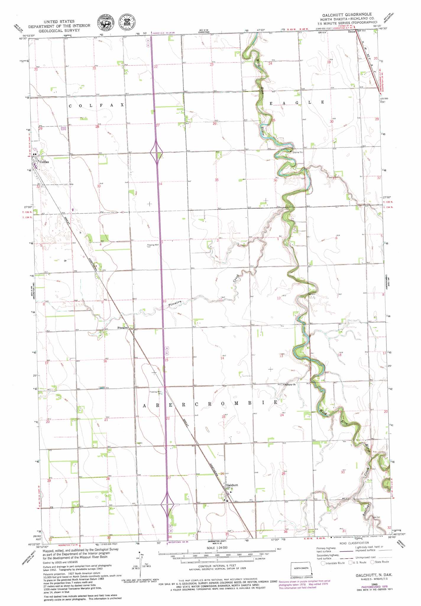
USGS Topo Quad 46096d7 - 1:24,000 scale
| Topo Map Name: | Galchutt |
| USGS Topo Quad ID: | 46096d7 |
| Print Size: | ca. 21 1/4" wide x 27" high |
| Southeast Coordinates: | 46.375° N latitude / 96.75° W longitude |
| Map Center Coordinates: | 46.4375° N latitude / 96.8125° W longitude |
| U.S. State: | ND |
| Filename: | O46096D7.jpg |
| Download Map JPG Image: | Galchutt topo map 1:24,000 scale |
| Map Type: | Topographic |
| Topo Series: | 7.5´ |
| Map Scale: | 1:24,000 |
| Source of Map Images: | United States Geological Survey (USGS) |
| Alternate Map Versions: |
Galchutt ND 1960, updated 1961 Download PDF Buy paper map Galchutt ND 2011 Download PDF Buy paper map Galchutt ND 2014 Download PDF Buy paper map |
1:24,000 Topo Quads surrounding Galchutt
Kindred |
Norman |
Hickson |
Comstock |
Baker |
Barrie |
Walcott |
Christine |
Wolverton |
Wolverton Se |
Wyndmere Ne |
Mooreton Nw |
Galchutt |
Abercrombie |
Wahpeton Ne |
Wyndmere Se |
Mooreton West |
Mooreton East |
Dwight |
Wahpeton |
Moselle |
Mantador |
Great Bend |
Fairmount Nw |
South Of Wahpeton |
> Back to 46096a1 at 1:100,000 scale
> Back to 46096a1 at 1:250,000 scale
> Back to U.S. Topo Maps home
Galchutt topo map: Gazetteer
Galchutt: Populated Places
Colfax elevation 293m 961′Enloe elevation 285m 935′
Galchutt elevation 290m 951′
Pitcairn elevation 290m 951′
Galchutt: Streams
Antelope Creek elevation 279m 915′Pitcairn Creek elevation 279m 915′
Galchutt digital topo map on disk
Buy this Galchutt topo map showing relief, roads, GPS coordinates and other geographical features, as a high-resolution digital map file on DVD:
Eastern North Dakota & Eastern South Dakota
Buy digital topo maps: Eastern North Dakota & Eastern South Dakota