Glover Topo Map North Dakota
To zoom in, hover over the map of Glover
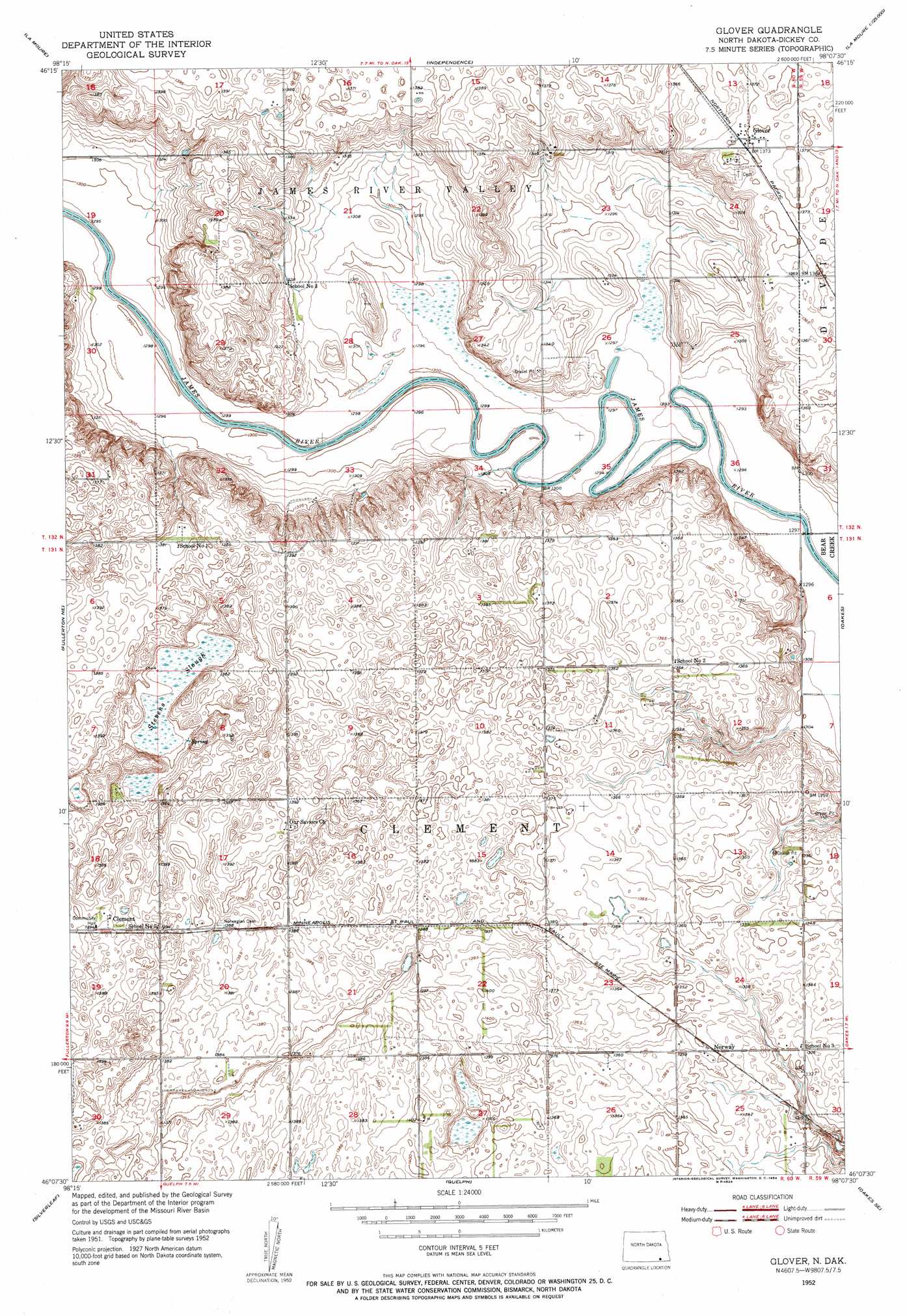
USGS Topo Quad 46098b2 - 1:24,000 scale
| Topo Map Name: | Glover |
| USGS Topo Quad ID: | 46098b2 |
| Print Size: | ca. 21 1/4" wide x 27" high |
| Southeast Coordinates: | 46.125° N latitude / 98.125° W longitude |
| Map Center Coordinates: | 46.1875° N latitude / 98.1875° W longitude |
| U.S. State: | ND |
| Filename: | O46098B2.jpg |
| Download Map JPG Image: | Glover topo map 1:24,000 scale |
| Map Type: | Topographic |
| Topo Series: | 7.5´ |
| Map Scale: | 1:24,000 |
| Source of Map Images: | United States Geological Survey (USGS) |
| Alternate Map Versions: |
Glover ND 1952, updated 1954 Download PDF Buy paper map Glover ND 2011 Download PDF Buy paper map Glover ND 2014 Download PDF Buy paper map |
1:24,000 Topo Quads surrounding Glover
Berlin |
Grand Rapids |
Verona Nw |
Verona Ne |
Englevale |
La Moure Sw |
La Moure |
Independence |
Verona |
Elliott Sw |
Fullerton |
Fullerton Ne |
Glover |
Oakes |
Crete |
Silverleaf |
Fullerton Se |
Guelph |
Oakes Se |
Straubville |
Savo Nw |
Savo Ne |
Hecla |
Hecla Ne |
Newark Nw |
> Back to 46098a1 at 1:100,000 scale
> Back to 46098a1 at 1:250,000 scale
> Back to U.S. Topo Maps home
Glover topo map: Gazetteer
Glover: Airports
Pfeifer Airstrip elevation 421m 1381′Glover: Guts
Stevens Slough elevation 410m 1345′Glover: Populated Places
Clement elevation 425m 1394′Glover elevation 419m 1374′
Norway elevation 412m 1351′
Glover digital topo map on disk
Buy this Glover topo map showing relief, roads, GPS coordinates and other geographical features, as a high-resolution digital map file on DVD:
Eastern North Dakota & Eastern South Dakota
Buy digital topo maps: Eastern North Dakota & Eastern South Dakota