Cleveland Topo Map North Dakota
To zoom in, hover over the map of Cleveland
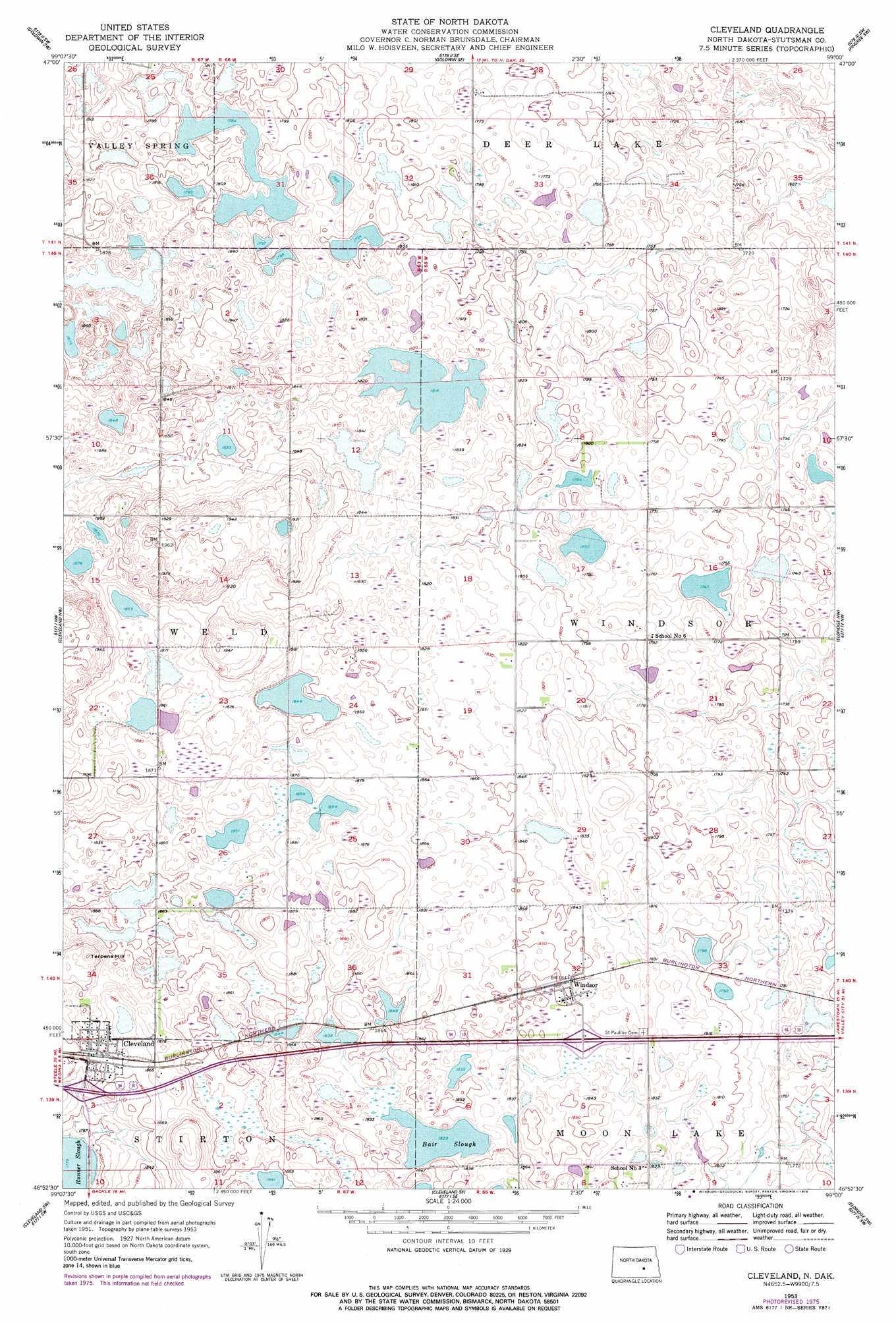
USGS Topo Quad 46099h1 - 1:24,000 scale
| Topo Map Name: | Cleveland |
| USGS Topo Quad ID: | 46099h1 |
| Print Size: | ca. 21 1/4" wide x 27" high |
| Southeast Coordinates: | 46.875° N latitude / 99° W longitude |
| Map Center Coordinates: | 46.9375° N latitude / 99.0625° W longitude |
| U.S. State: | ND |
| Filename: | O46099H1.jpg |
| Download Map JPG Image: | Cleveland topo map 1:24,000 scale |
| Map Type: | Topographic |
| Topo Series: | 7.5´ |
| Map Scale: | 1:24,000 |
| Source of Map Images: | United States Geological Survey (USGS) |
| Alternate Map Versions: |
Cleveland ND 1953, updated 1955 Download PDF Buy paper map Cleveland ND 1953, updated 1978 Download PDF Buy paper map Cleveland ND 2011 Download PDF Buy paper map Cleveland ND 2014 Download PDF Buy paper map |
1:24,000 Topo Quads surrounding Cleveland
Woodworth |
Goldwin |
Vashti |
Pingree |
Jim Lake |
Pearl Lake |
Goldwin Sw |
Goldwin Se |
Pingree Sw |
Buchanan |
Medina |
Cleveland Nw |
Cleveland |
Eldridge Nw |
Eldridge |
Medina Se |
Cleveland Sw |
Cleveland Se |
Eldridge Sw |
Eldridge Se |
Streeter |
Gackle North |
Gackle Ne |
Jud Nw |
Millarton |
> Back to 46099e1 at 1:100,000 scale
> Back to 46098a1 at 1:250,000 scale
> Back to U.S. Topo Maps home
Cleveland topo map: Gazetteer
Cleveland: Lakes
Bair Lake elevation 544m 1784′Bair Slough elevation 558m 1830′
Cleveland: Populated Places
Cleveland elevation 569m 1866′Windsor elevation 564m 1850′
Cleveland: Summits
Terpena Hill elevation 593m 1945′Cleveland digital topo map on disk
Buy this Cleveland topo map showing relief, roads, GPS coordinates and other geographical features, as a high-resolution digital map file on DVD:
Eastern North Dakota & Eastern South Dakota
Buy digital topo maps: Eastern North Dakota & Eastern South Dakota