Mineral Springs Topo Map North Dakota
To zoom in, hover over the map of Mineral Springs
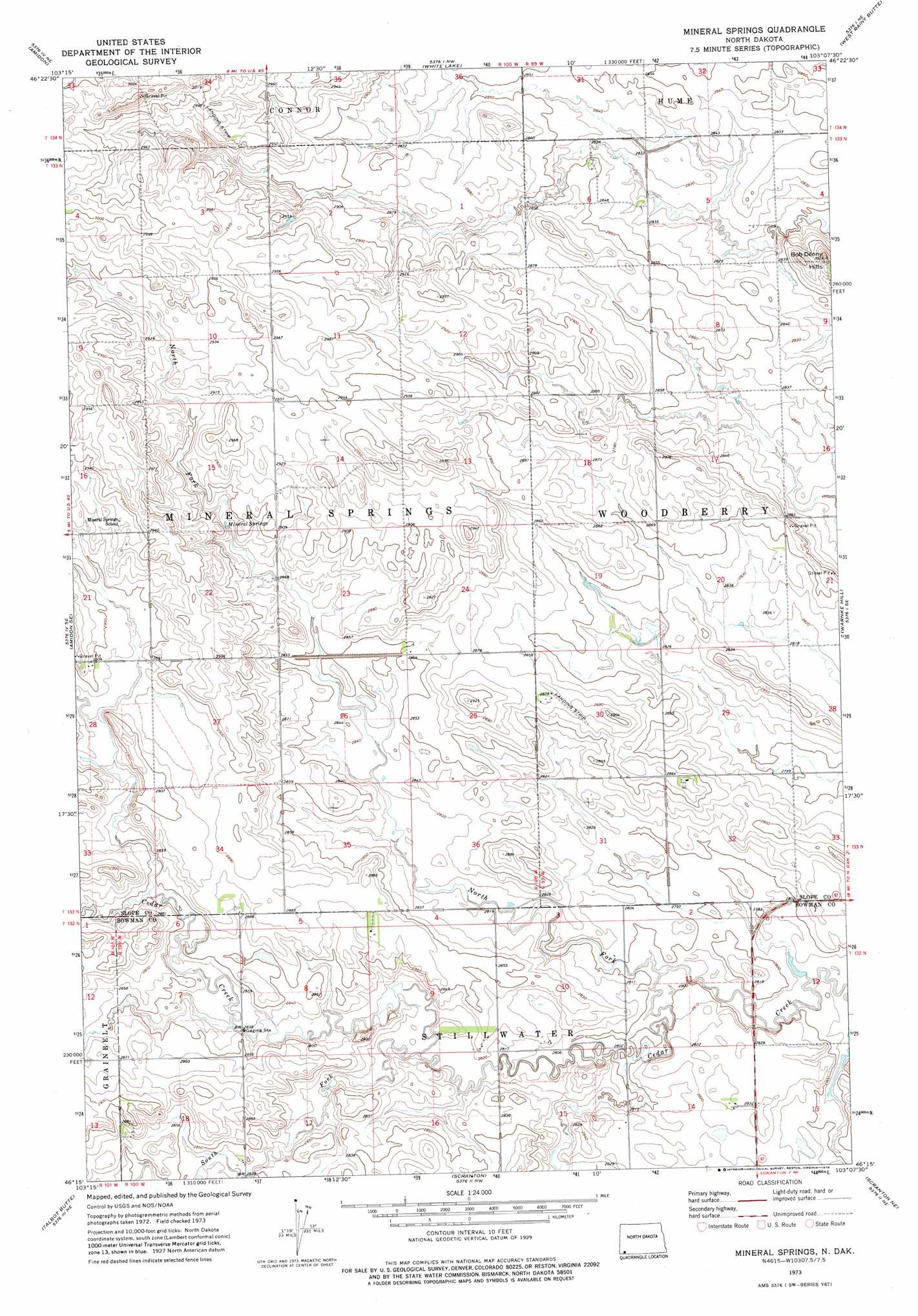
USGS Topo Quad 46103c2 - 1:24,000 scale
| Topo Map Name: | Mineral Springs |
| USGS Topo Quad ID: | 46103c2 |
| Print Size: | ca. 21 1/4" wide x 27" high |
| Southeast Coordinates: | 46.25° N latitude / 103.125° W longitude |
| Map Center Coordinates: | 46.3125° N latitude / 103.1875° W longitude |
| U.S. State: | ND |
| Filename: | O46103C2.jpg |
| Download Map JPG Image: | Mineral Springs topo map 1:24,000 scale |
| Map Type: | Topographic |
| Topo Series: | 7.5´ |
| Map Scale: | 1:24,000 |
| Source of Map Images: | United States Geological Survey (USGS) |
| Alternate Map Versions: |
Mineral Springs ND 1973, updated 1976 Download PDF Buy paper map Mineral Springs ND 2011 Download PDF Buy paper map Mineral Springs ND 2014 Download PDF Buy paper map |
1:24,000 Topo Quads surrounding Mineral Springs
Juniper Spur |
Rocky Ridge South |
Daglum Sw |
Daglum Se |
New England Sw |
Black Butte |
Amidon |
White Lake |
West Rainy Butte |
East Rainy Butte |
Stewart Lake |
Amidon Se |
Mineral Springs |
Warnke Hill |
Cedar Lake |
Bowman |
Talbot Butte |
Scranton |
Scranton Ne |
Whetstone Buttes |
Bowman Sw |
Bowman Se |
Scranton Sw |
Gascoyne |
Reeder |
> Back to 46103a1 at 1:100,000 scale
> Back to 46102a1 at 1:250,000 scale
> Back to U.S. Topo Maps home
Mineral Springs topo map: Gazetteer
Mineral Springs: Ranges
Bob Denny Hills elevation 875m 2870′Mineral Springs: Springs
Mineral Springs elevation 875m 2870′Mineral Springs: Streams
North Fork Cedar Creek elevation 850m 2788′South Fork Cedar Creek elevation 856m 2808′
Mineral Springs digital topo map on disk
Buy this Mineral Springs topo map showing relief, roads, GPS coordinates and other geographical features, as a high-resolution digital map file on DVD:
Eastern Montana & Western North Dakota
Buy digital topo maps: Eastern Montana & Western North Dakota