West Rainy Butte Topo Map North Dakota
To zoom in, hover over the map of West Rainy Butte
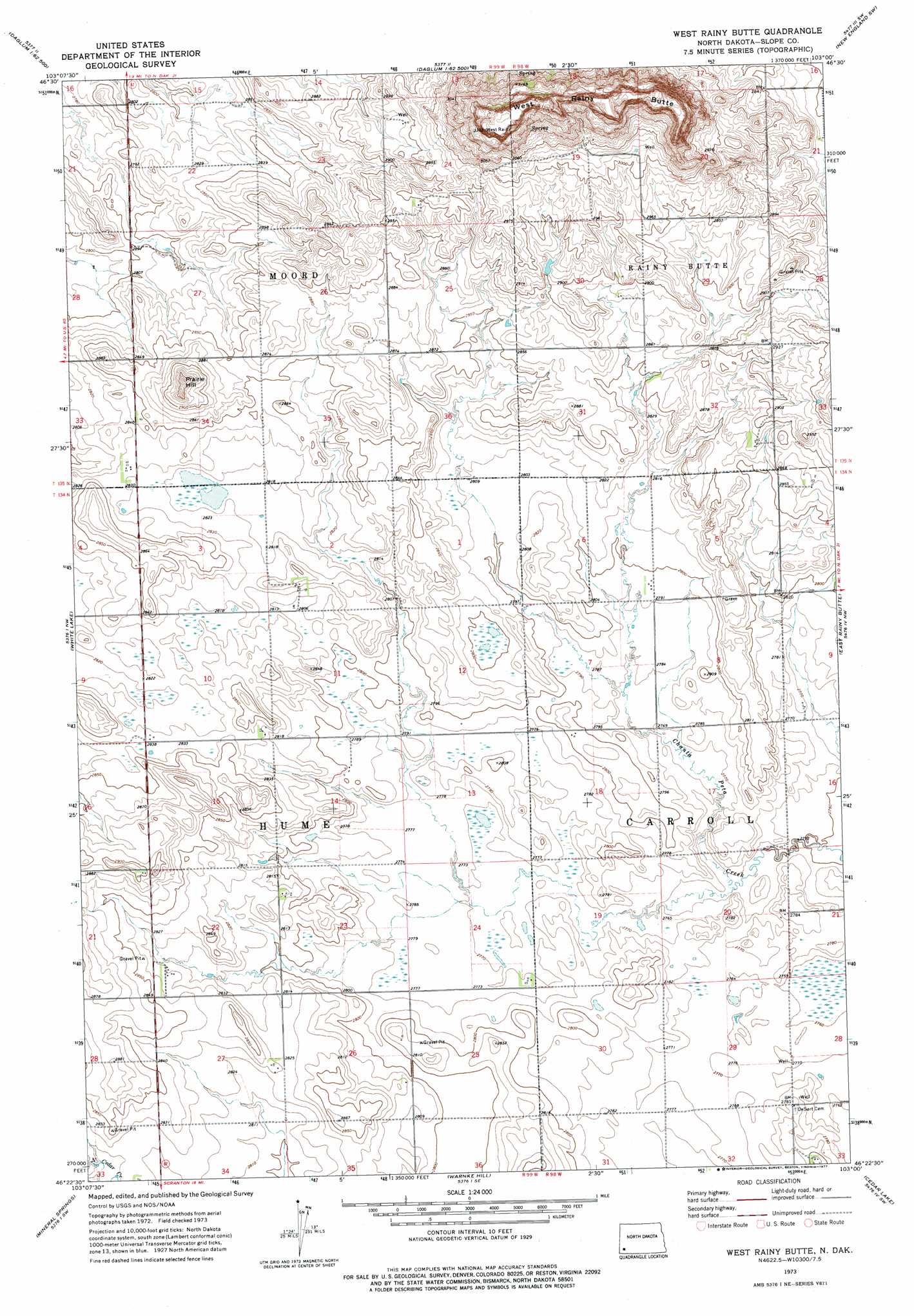
USGS Topo Quad 46103d1 - 1:24,000 scale
| Topo Map Name: | West Rainy Butte |
| USGS Topo Quad ID: | 46103d1 |
| Print Size: | ca. 21 1/4" wide x 27" high |
| Southeast Coordinates: | 46.375° N latitude / 103° W longitude |
| Map Center Coordinates: | 46.4375° N latitude / 103.0625° W longitude |
| U.S. State: | ND |
| Filename: | O46103D1.jpg |
| Download Map JPG Image: | West Rainy Butte topo map 1:24,000 scale |
| Map Type: | Topographic |
| Topo Series: | 7.5´ |
| Map Scale: | 1:24,000 |
| Source of Map Images: | United States Geological Survey (USGS) |
| Alternate Map Versions: |
West Rainy Butte ND 1973, updated 1977 Download PDF Buy paper map West Rainy Butte ND 2011 Download PDF Buy paper map West Rainy Butte ND 2014 Download PDF Buy paper map |
1:24,000 Topo Quads surrounding West Rainy Butte
Rocky Ridge North |
Daglum Nw |
Daglum |
New England Nw |
Schefield |
Rocky Ridge South |
Daglum Sw |
Daglum Se |
New England Sw |
New England |
Amidon |
White Lake |
West Rainy Butte |
East Rainy Butte |
Jung Lake |
Amidon Se |
Mineral Springs |
Warnke Hill |
Cedar Lake |
Enterprise School |
Talbot Butte |
Scranton |
Scranton Ne |
Whetstone Buttes |
Wolf Butte |
> Back to 46103a1 at 1:100,000 scale
> Back to 46102a1 at 1:250,000 scale
> Back to U.S. Topo Maps home
West Rainy Butte topo map: Gazetteer
West Rainy Butte: Summits
Prairie Hill elevation 908m 2979′Rainy Butte elevation 888m 2913′
West Rainy Butte elevation 1014m 3326′
West Rainy Butte digital topo map on disk
Buy this West Rainy Butte topo map showing relief, roads, GPS coordinates and other geographical features, as a high-resolution digital map file on DVD:
Eastern Montana & Western North Dakota
Buy digital topo maps: Eastern Montana & Western North Dakota