Fairbanks Topo Map Minnesota
To zoom in, hover over the map of Fairbanks
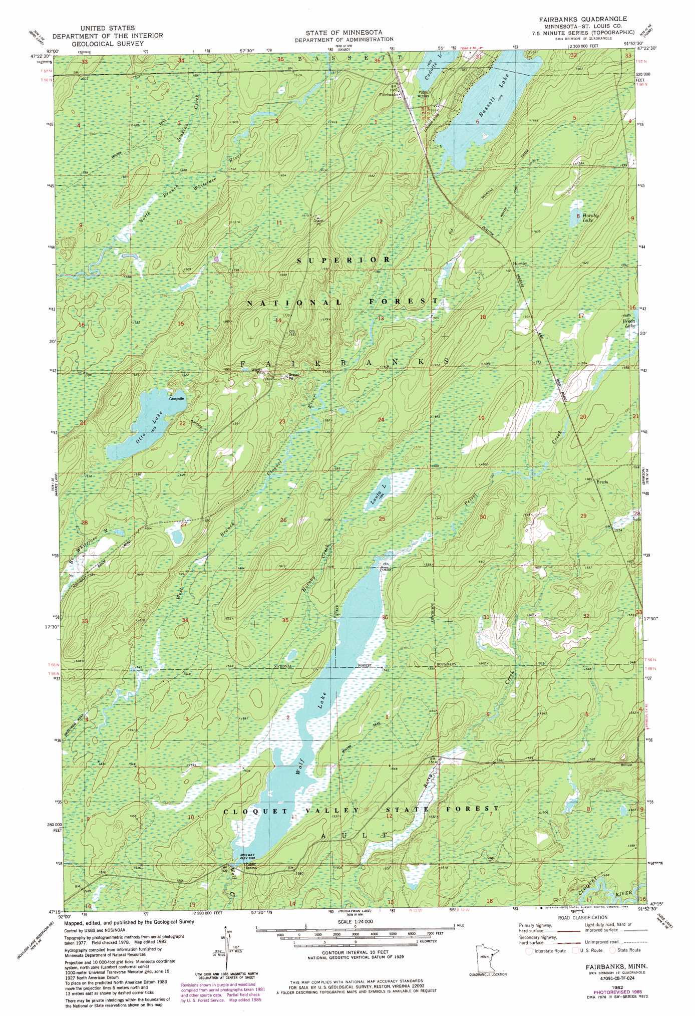
USGS Topo Quad 47091c8 - 1:24,000 scale
| Topo Map Name: | Fairbanks |
| USGS Topo Quad ID: | 47091c8 |
| Print Size: | ca. 21 1/4" wide x 27" high |
| Southeast Coordinates: | 47.25° N latitude / 91.875° W longitude |
| Map Center Coordinates: | 47.3125° N latitude / 91.9375° W longitude |
| U.S. State: | MN |
| Filename: | o47091c8.jpg |
| Download Map JPG Image: | Fairbanks topo map 1:24,000 scale |
| Map Type: | Topographic |
| Topo Series: | 7.5´ |
| Map Scale: | 1:24,000 |
| Source of Map Images: | United States Geological Survey (USGS) |
| Alternate Map Versions: |
Brimson SW MN 1976, updated 1979 Download PDF Buy paper map Fairbanks MN 1982, updated 1982 Download PDF Buy paper map Fairbanks MN 1982, updated 1985 Download PDF Buy paper map Fairbanks MN 2011 Download PDF Buy paper map Fairbanks MN 2013 Download PDF Buy paper map Fairbanks MN 2016 Download PDF Buy paper map |
| FStopo: | US Forest Service topo Fairbanks is available: Download FStopo PDF Download FStopo TIF |
1:24,000 Topo Quads surrounding Fairbanks
Aurora |
Allen |
Babbitt Sw |
Babbitt Se |
Greenwood Lake West |
Turpela Lake |
Bird Lake |
Skibo |
Toimi |
Mount Weber |
Whiteface Reservoir |
Harris Lake |
Fairbanks |
Brimson |
Kane Lake |
Comstock Lake |
Boulder Lake Reservoir Ne |
Pequaywan Lake |
King Lake |
Highland |
Boulder Lake Reservoir |
Thompson Lake |
Barrs Lake |
Mccarthy Creek |
Two Harbors |
> Back to 47091a1 at 1:100,000 scale
> Back to 47090a1 at 1:250,000 scale
> Back to U.S. Topo Maps home
Fairbanks topo map: Gazetteer
Fairbanks: Dams
Wolf Lake Dam elevation 474m 1555′Fairbanks: Lakes
Bassett Lake elevation 481m 1578′Hornby Lake elevation 492m 1614′
Lanta Lake elevation 477m 1564′
Otto Lake elevation 494m 1620′
Wolf Lake elevation 466m 1528′
Fairbanks: Populated Places
Breda elevation 482m 1581′Fairbanks elevation 504m 1653′
Hornby elevation 494m 1620′
Fairbanks: Post Offices
Fairbanks Post Office (historical) elevation 503m 1650′Fairbanks: Reservoirs
Wolf Lake elevation 474m 1555′Fairbanks: Streams
Hornby Creek elevation 466m 1528′Jenkins Creek elevation 484m 1587′
Petrel Creek elevation 467m 1532′
Pine Creek elevation 451m 1479′
Fairbanks digital topo map on disk
Buy this Fairbanks topo map showing relief, roads, GPS coordinates and other geographical features, as a high-resolution digital map file on DVD: