Guthrie Topo Map Minnesota
To zoom in, hover over the map of Guthrie
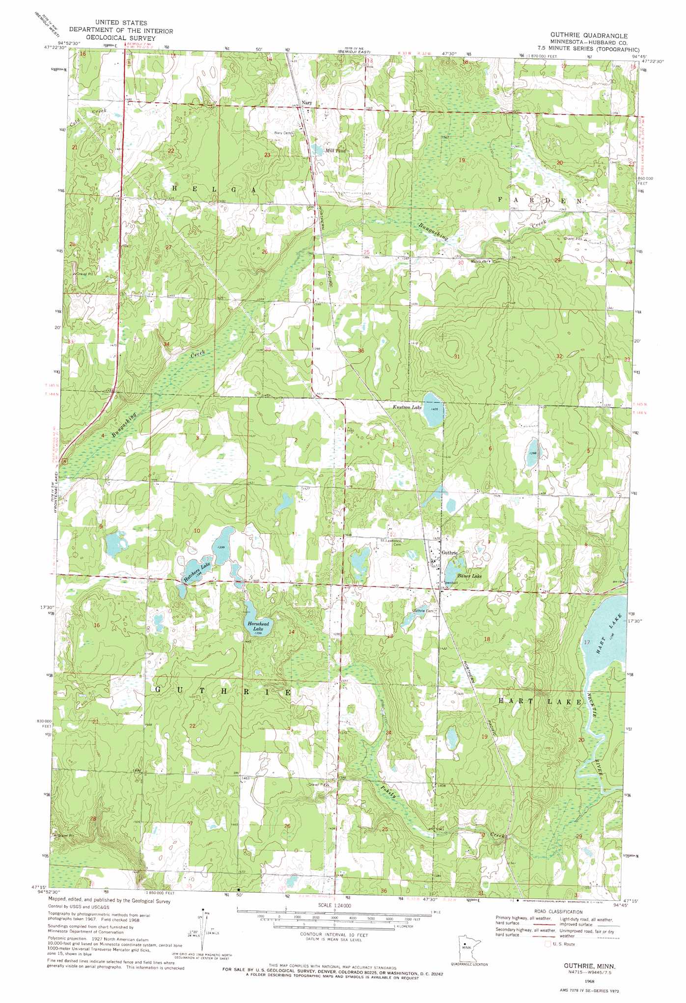
USGS Topo Quad 47094c7 - 1:24,000 scale
| Topo Map Name: | Guthrie |
| USGS Topo Quad ID: | 47094c7 |
| Print Size: | ca. 21 1/4" wide x 27" high |
| Southeast Coordinates: | 47.25° N latitude / 94.75° W longitude |
| Map Center Coordinates: | 47.3125° N latitude / 94.8125° W longitude |
| U.S. State: | MN |
| Filename: | p47094c7.jpg |
| Download Map JPG Image: | Guthrie topo map 1:24,000 scale |
| Map Type: | Orthophoto |
| Topo Series: | 7.5´ |
| Map Scale: | 1:24,000 |
| Source of Map Images: | United States Geological Survey (USGS) |
| Alternate Map Versions: |
Guthrie MN 1968, updated 1971 Download PDF Buy paper map Guthrie MN 2010 Download PDF Buy paper map Guthrie MN 2013 Download PDF Buy paper map Guthrie MN 2016 Download PDF Buy paper map |
1:24,000 Topo Quads surrounding Guthrie
Wilton |
Peterson Lake |
Turtle River |
Turtle River Lake |
Pimushe Lake |
Grant Lake |
Bemidji West |
Bemidji East |
Andrusia Lake |
Cass Lake |
Lake Hattie |
Frontenac Lake |
Guthrie |
Steamboat Lake |
Pike Bay |
Schoolcraft Lake |
Lake George |
Laporte |
Benedict |
Steamboat Bay |
Skunk Lake |
Mantrap Lake |
East Crooked Lake |
Akeley |
Walker |
> Back to 47094a1 at 1:100,000 scale
> Back to 47094a1 at 1:250,000 scale
> Back to U.S. Topo Maps home
Guthrie topo map: Gazetteer
Guthrie: Lakes
Bauer Lake elevation 427m 1400′Hatchers Lake elevation 426m 1397′
Horsehead Lake elevation 427m 1400′
Knutson Lake elevation 429m 1407′
Mill Pond elevation 429m 1407′
Guthrie: Populated Places
Guthrie elevation 431m 1414′Nary elevation 435m 1427′
Guthrie: Post Offices
Guthrie Post Office (historical) elevation 431m 1414′Nary Post Office (historical) elevation 435m 1427′
Guthrie: Streams
Pokety Creek elevation 396m 1299′Guthrie digital topo map on disk
Buy this Guthrie topo map showing relief, roads, GPS coordinates and other geographical features, as a high-resolution digital map file on DVD: