Manning Topo Map North Dakota
To zoom in, hover over the map of Manning
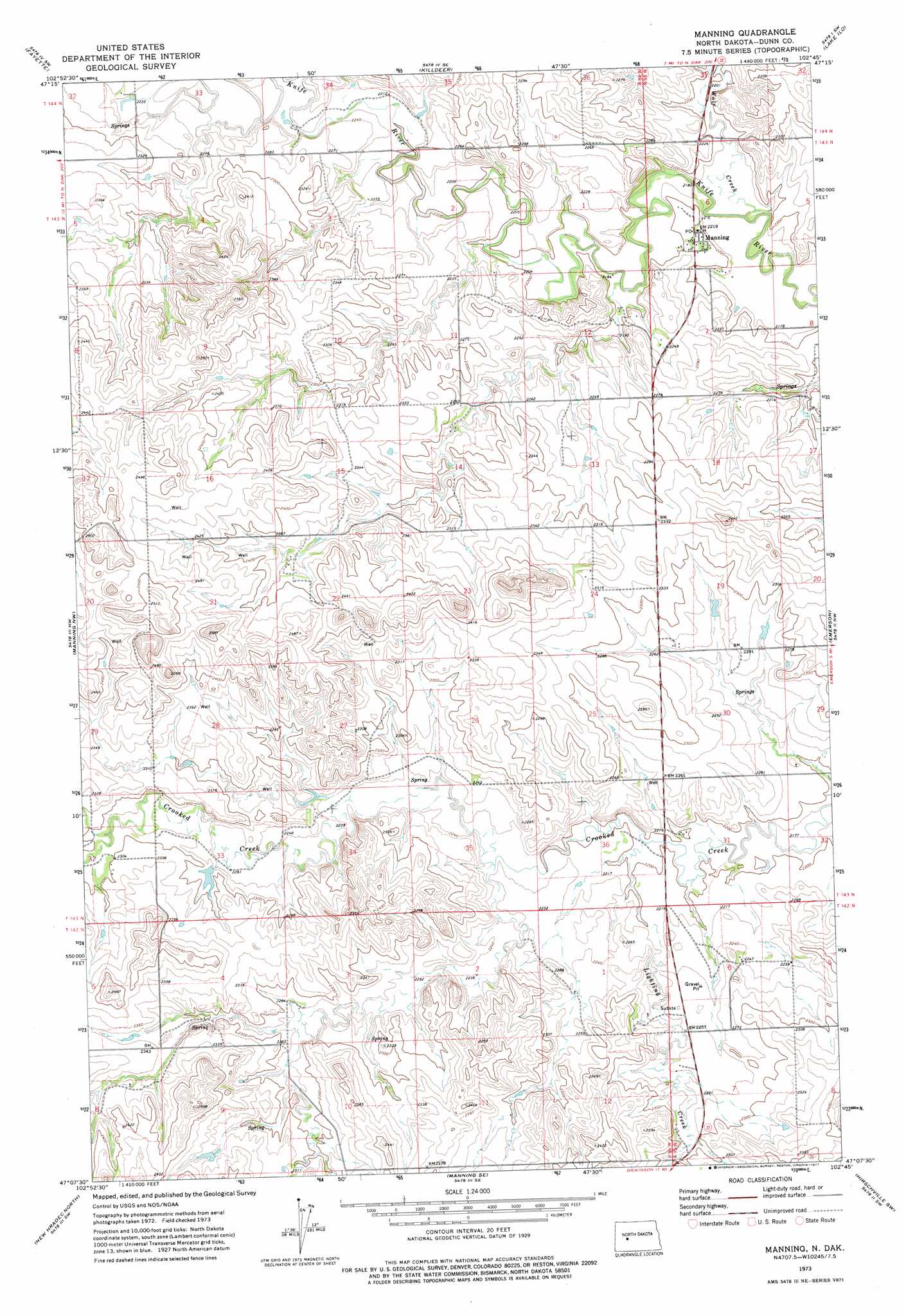
USGS Topo Quad 47102b7 - 1:24,000 scale
| Topo Map Name: | Manning |
| USGS Topo Quad ID: | 47102b7 |
| Print Size: | ca. 21 1/4" wide x 27" high |
| Southeast Coordinates: | 47.125° N latitude / 102.75° W longitude |
| Map Center Coordinates: | 47.1875° N latitude / 102.8125° W longitude |
| U.S. State: | ND |
| Filename: | O47102B7.jpg |
| Download Map JPG Image: | Manning topo map 1:24,000 scale |
| Map Type: | Topographic |
| Topo Series: | 7.5´ |
| Map Scale: | 1:24,000 |
| Source of Map Images: | United States Geological Survey (USGS) |
| Alternate Map Versions: |
Manning ND 1973, updated 1977 Download PDF Buy paper map Manning ND 2011 Download PDF Buy paper map Manning ND 2014 Download PDF Buy paper map |
1:24,000 Topo Quads surrounding Manning
Petes Creek |
Killdeer Mountains |
Oakdale |
Dunn Center Nw |
Dunn Center Ne |
Grassy Butte Se |
Fayette |
Killdeer |
Lake Ilo |
Dunn Center |
Hungry Man Butte |
Manning Nw |
Manning |
Emerson |
Ziner Butte |
Fairfield Se |
New Hradec North |
Manning Se |
Hirschville Sw |
Hirschville |
Belfield Ne |
New Hradec South |
Dickinson North |
Davis Buttes |
Boyle |
> Back to 47102a1 at 1:100,000 scale
> Back to 47102a1 at 1:250,000 scale
> Back to U.S. Topo Maps home
Manning topo map: Gazetteer
Manning: Populated Places
Manning elevation 674m 2211′Manning: Streams
Lighting Creek elevation 668m 2191′Wolf Creek elevation 660m 2165′
Manning digital topo map on disk
Buy this Manning topo map showing relief, roads, GPS coordinates and other geographical features, as a high-resolution digital map file on DVD:
Eastern Montana & Western North Dakota
Buy digital topo maps: Eastern Montana & Western North Dakota